Gwadabawa | |
|---|---|
LGA and town | |
 Interactive map of Gwadabawa | |
 Gwadabawa | |
| Coordinates: 13°22′11″N5°13′48″E / 13.36972°N 5.23000°E | |
| Country | |
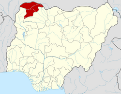
| State | Sokoto State |
| Government | |
| • Local Government Chairman | Ibrahim Aliyu Sakamaru [1] |
| Area | |
• Total | 991 km2 (383 sq mi) |
| Population (2006) | |
• Total | 231,358 |
| Time zone | UTC+1 (WAT) |
| 3-digit postal code prefix | 843 |
| ISO 3166 code | NG.SO.GW |
Gwadabawa is a Local Government Area in Sokoto State, Nigeria. Its headquarters are in the town of Gwadabawa on the A1 highway. It comprises Gwadabawa, Salame, Chimola and Asara districts.
It has an area of 991 km2 and a population of 231,358 at the 2006 census. [2]
The postal code of the area is 843. [3]