Tureta | |
|---|---|
LGA and town | |
 Interactive map of Tureta | |
 Tureta | |
| Coordinates: 12°35′22″N5°32′49″E / 12.58944°N 5.54694°E | |
| Country | |
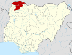
| State | Sokoto State |
| Government | |
| • Local Government Chairman | Aliyu Abubakar [1] |
| Area | |
• Total | 920 sq mi (2,383 km2) |
| Population (2006) | |
• Total | 68,370 |
| Time zone | UTC+1 (WAT) |
| 3-digit postal code prefix | 852 |
| ISO 3166 code | NG.OG.TT |
Tureta is a Local Government Area in Sokoto State, Nigeria. Its headquarters is in the town of Tureta. It shares a border with Zamfara State in the south and east. They are mainly Hausa people predominantly Burmawa.[ clarification needed ] Islam is there main religion. Fishing and farming are the major occupations. Currently[ when? ] Dr Muhammad Danrabi Tureta is their newly appointed king title as sarkin Burmin tureta.
Tureta has an area of 2,383 km2 and a population of 68,370 at the 2006 census. [2]
The postal code of the area is 852. [3]