Quincy, known as Illinois's "Gem City", is a city in and the county seat of Adams County, Illinois, United States, located on the Mississippi River. The 2020 census counted a population of 39,463 in the city itself, down from 40,633 in 2010. As of July 1, 2015, the Quincy Micro Area had an estimated population of 77,220. During the 19th century, Quincy was a thriving transportation center as riverboats and rail service linked the city to many destinations west and along the river. It was Illinois' second-largest city, surpassing Peoria in 1870. The city has several historic districts, including the Downtown Quincy Historic District and the South Side German Historic District, which display the architecture of Quincy's many German immigrants from the late 19th century.

Dwight is a village located mainly in Livingston County, Illinois, with a small portion in Grundy County. The population was 4,032 at the 2020 census. Dwight contains an original stretch of U.S. Route 66, and from 1892 until 2016 continuously used a railroad station designed in 1891 by Henry Ives Cobb. Interstate 55 bypasses the village to the north and west.

Rock Island is a city in and the county seat of Rock Island County, Illinois, United States. The original Rock Island, from which the city name is derived, is now called Arsenal Island. The population was 57,108 at the 2020 census. Located on the Mississippi River, it is one of the Quad Cities, along with neighboring Moline, East Moline, and the Iowa cities of Davenport and Bettendorf. The Quad Cities has a population of about 480,000. The city is home to Rock Island Arsenal, the largest government-owned weapons manufacturing arsenal in the US, which employs 6,000 people.

Oxford is a city in and the county seat of Lafayette County, Mississippi, United States. Oxford lies 75 miles (121 km) south-southeast of Memphis, Tennessee. A college town, the University of Mississippi or "Ole Miss" is located adjacent to the city. Founded in 1837, it is named for Oxford, England.

Duck Hill is a town in Montgomery County, Mississippi, United States. The population was 619 at the 2020 census.

Atoka is a local government area with a town charter in Tipton County, Tennessee, United States. In 1888, Atoka was a stop on the Newport News & Mississippi Valley Railroad. Today the City of New Orleans Amtrak passenger train makes its daily route between New Orleans and Chicago, through Atoka. The population was 10,008 at the 2020 census, making the Town of Atoka the largest municipality in Tipton County.

BNSF Railway is the largest freight railroad in the United States. One of six North American Class I railroads, BNSF has 35,000 employees, 32,500 miles (52,300 km) of track in 28 states, and nearly 8,000 locomotives. It has three transcontinental routes that provide rail connections between the western and eastern United States. BNSF trains traveled over 169 million miles in 2010, more than any other North American railroad.

On March 18, 1925, one of the deadliest tornado outbreaks in recorded history generated at least twelve significant tornadoes and spanned a large portion of the midwestern and southern United States. In all, at least 751 people were killed and more than 2,298 were injured, making the outbreak the deadliest tornado outbreak, March 18 the deadliest tornado day, and 1925 the deadliest tornado year in U.S. history. The outbreak generated several destructive tornadoes in Missouri, Illinois, and Indiana on the same day, as well as significant tornadoes in Alabama and Kansas. In addition to confirmed tornadoes, there were undoubtedly others with lesser impacts, the occurrences of which have been lost to history.

U.S. Route 45 is a major north-south United States highway and a border-to-border route, from Lake Superior to the Gulf of Mexico. A sign at the highway's northern terminus notes the total distance as 1,297 miles (2,087 km).

Southern Illinois, also known as Little Egypt, is a region of the U.S. state of Illinois comprising the southern third of the state, principally along and south of Interstate 64. Part of downstate Illinois, it is bordered by the two most voluminous rivers in the United States: the Mississippi below its connecting Missouri River to the west and the Ohio River to the east and south, with the Wabash as a tributary.

The City of New Orleans is a long-distance passenger train operated by Amtrak on an overnight schedule between Chicago and New Orleans. The train is a successor to the Illinois Central Railroad's Panama Limited.

U.S. Route 51 or U.S. Highway 51 is a major south-north United States highway that extends 1,277 miles (2,055 km) from the western suburbs of New Orleans, Louisiana, to within 150 feet (46 m) of the Wisconsin–Michigan state line. As most of the United States Numbered Highways ending with "1", it is a cross-country north-south route extending from the Gulf Coast region to the Great Lakes region. Much of the highway in northern Illinois and southern Wisconsin runs parallel to or is cosigned with Interstate 39 (I-39) and much of the route in several states also parallels the Illinois Central Railroad. From LaPlace, Louisiana, Mississippi, to Memphis, Tennessee, much of that portion of US 51 runs largely parallel or is concurrent with Interstate 55 (I-55). The highway's northern terminus is between Hurley, Wisconsin, and Ironwood, Michigan, where it ends with a Trumpet interchange at US 2. Its southern terminus is in Laplace, Louisiana, ending at US 61. US 51 is routed through the states of Louisiana, Mississippi, Tennessee, Kentucky, Illinois, and Wisconsin.

The Illinois Central Railroad, sometimes called the Main Line of Mid-America, was a railroad in the Central United States, with its primary routes connecting Chicago, Illinois, with New Orleans, Louisiana, and Mobile, Alabama, and thus, the Great Lakes to the Gulf of Mexico. A line also connected Chicago west to Sioux City, Iowa (1870). There was a significant branch to Omaha, Nebraska (1899), west of Fort Dodge, Iowa, and another branch reaching Sioux Falls, South Dakota (1877), starting from Cherokee, Iowa. The IC also serviced Miami, Florida, on trackage owned by other railroads

The Illinois Terminal Railroad Company, known as the Illinois Traction System until 1937, was a heavy duty interurban electric railroad with extensive passenger and freight business in central and southern Illinois from 1896 to 1956. When Depression era Illinois Traction was in financial distress and had to reorganize, the Illinois Terminal name was adopted to reflect the line's primary money making role as a freight interchange link to major steam railroads at its terminal ends, Peoria, Danville, and St. Louis. Interurban passenger service slowly was reduced, ending in 1956. Freight operation continued but was hobbled by tight street running in some towns requiring very sharp radius turns. In 1956, ITC was absorbed by a consortium of connecting railroads.
Illinois is in the midwestern United States. Surrounding states are Wisconsin to the north, Iowa and Missouri to the west, Kentucky to the east and south, and Indiana to the east. Illinois also borders Michigan, but only via a northeastern water boundary in Lake Michigan. Nearly the entire western boundary of Illinois is the Mississippi River, except for a few areas where the river has changed course. Illinois' southeastern and southern boundary is along the Wabash River and the Ohio River, whereas its northern boundary and much of its eastern boundary are straight survey lines. Illinois has a maximum north–south distance of 390 miles (630 km) and 210 miles (340 km) east-west. Its total area is 57,918 square miles (150,010 km2).

Memphis Central Station, referred to as Grand Central Station prior to 1944, is a passenger terminal in Memphis, Tennessee. Located along Main Street and G.E. Patterson Boulevard in Downtown Memphis, it currently a service stop for Amtrak's City of New Orleans route, arriving in late evening northbound and in the morning southbound. It is also served by the MATA Trolley system. The building was opened in 1914, and is located within the city's South Main Arts District. It is also an contributing property to the South Main Street Historic District of the National Register of Historic Places, as are the National Civil Rights Museum and other historic properties within the district boundaries.
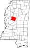
Tinsley is an unincorporated community located in Yazoo County, Mississippi, United States. Tinsley is approximately 11 miles (18 km) south of Yazoo City and 4 miles (6.4 km) North of Oil City near U.S. Route 49.

Mississippi Central Railroad is a short line railroad that operates three disconnected tracks: 51 miles from Oxford, Mississippi to Grand Junction, Tennessee; 11 miles in Iuka Mississippi, and 46 miles from Corinth, Mississippi to Red Bay, Alabama. It was formerly owned by Pioneer Railcorp, which was acquired by Patriot Rail. The railroad's principal commodities are aggregates and food products. The MSCI offers connections to the BNSF Railway in Holly Springs, the Norfolk Southern Railway in Grand Junction, and Canadian Pacific Kansas City in Corinth.

The Ripley & New Albany Railroad is a 27-mile long (43 km) shortline railroad that runs from New Albany to Falkner, Mississippi, and previously extended from Houston, Mississippi, to Middleton, Tennessee, along former Gulf, Mobile and Ohio Railroad trackage. RNA interchanges with the BNSF Railway in New Albany, Mississippi. It primarily hauls lumber products and Oil-Dri.

The Grenada Railroad is a 228-mile long (290 km) shortline railroad that runs from Southaven, Mississippi to Canton, Mississippi, along the former Illinois Central Railroad trackage. The GRYR interchanges at Canton, Mississippi, with the Canadian National, and at Memphis, Tennessee with CN, Norfolk Southern, Union Pacific, Canadian Pacific Kansas City, BNSF and CSX. The main commodities the Class III railroad hauls include chemicals, flour, lumber, paper, plastics, and petroleum. The Grenada Railroad is operated by Gulf & Atlantic Railways LLC.