Pluto, Mississippi | |
---|---|
Coordinates: 33°03′12″N90°22′52″W / 33.05333°N 90.38111°W Coordinates: 33°03′12″N90°22′52″W / 33.05333°N 90.38111°W | |
Country | United States |
State | Mississippi |
County | Holmes |
Elevation | 115 ft (35 m) |
Time zone | UTC-6 (Central (CST)) |
• Summer (DST) | UTC-5 (CDT) |
Area code | 662 |
GNIS feature ID | 676158 [1] |
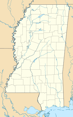
Pluto is an unincorporated community in Holmes County, Mississippi, United States. [1] Pluto is located on the Yazoo River. [2] A post office operated under the name Pluto from 1886 to 1918. [3]
Climate data for Pluto, MS (1991-2020 normals) | |||||||||||||
---|---|---|---|---|---|---|---|---|---|---|---|---|---|
Month | Jan | Feb | Mar | Apr | May | Jun | Jul | Aug | Sep | Oct | Nov | Dec | Year |
Average high °F (°C) | 58.4 (14.7) | 62.6 (17.0) | 70.8 (21.6) | 78.9 (26.1) | 86.0 (30.0) | 92.1 (33.4) | 94.3 (34.6) | 94.9 (34.9) | 90.5 (32.5) | 80.5 (26.9) | 68.8 (20.4) | 60.7 (15.9) | 78.2 (25.7) |
Daily mean °F (°C) | 48.5 (9.2) | 52.0 (11.1) | 59.4 (15.2) | 67.5 (19.7) | 75.6 (24.2) | 82.1 (27.8) | 84.7 (29.3) | 84.6 (29.2) | 79.3 (26.3) | 68.7 (20.4) | 57.5 (14.2) | 51.0 (10.6) | 67.6 (19.8) |
Average low °F (°C) | 38.6 (3.7) | 41.4 (5.2) | 48.0 (8.9) | 56.1 (13.4) | 65.1 (18.4) | 72.1 (22.3) | 75.1 (23.9) | 74.4 (23.6) | 68.2 (20.1) | 57.0 (13.9) | 46.1 (7.8) | 41.2 (5.1) | 56.9 (13.8) |
Average precipitation inches (mm) | 5.69 (145) | 5.57 (141) | 5.94 (151) | 6.58 (167) | 5.74 (146) | 4.37 (111) | 4.02 (102) | 4.51 (115) | 3.31 (84) | 4.27 (108) | 4.57 (116) | 5.81 (148) | 60.38 (1,534) |
Average snowfall inches (cm) | 0.1 (0.25) | 0.0 (0.0) | 0.0 (0.0) | 0.0 (0.0) | 0.0 (0.0) | 0.0 (0.0) | 0.0 (0.0) | 0.0 (0.0) | 0.0 (0.0) | 0.0 (0.0) | 0.0 (0.0) | 0.0 (0.0) | 0.1 (0.25) |
Average precipitation days (≥ 0.01 in) | 8.9 | 8.8 | 8.9 | 7.6 | 8.1 | 7.5 | 7.9 | 7.2 | 5.0 | 5.9 | 7.2 | 9.0 | 92.0 |
Average snowy days (≥ 0.1 in) | 0.1 | 0.0 | 0.0 | 0.0 | 0.0 | 0.0 | 0.0 | 0.0 | 0.0 | 0.0 | 0.0 | 0.0 | 0.1 |
Source: NOAA [4] [5] |
The National Oceanic and Atmospheric Administration is an American scientific and regulatory agency within the United States Department of Commerce that forecasts weather, monitors oceanic and atmospheric conditions, charts the seas, conducts deep sea exploration, and manages fishing and protection of marine mammals and endangered species in the U.S. exclusive economic zone.
Holmes County is a county in the U.S. state of Mississippi; its western border is formed by the Yazoo River and the eastern border by the Big Black River. The western part of the county is within the Yazoo-Mississippi Delta. As of the 2010 census, the population was 19,198. Its county seat is Lexington. The county is named in honor of David Holmes, territorial governor and the first governor of the state of Mississippi and later United States Senator for Mississippi. A favorite son, Edmond Favor Noel, was an attorney and state politician, elected as governor of Mississippi, serving from 1908 to 1912.
Marion is a city in and the county seat of Crittenden County, Arkansas, United States. The population was 12,345 at the 2010 census, a 38.7% increase since 2000. The city is part of the Memphis metropolitan area. It is the second largest city in Crittenden County, behind West Memphis.
Appomattox is a town in Appomattox County, Virginia, United States. The population was 1,733 at the 2010 census. It is the county seat of Appomattox County.
The National Sea Grant College Program is a program of the National Oceanic and Atmospheric Administration (NOAA) within the U.S. Department of Commerce. It is a national network of 34 university-based Sea Grant programs involved in scientific research, education, training, and extension projects geared toward the conservation and practical use of the coasts, Great Lakes, and other marine areas. The program is administered by the National Oceanic and Atmospheric Administration (NOAA) with the national office located in Silver Spring, Maryland. There are Sea Grant programs located in every coastal and Great Lakes state as well as in Puerto Rico and Guam.
The 1960 Atlantic hurricane season was the least active season since 1952. The season officially began on June 15, and lasted until November 15. These dates conventionally delimit the period of each year when most tropical cyclones form in the Atlantic basin. The first system, an unnamed storm, developed in the Bay of Campeche on June 22. It brought severe local flooding to southeastern Texas and was considered the worst disaster in some towns since a Hurricane in 1945. The unnamed storm moved across the United States for almost a week before dissipating on June 29. In July, Hurricane Abby resulted in minor damage in the Leeward Islands, before impacting a few Central American counties — the remnants of the storm would go on to form Hurricane Celeste in the East Pacific. Later that month, Tropical Storm Brenda caused flooding across much of the East Coast of the United States. The next storm, Hurricane Cleo, caused no known impact, despite its close proximity to land.
The 1985 Atlantic hurricane season had six United States landfalling hurricanes, tied with 1886 and 2020 for the highest number on record. The season officially began on June 1 and lasted until November 30. It was an average season, with 11 named storms developing. This was partially attributed to a La Niña – a meteorological phenomenon that produces favorable conditions across the Atlantic basin, such as lower wind shear and higher sea surface temperatures. The first storm, Ana, developed on July 15 near Bermuda and caused minor effects in Canada while transitioning into an extratropical cyclone. Three other tropical cyclones – Claudette, Henri, and Isabel – did not significantly affect land. Claudette developed offshore of the Southeastern United States and brushed Bermuda and the Azores. Henri and Isabel were dissipating as they approached land. However, the precursor of the latter caused a severe flood in Puerto Rico that killed 180 people. Additionally, Tropical Storm Fabian and three tropical depressions did not have any known impact on land.
Hurricane Hilda was an intense tropical cyclone that ravaged areas of the United States Gulf Coast, particularly Louisiana. In addition to its damage inland, the hurricane greatly disrupted offshore oil production, and at its time was the costliest tropical cyclone for Louisiana's offshore oil production. Due in part to flights made by the National Hurricane Research Laboratory, Hilda became one of the most well-documented storms meteorologically in the Atlantic. Lasting for seven days as a tropical cyclone, Hilda caused US$126 million in damage and 38 deaths. It was the tenth named storm, sixth hurricane, and the fourth major hurricane of the 1964 Atlantic hurricane season.
Richard Grant is a freelance British travel writer based in Arizona.
The 2010 New Year's Eve tornado outbreak was a three-day-long tornado outbreak that impacted the central and lower Mississippi Valley from December 30, 2010 to January 1, 2011. Associated with a low pressure system and a strong cold front, 37 tornadoes tracked across five states over the length of the severe event, killing nine and injuring several others. Activity was centered in the states of Missouri and later Mississippi on December 31. Seven tornadoes were rated EF3 on the Enhanced Fujita Scale; these were the strongest during the outbreak. Non-tornadic winds were recorded to have reached as high as 80 mph (130 km/h) at eight locations on December 31, while hail as large as 2.75 in (7.0 cm) was documented north-northeast of Mansfield, Missouri. Overall, damage from the outbreak totaled US$123.3 million, most of which was related to tornadoes. This is the most prolific tornado outbreak in Missouri in the month of December.
The 2011 Super Outbreak was the largest, costliest, and one of the deadliest tornado outbreaks ever recorded, taking place in the Southern, Midwestern, and Northeastern United States from April 25–28, 2011, leaving catastrophic destruction in its wake. Over 175 tornadoes struck Alabama, Mississippi, and Tennessee, which were the most severely damaged states. Other destructive tornadoes occurred in Arkansas, Georgia, Kentucky, Louisiana, New York, and Virginia, with storms also affecting other states in the Southern and Eastern United States. In total, 360 tornadoes were confirmed by NOAA's National Weather Service (NWS) and Government of Canada's Environment Canada in 21 states from Texas to New York to southern Canada. Widespread and destructive tornadoes occurred on each day of the outbreak. April 27 was the most active day, with a record 216 tornadoes touching down that day from midnight to midnight CDT. Four of the tornadoes were rated EF5, which is the highest ranking on the Enhanced Fujita scale; typically these tornadoes are recorded no more than once a year.
Hurricane Andrew was a very powerful and destructive Category 5 Atlantic hurricane that struck the Bahamas, Florida, and Louisiana in August 1992. It is the most destructive hurricane to ever hit Florida in terms of structures damaged or destroyed, and remained the costliest in financial terms until Hurricane Irma surpassed it 25 years later. Andrew was also the strongest landfalling hurricane in the United States in decades and the costliest hurricane to strike anywhere in the country, until it was surpassed by Katrina in 2005. In addition, Andrew is one of only four tropical cyclones to make landfall in the continental United States as a Category 5, alongside the 1935 Labor Day hurricane, 1969's Camille, and 2018's Michael. While the storm also caused major damage in the Bahamas and Louisiana, the greatest impact was felt in South Florida, where the storm made landfall as a Category 5 hurricane, with 1-minute sustained wind speeds as high as 165 mph (265 km/h) and a gust as high as 174 mph (280 km/h). Passing directly through the city of Homestead in Dade County, the hurricane stripped many homes of all but their concrete foundations. In total, Andrew destroyed more than 63,500 houses, damaged more than 124,000 others, caused $27.3 billion in damage, and left 65 people dead.
This page documents the tornadoes and tornado outbreaks of 2013. Strong and destructive tornadoes form most frequently in the United States, Bangladesh, Brazil and Eastern India, but they can occur almost anywhere under the right conditions. Tornadoes also appear regularly in neighboring southern Canada during the Northern Hemisphere's summer season, and somewhat regularly in Europe, Asia, and Australia.
Near the end of 2012, a massive storm complex developed that produced both a tornado outbreak and a blizzard across the southern and eastern United States. On Christmas Day 2012, a tornado outbreak occurred across the Southern United States. This severe weather/tornado event affected the United States Gulf Coast and southern East Coast over a two-day span. It occurred in conjunction with a much larger winter storm event that brought blizzard conditions to much of the interior United States. In total, 31 tornadoes were confirmed by the National Weather Service in five states from Texas to North Carolina. All but one of the tornadoes that occurred during the outbreak touched down on December 25, with the other occurring the following day in North Carolina. Two of the tornadoes were destructive enough to be rated EF3 on the Enhanced Fujita Scale. At least 16 people died as a result of the related blizzard, and thousands were without power.
The Hurricane Rita tornado outbreak was a significant tropical cyclone-produced tornado outbreak and severe weather event that resulted from the remnants of Hurricane Rita in late-September 2005. The event was the fourth-largest tornado outbreak caused by a tropical cyclone in recorded history. After the hurricane made landfall on the extreme southwestern coast of Louisiana on September 24, the tropical cyclone's strong rainbands affected much of the West South Central and East South Central States, producing heavy rainfall in addition to numerous tornadoes. Tornadic activity was distributed roughly evenly from September 24–25, though activity shifted slightly eastward on September 25. The severe activity ended by September 26, by which time the remnants of Hurricane Rita were absorbed by a frontal boundary.
Tropical Storm Colin was the earliest third named storm in the Atlantic basin on record for four years, until it was surpassed by Tropical Storm Cristobal in 2020. An atypical, poorly organized tropical cyclone, Colin developed from a low pressure area over the Gulf of Mexico near the northern coast of the Yucatán Peninsula late on June 5, 2016. Moving northward, the depression strengthened into a tropical storm about eight hours after its formation. On June 6, Colin curved to the north-northeast and intensified slightly to winds of 50 mph (85 km/h). Strong wind shear prevented further strengthening and resulted in the system maintaining a disheveled appearance on satellite imagery. Later, the storm began accelerating to the northeast. Early on June 7, Colin made landfall in rural Taylor County, Florida, still at peak intensity. The system rapidly crossed northern Florida and emerged into the Atlantic Ocean several hours later. By late on June 7, Colin transitioned into an extratropical cyclone offshore North Carolina before being absorbed by a frontal boundary the following day.
{{cite web}}
: Missing or empty |url=
(help)