
Holmfirth is a town in the Metropolitan Borough of Kirklees, West Yorkshire, England. It is located 6 miles (9.7 km) south of Huddersfield and 14 miles (23 km) west of Barnsley; the boundary of the Peak District National Park is 2 miles (3.2 km) to the south-west. The town is sited on the A635 and A6024 roads in the Holme Valley, at the confluence of the River Holme and Ribble. It mostly consists of stone-built cottages nestled on the eastern slopes of the Pennine hills.

Meltham is a town and civil parish within the Metropolitan Borough of Kirklees, in West Yorkshire, England. It lies in the Holme Valley, below Wessenden Moor, 5 miles south-west of Huddersfield on the edge of the Peak District National Park. It had a population of 8,089 at the 2001 census, which was estimated to have increased to 8,600 by 2005. The population assessed at the 2011 Census was 8,534. It has 12 elected council members who meet up around every 6 weeks.

Dunford Bridge is a remote hamlet in the civil parish of Dunford, lying northwest of Sheffield in South Yorkshire, England, 1.3 miles (2 km) from the border with West Yorkshire and 2.3 miles (4 km) from the border with Derbyshire. It lies in the Peak District, 5 miles (8 km) west of Penistone and 5 miles (8 km) south of Holmfirth, within the Metropolitan Borough of Barnsley. Before the Local Government Act 1972 the area covered by South Yorkshire was part of the West Riding of Yorkshire.

Irthlingborough is a town on the River Nene in North Northamptonshire, England. As of 2021, it has a population of 9,325, and was at one point the smallest town in England to have had a Football League team, Rushden & Diamonds F.C.. The parish church, St Peter, has a lantern tower, unusual for Northamptonshire churches, which was built to guide travellers across the Nene valley in foggy weather. It also has doors at the four cardinal points and has eight misericords in the chancel.

Horsforth is a town and civil parish in the City of Leeds, West Yorkshire, England, five miles north-west of Leeds city centre. Historically a village within the West Riding of Yorkshire, it had a population of 18,895 at the 2011 Census. It became part of the City of Leeds metropolitan borough in 1974. In 1999, a civil parish was created for the area, and the parish council voted to rename itself a town council. The area is within the Horsforth ward of Leeds City Council, which also includes the southern part of Rawdon.
Honley is a village in the Holme Valley civil parish in Kirklees, West Yorkshire, England. Historically part of the West Riding of Yorkshire, it is situated near to Holmfirth and Huddersfield, and on the banks of the River Holme. According to the 2011 Census it had a population of 6,474, a growth of 577 from the 2001 Census

Greenfield is a village in the civil parish of Saddleworth in the Metropolitan Borough of Oldham, in Greater Manchester, England. It is 4 miles (6.4 km) east of Oldham and 13 miles (21 km) north-east of Manchester. It is located in a broad rural area at the southern edge of the South Pennines; Dovestone Reservoir, Chew Reservoir and Greenfield Reservoir lie to the east of the village in the Peak District National Park.
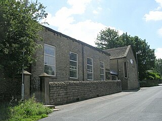
Upperthong is a village approximately 807 feet (246 m) above sea level, near the town of Holmfirth in Holme Valley, approximately 7 miles (11 km) south of Huddersfield, West Yorkshire, England.

Scholes-in-Elmet is a village in Leeds, West Yorkshire, England. Its name is a plural of Old Norse skáli meaning "temporary shed".
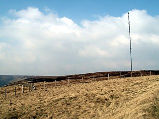
Holme Moss is high moorland on the border between the Holme Valley district of Kirklees in West Yorkshire and the High Peak district of Derbyshire in England. Historically on the boundary between the West Riding of Yorkshire and Cheshire, it is just inside the boundary of the Peak District National Park. The A6024 road between Holmfirth and Longdendale crosses the moor near its highest point close to Holme Moss transmitting station's prominent mast.

Lliswerry, or Liswerry is an electoral district (ward) and community of the city of Newport, South Wales. The area is governed by Newport City Council. It is the largest community/ward in the city.

Altofts is a village in the civil parish of Normanton and Altofts, in the City of Wakefield, West Yorkshire, England. It lies 5 miles (8 km) north-east from the centre of Wakefield and less than 1 mile (1.6 km) north-west of Normanton. The M62 runs close to the village to the north-east, and the Aire and Calder Navigation to the north-west.

Holme is a village in the Holme Valley civil parish of Kirklees in West Yorkshire, England. The village straddles the A6024 road between Holmbridge and Lane village, 2.5 miles (4 km) south-west of Holmfirth. It is close to the boundaries of Derbyshire and the Peak District National Park: some properties lie outside of the National Park. Holme Moss, an area of high moorland with a prominent transmitter mast, overlooks the village from the south-west.

Shepley is a village in the civil parish of Kirkburton, in Kirklees, West Yorkshire, England. It lies 8 miles (13 km) south south east of Huddersfield and 6 miles (9.7 km) north west of Penistone.
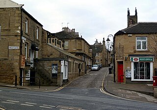
Scholes is a village and former civil parish, now in the parish of Holme Valley, in Kirklees, West Yorkshire, England. It is situated 1 mile (2 km) to the south-east and above Holmfirth, 7 miles (11 km) south-west of Huddersfield, in the Holme Valley. It has a population of 1,990. The name Scholes may have originated from the Scandinavian language meaning 'the temporary huts or sheds'.

Brockholes is a small village in West Yorkshire, England, in the administrative area of Kirklees Metropolitan Council and Holme Valley Parish Council. The village of Honley borders to the immediate north of the village and Holmfirth lies to the south. Brockholes is within the Postal district of Holmfirth.

Hepworth is a village and former civil parish, now in the parish of Holme Valley, in the metropolitan borough of Kirklees, in West Yorkshire, England. It is southeast of Holmfirth and southwest of Jackson Bridge. In 1931 the parish had a population of 840.

Springhead is a suburban area in the civil parish of Saddleworth in the Metropolitan Borough of Oldham, in Greater Manchester, England.
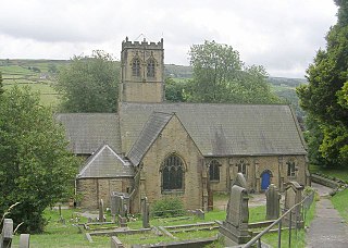
Holmbridge is a small village on the A6024 to the southwest of Holmfirth and south of Huddersfield in West Yorkshire, England. It is in the parish of Holme Valley and the metropolitan borough of Kirklees.

