Haimchar Upazila

Last updated • 1 min readFrom Wikipedia, The Free Encyclopedia
Haimchar
হাইমচর
Haimchar in Chattogram division (Bangladesh).svg
Coordinates: 23°4′N90°38.3′E / 23.067°N 90.6383°E / 23.067; 90.6383
Country Flag of Bangladesh.svg  Bangladesh
Division Chittagong
District Chandpur
Government
Area
  Total
134.16 km2 (51.80 sq mi)
Population
 (2022) [1]
  Total
124,833
  Density930/km2 (2,400/sq mi)
Time zone UTC+6 (BST)
Postal code
3660 [2]
Website Official Map of Haimchar

Haimchar (Bengali : হাইমচর) is an upazila of Chandpur District [3] in the Division of Chittagong, Bangladesh.

Contents

Geography

Haimchar is located at 23°04′00″N90°38′15″E / 23.0667°N 90.6375°E / 23.0667; 90.6375 . It has a total area of 134.16 km2.

Demographics

Religions in Haimchar Upazila (2022) [4]
ReligionPercent
Islam
96.60%
Hinduism
3.38%
Other or not stated
0.02%

According to the 2011 Census of Bangladesh, Haimchar Upazila had 24,903 households and a population of 109,575. 28,239 (25.77%) were under 10 years of age. Haimchar had a literacy rate (age 7 and over) of 48.13%, compared to the national average of 51.8%, and a sex ratio of 1042 females per 1000 males. 8,847 (8.07%) lived in urban areas. [5] [6]

According to the 1991 Bangladesh census, Haimchar had a population of 113,306. Males constituted 51.29% of the population, and females 48.71%. The population aged 18 or over was 52,033. Haimchar had an average literacy rate of 25.4% (7+ years), compared to the national average of 32.4%. [7]

Administration

Haimchar Upazila is divided into six union parishads: Char Bhairabi, Dakshin Algi Durgapur, Gazipur, Haimchar, Nilkamal, and Uttar Algi Durgapur. The union parishads are subdivided into 27 mauzas and 65 villages. [8]

Notable people

See also

Related Research Articles

<span class="mw-page-title-main">Kumarkhali Upazila</span> Upazila in Khulna, Bangladesh

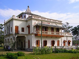
Kumarkhali is an upazila of Kushtia District in the Division of Khulna, Bangladesh. It is famous for the Shelaidaha area, where the poet Rabindranath Tagore spent a considerable time of his youth.

<span class="mw-page-title-main">Hizla Upazila</span> Upazila in Barisal, Bangladesh

Hizla is the largest upazila (sub-district) of southern Bangladesh's Barisal District.

<span class="mw-page-title-main">Faridganj Upazila</span> Upazila in Chittagong, Bangladesh

Faridganj is an upazila of Chandpur District in Chittagong Division of Bangladesh. It is located between 23°03' and 23°14' north latitudes and in between 90°41' and 90°53' east longitudes.

<span class="mw-page-title-main">Haziganj Upazila</span> Upazila in Chittagong, Bangladesh

Haziganj or Hajiganj is an upazila of Chandpur District in the Division of Chittagong, Bangladesh.

<span class="mw-page-title-main">Matlab Dakshin Upazila</span> Upazila in Chittagong, Bangladesh

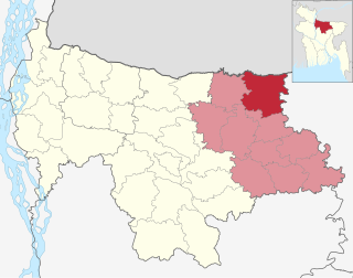
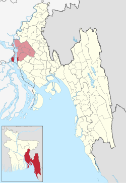
Matlab Dakshin is an upazila of Chandpur District in the division of Chittagong, Bangladesh. The former Matlab Upazila was bifurcated in 2000, creating Matlab Dakshin and Matlab Uttar upazilas.

<span class="mw-page-title-main">Comilla Adarsha Sadar Upazila</span> Upazila in Chittagong, Bangladesh

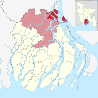
Comilla Adarsha Sadar is an upazila of Comilla District in the Division of Chittagong, Bangladesh.

<span class="mw-page-title-main">Raipur Upazila</span> Upazila in Chittagong Division, Lakshmipur District, Bangladesh

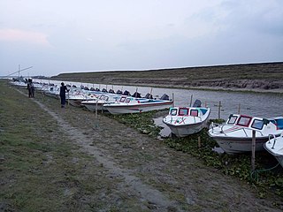
Raipur is an upazila in Lakshmipur District, Chittagong Division, Bangladesh. It is surrounded by the upazilas of Faridganj, Ramganj, Lakshmipur Sadar, Mehendiganj and Haimchar, and on the west by the Meghna River. Raipur has 40,618 households, and covers an area of 201.32 square kilometres (77.73 sq mi).

<span class="mw-page-title-main">Bhanga Upazila</span> Upazila in Dhaka, Bangladesh

Bhanga is an upazila of Faridpur District in the Division of Dhaka, Bangladesh.

<span class="mw-page-title-main">Nikli Upazila</span> Upazila in Dhaka, Bangladesh

Nikli is an upazila of Kishoreganj District in the Division of Dhaka, Bangladesh.

<span class="mw-page-title-main">Saturia Upazila</span> Upazila in Dhaka, Bangladesh

Saturia is an upazila of Manikganj District in the Division of Dhaka, Bangladesh. The administrative center is located in Saturia.

<span class="mw-page-title-main">Sreenagar Upazila</span> Upazila in Dhaka, Bangladesh

Sreenagar is an upazila of Munshiganj District in the Division of Dhaka, Bangladesh. Division of Dhaka

<span class="mw-page-title-main">Rupganj Upazila</span> Upazila in Dhaka, Bangladesh

Rupganj is an upazila of Narayanganj District in the Division of Dhaka, Bangladesh.

<span class="mw-page-title-main">Durgapur Upazila, Netrokona</span> Upazila in Mymensingh, Bangladesh

Durgapur is an upazila of the Netrokona District in the Mymensingh Division of Bangladesh.

<span class="mw-page-title-main">Kalmakanda Upazila</span> Upazila in Mymensingh, Bangladesh

Kalmakanda, originally Karamakhanda, is an upazila of Netrokona District in the Division of Mymensingh, Bangladesh.

<span class="mw-page-title-main">Purbadhala Upazila</span> Upazila in Mymensingh Division, Bangladesh

Purbadhala is an upazila of Netrokona District in the Division of Mymensingh, Bangladesh.

<span class="mw-page-title-main">Gosairhat Upazila</span> Upazila in Dhaka, Bangladesh

Gosairhat is an upazila of Shariatpur District in the Division of Dhaka, in south central Bangladesh.

<span class="mw-page-title-main">Ulipur Upazila</span> Upazila in Rangpur, Bangladesh

Ulipur is an upazila of Kurigram District in the Rangpur Division, Bangladesh.

<span class="mw-page-title-main">Bera Upazila</span> Upazila in Rajshahi, Bangladesh

Bera is an upazila of Pabna District in the Division of Rajshahi, Bangladesh.

<span class="mw-page-title-main">Chauhali Upazila</span> Upazila in Rajshahi, Bangladesh

Chauhali is an upazila, or sub-district of Sirajganj District, located in Rajshahi Division, Bangladesh.

<span class="mw-page-title-main">Matlab Uttar Upazila</span> Upazila in Chittagong, Bangladesh

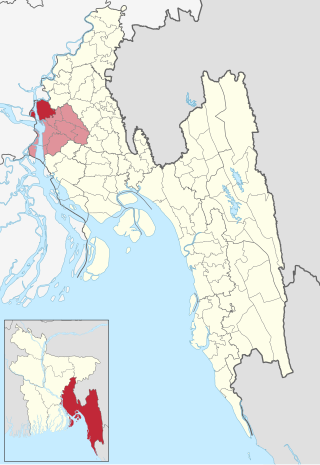
Matlab Uttar is an upazila of Chandpur District in the division of Chittagong, Bangladesh. The former Matlab Upazila was bifurcated in 2000, creating Matlab Dakshin and Matlab Uttar upazilas.

References

  1. National Report (PDF). Population and Housing Census 2022. Vol. 1. Dhaka: Bangladesh Bureau of Statistics. November 2023. p. 396. ISBN   978-9844752016.
  2. "Bangladesh Postal Code". Dhaka: Bangladesh Postal Department under the Department of Posts and Telecommunications of the Ministry of Posts, Telecommunications and Information Technology of the People's Republic of Bangladesh. 20 October 2024.
  3. Md. Mahbubur Rahman (2012), "Haimchar Upazila", in Sirajul Islam and Ahmed A. Jamal (ed.), Banglapedia: National Encyclopedia of Bangladesh (Second ed.), Asiatic Society of Bangladesh
  4. Population and Housing Census 2022 - District Report: Chandpur (PDF). District Series. Dhaka: Bangladesh Bureau of Statistics. June 2024. ISBN   978-984-475-248-1.
  5. "Community Tables: Chandpur district" (PDF). bbs.gov.bd. 2011.
  6. "Bangladesh Population and Housing Census 2011 Zila Report – Chandpur" (PDF). bbs.gov.bd. Bangladesh Bureau of Statistics.
  7. "Population Census Wing, BBS". Archived from the original on 2005-03-27. Retrieved November 10, 2006.
  8. "District Statistics 2011: Chandpur" (PDF). Bangladesh Bureau of Statistics. Archived from the original (PDF) on 13 November 2014. Retrieved 14 July 2014.