
Sehnsa is a large town in Pakistan Administered Azad Kashmir which lies on the west of Gulpur on the Kotli-Rawaplindi road. Sehnsa is a sub-divisional (Tehsil) headquarters of Kotli district in the center of Sehnsa valley.

Kotli Sattian is a tehsil (subdivision) of Rawalpindi District in the Punjab province of Pakistan.
Panjera is a historic town in the district Kotli in Azad Kashmir situated at Kotli Plandary road about 15 kilometers from Kotli city in the west. Panjera town was burnt once when a rebellious movement against the Dogra Raj in 1947 was initiated.
Khuiratta or Khoi ratta, as known in Britain, is the chief town of Kotli District, in the Azad Jammu and Kashmir. Khuiratta is linked with Kotli & Nakyal by a circular road and to Mirpur (80 km) with two links one via Dhongi-Charhoi and the other via Darghoti-Charhoi. Khuiratta is also linked with Seri, Battal, Ghaian and khor gumbi bhera, Khuiratta is also linked with Rajori in Indian-administered Kashmir via Seri but this road is now closed at the point Janjoot Bhadar and is separated by the Line of Control.
Chowki Tinda is a town in Kotli District, Azad Kashmir, Pakistan.
Nidi Sohana is a union council in the district of Kotli, Azad Jammu and Kashmir, Pakistan. It lies 19 km from Khoiratta, and is a union council of Khoi Ratta tehsil LA Kotli 5 situated at LOC and the end of Tehsil Kotli. Before partition, Nidi Sohana was part of tehsil Rajori District Riyasi. The highest point in Kotli district is Muthrani Post. It is in this union council and its peak is 4,500 feet (1,370 m) above sea level.
Dandli is a town in Kotli District, Azad Kashmir. It is located 13 kilometres from Kotli. There are many mineral resources in the town Koila, Gandhaik. A big hill Arri Gala is located near Dandli. The Dandli area contains the small villages of Gawan, Plung, Gojra Town, Nailan, Gunni.
Nailan is a Union council in Kotli District, Azad Kashmir. It is located at 33°30'10N 74°3'0E. There is no school in the area so children get their education at the Government high school in Dandli and the Govt Girls Middle School Dandli. Temperature of Nailan is very low and is very cold place in whole district Kotli.
Gulpur is a town in Kotli District, Azad Kashmir. It is located at 33°26'5N 73°51'40E. It is located southwest of Kotli city and is located on the junction of the Kotli-Mirpur and Kotli-Rawalpindi road. Gulpur is a small town providing for the local villages as well as the residents of a large refugee camp.
Barali is a village and union council, located between Kotli and Gulpur in Kotli District, Azad Kashmir. It's a small town with vast fields and good views, placed on a valley.
Ban is a village and union council of Murree Tehsil in the Rawalpindi District of Punjab, Pakistan. It is located in the south of the tehsil, and is bounded to the north by Mussiari, to the north-east by Charhan, to the east by Angoori and to the south by Kotli Sattian.

Kotli Rai Abu Bakar is a Village and Union Council NO.25 of Kasur District in the Punjab province of Pakistan. It is Major Village and Union Council of Kasur Tehsil, and is located at 31°6'1N 74°16'42E with an altitude of 188 metres (620 feet).
Rajdhani is a Union Council in Kotli District, Azad Jammu and Kashmir, Pakistan, 40 kilometres (25 mi) west of Kotli City, the capital of District Kotli and 64 kilometres (40 mi) north of Azad Jammu Kashmir's rapidly expanding model city Mirpur. The Kotli-Mirpur Main Road passes through the Village.
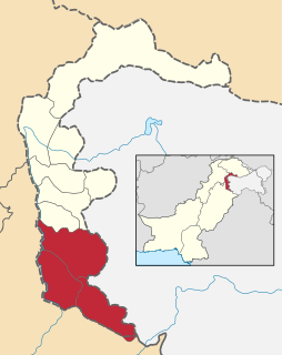
Fatehpur Thakiala, also known as Nakyal, is one of the three tehsils of the Kotli District in Azad Kashmir, Pakistan.
Mirpur Division is an administrative division of Azad Kashmir, Pakistan. It comprises the portion of the former Mirpur district of the princely state of Jammu and Kashmir that came under Pakistani control at the end of te Indo-Pakistani War of 1947.

Kotli Khakhian is a village in Phillaur tehsil of Jalandhar District of Punjab State, India. It is located 15 km from postal head office Apra, 8 km from Phagwara, 30.8 km from Jalandhar and 123 km from state capital Chandigarh. The village is administrated by a Sarpanch, an elected representative of the village.


