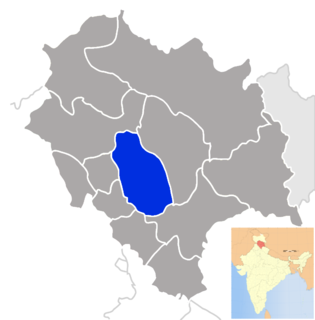
Mandi district is one of the central districts of Himachal Pradesh state in northern India. The town of Mandi is the headquarters of the district. The town has mythological and historical significance and boasts of a unique temple architecture. It is referred to as Chhoti Kashi as there are many ancient temples in the city and on the banks of river Beas.

Kotli District is one of ten districts of Azad Kashmir, Pakistan. Kotli is the chief town of the district.It is biggest District of AJK by Population and 2nd biggest by Land Area after Neelum.Chief Town of Kotli District is Kotli City. Other main towns are Khuiratta, Nakyal, Sehnsa & Tatta Pani.

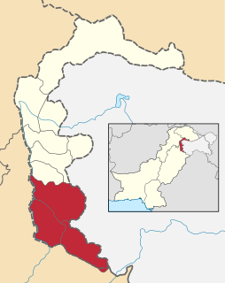
Rawalakot is the capital of Poonch district in Azad Kashmir, Pakistan. It is located in the Pir Panjal Range.

Sehnsa is a large town in Pakistan Administered Azad Kashmir which lies on the west of Gulpur on the Kotli-Rawaplindi road. Sehnsa is a sub-divisional (Tehsil) headquarters of Kotli district in the center of Sehnsa valley.

Rajouri is a district of Jammu region in the Indian union territory of Jammu and Kashmir. The Line of Control lies to its west, Poonch to its north, the Reasi district to the east and the Jammu district to its south. Rajouri is famous for its "Kalari". Representing an ancient principality, Rajouri was a joint district, along with Reasi, at the time of princely state's accession to India in 1947. The two tehsils were separated and Rajouri was merged with the Poonch district. Rajouri again became a separate district in 1968.
Panjera is a historic town in the district Kotli in Azad Kashmir situated at Kotli Plandary road about 15 kilometers from Kotli city in the west.
Khuiratta or Khoi ratta is a town in Kotli District, in Pakistan-administered Azad Kashmir.
Fatehpur is a town in Nakyal, Kotli District, in the Azad Kashmir, Pakistan. Fatehpur was a part of tehsil Mahnder before independence in 1947. It is located at 33° 38' 20N 73° 58' 45E ). It is 40 kilometres from Kotli city and 181 kilometres from Islamabad. Due to high altitude Fatehpur is comparatively a colder place than the rest of the district.
Dandli is a town in Kotli District, Azad Kashmir. It is located 13 kilometres from Kotli. There are many mineral resources in the town Koila, Gandhaik. A big hill Arri Gala is located near Dandli. The Dandli area contains the small villages of Gawan, Plung, Gojra Town, Nailan, Gunni.
Gulpur is a town in Kotli District, Azad Kashmir. It is located at 33°26'5N 73°51'40E. It is located southwest of Kotli city and is located on the junction of the Kotli-Mirpur and Kotli-Rawalpindi road. Gulpur is a small town providing for the local villages as well as the residents of a large refugee camp. Gulpur has a historical background. It has a beautiful and historical fort with name 'Throachi Fort' that is located in the Throachi village. This fort is 2 kilometres away from the Gulpur city.
Barali is a village and union council, located between Kotli and Gulpur in Kotli District, Azad Kashmir.

Dhoong, part of Narali Union Council, is the second largest village in Gujar Khan Tehsil, Rawalpindi District, Punjab, Pakistan. Dhoong is a historic village of Rawalpindi District and noted for its reserves of oil and natural gas.
Rajdhani is a Union Council in Kotli District, Azad Jammu and Kashmir, Pakistan, 40 kilometres (25 mi) west of Kotli City, the capital of District Kotli and 64 kilometres (40 mi) north of Azad Jammu Kashmir's rapidly expanding model city Mirpur. The Kotli-Mirpur Main Road passes through the Village.
Kotli Khurdکوٹلی خورد is a small village located in the foot of Cherat hill area of Nowshera District, at 23 kilometers distance from Pabbi Railway Station Pakistan, near Kotli Kalan, Saleh Khana with a population of about 5000. Khurd and Kalan Persian language word which means small and Big respectively when two villages have same name then it is distinguished as Kalan means Big and Khurd means Small with Village Name.
Charihan is a village and union council of Murree Tehsil in the Rawalpindi District of Punjab, Pakistan. It is located in the east of the tehsil at 33°49'0N 73°28'0E and is bounded to the north by Mussiari, to the north by Ghel, to the north-west by Murree city, to the west by Mussiari, to the south by Ban and to the south and east by Kotli Sattian.
Hajira is a small town in Poonch District of Azad Kashmir, Pakistan. It is the headquarters of Tehsil Hajira also known as 'Cheara' in local accents. Hajira is a transport hub, being the center point of different districts. In front (North) of Hajira there is district 'Sudhnoti' and Trarkhal. On the left side (East) of Hajira there is district Kotli and Tata-Pani. On the back side (South) of Hajira there is district 'Haveli' and Abbas-Pur. District Bagh is in the right side (West) of Hajira. Khai Gala and Rawalakot are the other nearest cities of Hajira and located in the right side (West) of Hajira. While summers can be very hot the winters are mild in Hajira, with snowfall very rare due to the low altitude.
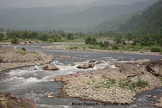
The Poonch River is a tributary of the Jhelum River that flows through Jammu and Kashmir in India, and Azad Jammu and Kashmir in Pakistan.
Helan is a city union council in Phalia Tehsil, Mandi Bahauddin District, Punjab province, Pakistan. The union council contains 10 villages. Helan is 20 kilometers south-east of Mandi Bahauddin, 8 kilometers north-east of Phalia, 20 kilometers south of Dinga and 4 kilometers north of Mano Chak.
Mirpur Division is an administrative division of Azad Kashmir, Pakistan. It comprises the portion of the former Mirpur district of the princely state of Jammu and Kashmir that came under Pakistani control at the end of te Indo-Pakistani War of 1947.
Rathoa Haryam Bridge, Mirpur, also known as the Islamgarh Bridge is a long bridge under construction in the Mirpur District of Azad Jammu Kashmir in Pakistan.