Haversham is a village and former civil parish, now in the parish of Haversham-cum-Little Linford, in the City of Milton Keynes unitary authority area, in Buckinghamshire, England. It is situated to the north of the Milton Keynes urban area, near Wolverton and about 5 miles (8 km) north of Central Milton Keynes.

Shepperton is a village in the Spelthorne district, in north Surrey, England, around 15 mi (24 km) south west of central London. The settlement is on the north bank of the River Thames, between the towns of Chertsey and Sunbury-on-Thames. The village is mentioned in a document of 959 AD and in Domesday Book.

Stanwell is a village in the Spelthorne district, in Surrey, England. It is 16 miles (26 km) west of central London. A small corner of its land is used as industrial land for nearby Heathrow Airport. The rest of the village is made up of residential and recreational land. Historically part of the county of Middlesex, it has, like the rest of Spelthorne, been in Surrey since 1965. The village is to the south of the cargo-handling area of Heathrow Airport and to the east of the Staines Reservoirs. Stanwell is the northernmost settlement in Surrey, bordering Berkshire and Greater London.
Dyrham is a village and parish in South Gloucestershire, England.

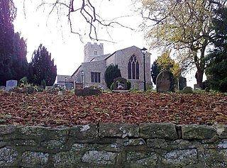
Horton is a village and civil parish on the Cotswold Edge, in the South Gloucestershire district, in the ceremonial county of Gloucestershire, England. It is about 2+1⁄2 miles (4.0 km) north of Chipping Sodbury. The nearest settlement is Little Sodbury, about 1+1⁄2 miles (2.4 km) away; Hawkesbury Upton and Dunkirk are both 2+1⁄2 miles (4.0 km) miles away. It is a linear settlement built on the slopes of a steep hill. In 2011 the parish had a population of 355. On 1 April 2023 the parish of Little Sodbury was merged with Horton.

"The Isis" is an alternative name for the River Thames, used from its source in the Cotswolds until it is joined by the River Thame at Dorchester in Oxfordshire. Notably, the Isis flows through Oxford and has given its name to several institutions and products of the city.

Weeton is a village and civil parish in the Harrogate district of North Yorkshire, England.

Hampton Poyle is a village in the civil parish of Hampton Gay and Poyle, in the Cherwell district, in the county of Oxfordshire, England. It is the Cherwell in valley, about 1 mile (1.6 km) northeast of Kidlington and about 5 miles (8 km) north of the centre of Oxford.
Hinton on the Green is a village and civil parish in the Wychavon district of Worcestershire in England. It is situated at the foot of Bredon Hill, about two miles south of Evesham.

Seale is a village in Surrey, England. Seale covers most of the civil parish of Seale and Sands and the steep slope and foot of the south side of the Hog's Back as well as a large hill which exceeds it – as such is part of the Surrey Hills Area of Outstanding Natural Beauty.

The River Seven is a river in North Yorkshire, England. It rises on Danby High Moor, in the middle of the North York Moors, and flows south for about 15 miles (24 km) to meet the River Rye, at Brawby.
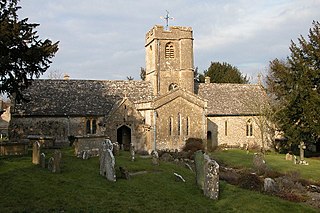
Sevenhampton is a village and civil parish in Cotswold District, Gloucestershire, 5 miles (8.0 km) east of Cheltenham. The parish is located in the Cotswolds in an area designated as an Area of Outstanding Natural Beauty. Most of the parish population reside in the two main settlements of Sevenhampton village and Brockhampton village, both are located in the valley of the River Coln.
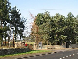
Middleton is a settlement and civil parish in Northumberland, England. The parish is situated on the North Sea coast, south of the island of Lindisfarne, and contains the villages of Ross, Detchant and Elwick; all are shrunken medieval villages. Both the A1 London to Edinburgh road and East Coast Main Line pass through the parish. In the 2001 census the parish had a population of 136, falling to 115 at the 2011 Census.

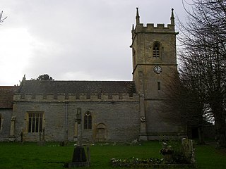
Sedgeberrow is a village and civil parish in the Wychavon district of Worcestershire, England, about 3 miles (4.8 km) south of Evesham. It stands beside the River Isbourne, a tributary of the River Avon.

Prescote is a hamlet and civil parish about 4 miles (6.4 km) north of Banbury in Oxfordshire. Its boundaries are the River Cherwell in the southeast, a tributary of the Cherwell called Highfurlong Brook in the west, and Oxfordshire's boundary with Northamptonshire in the northeast.

Hampton Gay is a village in the civil parish of Hampton Gay and Poyle, in the Cherwell district, in the county of Oxfordshire, England. It is in the Cherwell Valley about 1.5 miles (2.4 km) north of Kidlington. In 1931 the parish had a population of 28. On 1 April 1932 the parish was abolished to form "Hampton Gay and Poyle".

The River Isbourne is a 14 mile (22 km) long tributary of the River Avon which flows through Gloucestershire and Worcestershire in the Midlands of England.

In a charter of c. 957 AD, King Eadwig granted twenty hides of land to Abingdon Abbey.
aet Hengestesige , and aet Seofecanwyrthe , and aet Wihtham
Poile is an English surname of several possible origins.

Hinton is a place name of Old English origin, and is a common English village name, particularly in Southern England. Village names often include a suffix, for example Hinton on the Green and Hinton-in-the-Hedges.