Harbison Crossroads, Tennessee Gibbs [1] | |
|---|---|
| Harbison Crossroads | |
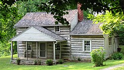 Nicholas Gibbs cabin | |
 Harbison Crossroads Location in Tennessee and the United States  Harbison Crossroads Harbison Crossroads (the United States) | |
| Coordinates: 36°07′15″N83°51′09″W / 36.12083°N 83.85250°W | |
| Country | United States |
| State | Tennessee |
| County | Knox |
| Elevation | 1,109 ft (338 m) |
| Time zone | UTC-5 (Eastern (EST)) |
| • Summer (DST) | UTC-4 (EDT) |
| ZIP codes | 37721, 37918, 37938 |
| Area code | 865 |
| FIPS code | US47 |
| GNIS feature ID | 1281332 [2] |
Harbison Crossroads is an unincorporated community of Knox County, Tennessee, United States, located approximately 10 miles Northeast of Knoxville. It is also referred by the unofficial name of Gibbs. [1]
