Polk County is a county located in the southeastern corner of the U.S. state of Tennessee. As of the 2020 United States census, its population was 17,544. Its county seat is Benton. The county was created on November 28, 1839, from parts of Bradley and McMinn counties, after final removal of most Cherokee from the region that year. The county was named after then-governor James K. Polk. Polk County is included in the Cleveland, Tennessee Metropolitan Area Statistical Area, which is also included in the Chattanooga–Cleveland–Dalton, TN–GA–AL Combined Statistical Area.

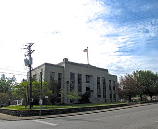
Maury County is a county located in the U.S. state of Tennessee, in the Middle Tennessee region. As of the 2020 census, the population was 100,974. Its county seat is Columbia. Maury County is part of the Nashville-Davidson–Murfreesboro–Franklin, TN metropolitan statistical area.

State Route 123 (SR 123) is a short state route in the U.S. state of Tennessee. It serves to link SR 68 with NC 294, at the Tennessee/North Carolina state line.

The State Route System of Tennessee is maintained and developed by the Tennessee Department of Transportation (TDOT) in the U.S. state of Tennessee. Currently the state has 14,150 miles (22,770 km) of state-maintained roadways, including 1,233 miles (1,984 km) of Interstate Highways and 13,077 miles (21,045 km) of State Highways. All of the U.S. Routes in Tennessee have a state route routed concurrently with them, though the state route is hidden and only signed along the green mile marker signs that display mileage within each county. The state route system in Tennessee was established in 1923. Since the 1983 renumbering, state routes have been divided into primary and secondary routes with separate shields used for each.
The Cleveland, Tennessee Metropolitan Statistical Area, as defined by the United States Census Bureau, is an area consisting of two counties in southeast Tennessee – Bradley and Polk – anchored by the city of Cleveland. As of the 2020 United States census, the MSA had a population of 126,164. The MSA is also part of the Chattanooga Combined Statistical Area. The MSA was first designated in June 2003. Geographically, this metropolitan area is mostly coexistant with the Ocoee Region, a historical and cultural name that reflects the heritage of the area.
This is a list of the National Register of Historic Places listings in Polk County, Tennessee.

In Tennessee, U.S. Route 64 stretches 404.1 miles (650.3 km) from the Mississippi River in Memphis to the North Carolina state line near Ducktown. The highway, along with US 72, is a major route for travel between Memphis and Chattanooga.
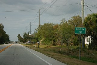
Bradley Junction is an unincorporated community and census-designated place in southwestern Polk County, Florida, United States. Its population was 542 as of the 2020 census.

The Ocoee Scenic Byway is a 26-mile (42 km) National Forest Scenic Byway and Tennessee Scenic Byway that traverses through the Cherokee National Forest, in East Tennessee. It is part of both U.S. Route 64 and U.S. Route 74, and features the Ocoee Whitewater Center and scenic bluffs along Ocoee River and Gorge.

Turtletown is an unincorporated community in Polk County, Tennessee, United States. Turtletown is located on Tennessee State Route 68 6.5 miles (10.5 km) north-northeast of Ducktown. Turtletown is in a primarily mountainous terrain, covered in forests except for areas cleared by farmers, ponds, or roads. Turtletown has a post office with ZIP code 37391. Turtletown's borders, however, in the eyes of some are disputed. According to one, parts of it are known as Dogtown, which appears on a few local maps. However, to others, it is simply all Turtletown and Dogtown does not exist. The only known map that contains this is the USGS map of the area, and a U.S. Forest Service map. There is an abandoned school, Turtletown School, across the street from the Post Office.
Delano is an unincorporated community in Polk County, Tennessee, United States. It is located near the junction of U.S. Route 411, Tennessee State Route 30 and Tennessee State Route 163 4.3 miles (6.9 km) south-southwest of Etowah. Delano has a post office with ZIP code 37325, which opened on August 14, 1909.
Farner is an unincorporated community in Polk County, Tennessee, United States. Farner is located in a mountainous area along Tennessee State Route 68 near the North Carolina border, 9 miles (14 km) north-northeast of Ducktown. Farner has a post office with ZIP code 37333. The Hiwassee River and Apalachia Dam are located just to the north.
Old Fort is an unincorporated community in Polk County, Tennessee, United States. Old Fort is located along U.S. Route 411, Tennessee State Route 33 and a CSX Transportation line 8.75 miles (14.08 km) south-southwest of Benton. Oldfort has a post office with ZIP code 37362.

Reliance is an unincorporated community in Polk County, Tennessee, United States. Reliance is located on the Hiwassee River at the junction of Tennessee State Route 30 and Tennessee State Route 315, 8.8 miles (14.2 km) east of Benton. Reliance had a post office until it closed on May 21, 2011; it still has its own ZIP code, 37369.
Conasauga is an CDP in southern Polk County, Tennessee, United States. It is located approximately 1.2 miles north of the Tennessee-Georgia state line and roughly 17 miles southeast of Cleveland. The Conasauga River Lumber Company is located at Conasauga.
Bumpus Cove is an unincorporated community in Unicoi and Washington Counties, Tennessee, United States. Bumpus Cove is located on Bumpus Cove Creek and Bumpus Cove Road 4 miles (6.4 km) west of Erwin. The community occupies a cove of the same name between Embreeville Mountain on the west and Rich Mountain on the east.
Little Falls is an unincorporated community located in the town of Alden, Polk County, Wisconsin, United States. Little Falls is located at the junction of County Highways C and PP 3.6 miles (5.8 km) southwest of Amery. The Apple River flows through Little Falls and was once dammed where County Road C now crosses the river.

Arkansas Highway 84 is a designation for two state highways in west Arkansas. The western segment is 3.7 miles (6.0 km) long and travels from County Road 14 (CR 14) in Bogg Springs and heads east to U.S. Route 59 and U.S. Route 71 (US 59/US 71) before terminating. The eastern segment is 85.8 miles long and travels from US 278 in Umpire to U.S. 270B in Malvern.

U.S. Route 41 Alternate, also signed U.S. Route 41A in Tennessee (US 41A), connects the town of Monteagle, Tennessee, with Hopkinsville, Kentucky, 10 miles (16 km) north of the Tennessee line. It serves the city of Clarksville, Tennessee, on its way to Nashville, where it briefly runs concurrently with US 41. It then separates again to serve Shelbyville, Winchester, and Tullahoma before rejoining the main route atop Monteagle Mountain. US 41A runs west of US 41 for its entire length, aside from one mile in downtown Nashville where they are concurrent. US 41A is also concurrent with U.S. Route 31A from Nashville to Triune, Tennessee, for a distance of approximately 25 miles (40 km).

State Route 74 (SR 74) is a north–south state highway located primarily in Bradley County, Tennessee. It runs from the Georgia state line to downtown Cleveland. The route serves as a major shortcut, along with SR 60, for Cleveland citizens to commute to Atlanta, Georgia.


