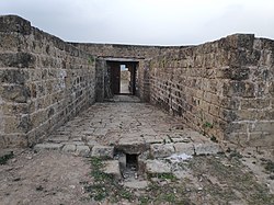
Kamalamai is a municipality in Sindhuli District, in the Bagmati Province of central south Nepal. At the time of the 2011 Nepal census it had a population of 39,413 people in 9,304 households. The city is located in the Sindhuli Valley of central south Nepal. The historic symbol of the valley, Sindhuli Gadhi fort, is at the peak of a hill of the Mahabharata range. The city is in the plain valley made by the Kamla River. Kamalamai Municipality is the largest municipality of Nepal according to area.
Ramechhap Municipality is a municipality in Ramechhap District in Bagmati Province of Nepal. It was established on 2 December 2014 by merging the former village development committees Old-Ramechhap, Okhreni and Sukajor. At the time of the 2011 Nepal census it had a population of 28,612 people living in 6,126 individual households.

Dudhauli is a municipality of the Sindhuli District in the Janakpur Zone of south-eastern Nepal.
Godawari is a municipality in Lalitpur District in Bagmati Province of Nepal. It was established on 2 December 2014 by merging the former Village development committees Godawari, Badikhel, Bisankhunarayan, Godamchaur and Thaiba of Lalitpur District of Bagmati Zone. The municipality area was again expanded in March 2017 to include in total 12 previous VDCs. The six VDCs added were Devichaur, Dukuchhap, Chhampi, Thecho, Chapagaun, Jharuwarasi and Lele. The centre of this municipality is located at Bajrabarahi.
Konjyosom Rural Municipality is a Rural Municipality in Lalitpur District in Bagmati Province of Nepal that was established in 2017 by merging the former Village development committees Sankhu, Dalchoki, Chaughare, Nallu and Bhardev.The center of this rural municipality is located at Chaughare. The major ethnic group of this rural municipality are Tamang. The name Konjyosom itself means Gautama Buddha in Tamang language.
Mahalaxmi is a municipality in Dhankuta District of Koshi Province in Nepal. It is a municipality out of three urban municipalities in Dhankuta District. Total area of the municipality is 126.3 km (78.5 mi) and according to 2011 census of Nepal, the population of this municipality is 24,800. The municipality is divided into nine wards. The headquarter of the municipality is in Jitpur Bazar.
Sunkoshi Rural Municipality is a rural municipality in Sindhuli district of Bagmati Province in Nepal. The Rural municipality is divided into 7 wards. According to 2011 Nepal census, the total population of the municipality is 21,473 with 4,557 households. The total area of the municipality is 158.68 square kilometres (61.27 sq mi) The headquarter of the municipality is at Jhangajholi Ratmata.
Mandandeupur is a municipality in Kavrepalanchok District of Bagmati Province of Nepal.
Myagde Rural Municipality (Myagde Gaupalika) (Nepali: म्याग्दे गाउँपालिका) is a Gaunpalika in Tanahaun District in Gandaki Province of Nepal. On 12 March 2017, the government of Nepal implemented a new local administrative structure, in which VDCs have been replaced with municipal and Village Councils. Myagde is one of these 753 local units.
Arughat Rural Municipality is a Gaunpalika in Gorkha District in Gandaki Province of Nepal. It is divided into 10 wards. On 12 March 2017, the government of Nepal implemented a new local administrative structure, with the implementation of the new local administrative structure, VDCs have been replaced with municipal and Village Councils. Arughat is one of these 753 local units.
Chaurideurali is a Rural municipality located within the Kavrepalanchowk District of the Bagmati Province of Nepal. The municipality spans 98 square kilometres (38 sq mi) of area, with a total population of 20,829 according to a 2011 Nepal census.
Bhumlu is a Rural municipality located within the Kavrepalanchowk District of the Bagmati Province of Nepal. The municipality spans 91 square kilometres (35 sq mi) of area, with a total population of 18,916 according to a 2011 Nepal census.
Khanikhola is a Rural municipality located within the Kavrepalanchowk District of the Bagmati Province of Nepal. The municipality spans 132 square kilometres (51 sq mi) of area, with a total population of 14,398 according to a 2011 Nepal census.
Mahabharat is a Rural municipality located within the Kavrepalanchowk District of the Bagmati Province of Nepal. The municipality spans 186 square kilometres (72 sq mi) of area, with a total population of 18,283 according to a 2011 Nepal census.
Golanjor is a Rural municipality located within the Sindhuli District of the Bagmati Province of Nepal. The municipality spans 184.13 square kilometres (71.09 sq mi) of area, with a total population of 19,329 according to a 2011 Nepal census.
Khandadevi is a Rural municipality located within the Ramechhap District of the Bagmati Province of Nepal. The municipality spans 150.7 square kilometres (58.2 sq mi) of area, with a total population of 25,761 according to a 2011 Nepal census.
Sunapati is a Rural municipality located within the Ramechhap District of the Bagmati Province of Nepal. The municipality spans 86.98 square kilometres (33.58 sq mi) of area, with a total population of 18,141 according to a 2011 Nepal census.
Tinpatan is a Rural municipality located within the Sindhuli District of the Bagmati Province of Nepal. The municipality spans 280.26 square kilometres (108.21 sq mi) of area, with a total population of 38,395 according to a 2011 Nepal census.
Marin is a Rural municipality located within the Sindhuli District of the Bagmati Province of Nepal. The municipality spans 324.55 square kilometres (125.31 sq mi) of area, with a total population of 27,822 according to a 2011 Nepal census.
Phikkal is a Rural municipality located within the Sindhuli District of the Bagmati Province of Nepal. The municipality spans 186.06 square kilometres (71.84 sq mi) of area, with a total population of 16,968 according to a 2011 Nepal census.