Harrison Township | |
|---|---|
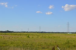 Along State Road 18 west of Montpelier | |
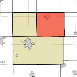 Location of Harrison Township in Blackford County | |
| Coordinates: 40°31′49″N85°16′07″W / 40.53028°N 85.26861°W | |
| Country | United States |
| State | Indiana |
| County | Blackford |
| Government | |
| • Type | Indiana township |
| Area | |
• Total | 42.23 sq mi (109.4 km2) |
| • Land | 42.13 sq mi (109.1 km2) |
| • Water | 0.1 sq mi (0.26 km2) |
| Elevation | 879 ft (268 m) |
| Population | |
• Total | 2,353 |
| • Density | 55.85/sq mi (21.56/km2) |
| FIPS code | 18-31630 [3] |
| GNIS feature ID | 453378 |
Harrison Township is one of four townships in Blackford County, Indiana. As of the 2020 census, its population was 2,353 (down from 2,640 at 2010 [4] ) and it contained 1,155 housing units. [2] The township was named after William Henry Harrison, hero of the Battle of Tippecanoe, former governor of the Indiana Territory, and ninth President of the United States. [5]

