
Blackford County is located in the east central portion of the U.S. state of Indiana. The county is named for Judge Isaac Blackford, who was the first speaker of the Indiana General Assembly and a long-time chief justice of the Indiana Supreme Court. Created in 1838, Blackford County is divided into four townships, and its county seat is Hartford City. Two incorporated cities and one incorporated town are located within the county. The county is also the site of numerous unincorporated communities and ghost towns. Occupying only 165.58 square miles (428.9 km2), Blackford County is the fourth smallest county in Indiana. As of the 2010 census, the county's population was 12,766 people in 5,236 households. Based on population, the county is the 8th smallest county of the 92 in Indiana. Although no interstate highways are located in Blackford County, three Indiana state roads cross the county, and an additional state road is located along the county's southeast border. The county has two railroad lines. A north–south route crosses the county, and intersects with a second railroad line that connects Hartford City with communities to the west.

Montpelier is a city in Harrison Township, Blackford County, in the U.S. state of Indiana. This small rural community, the county's first to be platted, was established by settlers from Vermont, and is named after Vermont's capital city of Montpelier.
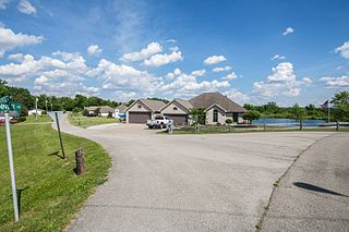
Shamrock Lakes is a town in Licking Township, Blackford County, Indiana, United States. It was incorporated on May 21, 1973—and was the first community in Indiana to do so in 50 years. The small town consists of a group of six lakes that were created between 1960 and 1965, and the first lake was originally intended to be a water supply for a farmer's cattle. The community was listed on the front page of USA Today as one of only five places in the United States named after Ireland's clover emblem, the shamrock. The town's population was 231 at the 2010 census.

Matamoras is a village in Washington County, Ohio, United States, along the Ohio River. It is also commonly known as New Matamoras. The population was 896 at the 2010 census.

Center Township is one of twelve townships in Porter County, Indiana, United States. As of the 2010 census, its population was 43,267.

Morgan Township is one of twelve townships in Porter County, Indiana. As of the 2010 census, its population was 3,684.

Pine Township is one of twelve townships in Porter County, Indiana. As of the 2010 census, its population was 2,709.

Porter Township is one of twelve townships in Porter County, Indiana. As of the 2010 census, its population was 9,367.

Union Township is one of twelve townships in Porter County, Indiana. As of the 2010 census, its population was 8,811.

Washington Township is one of twelve townships in Porter County, Indiana. As of the 2010 census, its population was 4,785.

Harrison Township is one of four townships in Blackford County, Indiana. As of the 2010 census, its population was 2,640 and it contained 1,196 housing units. The township was named after William Henry Harrison, hero of the Battle of Tippecanoe, former governor of the Indiana Territory, and ninth President of the United States.

Jackson Township is one of four townships in Blackford County, Indiana. As of the 2010 census, its population was 1,354 and it contained 596 housing units. The township was named after Andrew Jackson, hero of the Battle of New Orleans and the seventh President of the United States.

Licking Township is one of four townships in Blackford County, Indiana. As of the 2010 census, its population was 7,899 and it contained 3,885 housing units. The township was named after Lick Creek and a salt lick in the area. The first settlers in what became Blackford County arrived in the Lick Creek area in 1831.

Washington Township is one of four townships in Blackford County, Indiana. As of the 2010 census, its population was 873 and it contained 374 housing units. County Commissioners named the township after George Washington in 1833, and it was part of Jay County. In 1838, Washington Township became part of the newly organized Blackford County.

Converse is an unincorporated community in Jackson Township, Blackford County, in the U.S. state of Indiana. Although not much of the community remains, the U.S. Geological Survey considers it a populated place. The community existed as a "flag" station along a railroad, and is named after railroad executive Joel N. Converse. Like many communities in Blackford County, this village declined after the end of the Indiana Gas Boom, which ended in the early 20th century.

Millgrove is an unincorporated community in Jackson Township, Blackford County, in the U.S. state of Indiana. Nearly all of the community's businesses have been closed for many years. Although the Blackford County Historical Society lists this community as a ghost town, homes are still maintained in the area.
Renner is an extinct American village in Indiana's Blackford County. Although Renner has been listed as a “populated place” by the U.S. Geological Survey, this description is misleading. Renner was a railroad stop on the Pittsburgh, Cincinnati and St. Louis Railroad. The land around the railroad stop was originally used to supply timber for railroad crossties, and eventually became a livestock farm. Housing for the families of the employees of the livestock farm was also located nearby. Although it is not known for certain, Renner is thought to have been named for railroad executive John W. Renner. Renner was an executive of the Pittsburgh, Cincinnati and St. Louis Railroad, and later the Pennsylvania Railroad, and retired with over 50 years of railroad experience. Another community, Rennerdale, Pennsylvania, was named in his honor in 1895.
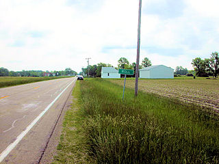
Roll is an unincorporated community in Washington Township, Blackford County, in the U.S. state of Indiana. Nearly all of the community's businesses have been closed for years. Although the Blackford County Historical Society lists Roll as a ghost town, homes are still maintained in the area, and it is still listed as a populated place by the U.S. Geological Survey. The rural community is located on Indiana State Road 18, about one mile west of its intersection with Indiana State Road 3.
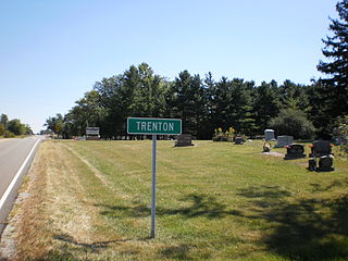
Trenton is an unincorporated community in Jackson Township, Blackford County, in the U.S. state of Indiana. Nearly all of the community's businesses have been closed for many years. Although the Blackford County Historical Society lists this community as a ghost town, homes are still maintained in the area, and it is still listed as a populated place by the U.S. Geological Survey.

Santa Fe is an unincorporated community in Butler Township, Miami County, in the U.S. state of Indiana.


