
Akron–Canton Airport is a commercial airport in the city of Green, in southern Summit County, Ohio. The airport is located about 14 miles (23 km) southeast of Akron and 10 miles (16 km) northwest of Canton. It is jointly operated by Summit County and Stark County. The airport is a "reliever" airport for Northeast Ohio and markets itself as "A better way to go", emphasizing the ease of travel in comparison to Cleveland Hopkins International Airport. Just under 90% of its traffic is general aviation. It is included in the Federal Aviation Administration (FAA) National Plan of Integrated Airport Systems for 2019–2023, in which it is categorized as a small-hub primary commercial service facility.

Dayton–Wright Brothers Airport is a public airport located 10 miles (16 km) south of the central business district of Dayton, Ohio, located mainly in Miami Township, Montgomery County and partly in Clearcreek Township, Warren County, near the suburb of Springboro. It is owned and operated by the City of Dayton and serves as the reliever airport for Dayton International Airport. It mainly serves corporate and personal aircraft users. The airport's identifying code, MGY, is a reference to its former name of Montgomery County Airport.

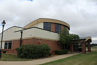
Cuyahoga County Airport, also known as Robert D. Shea Field, is a public use airport in northeastern Cuyahoga County, Ohio, United States. Owned and operated by Cuyahoga County since 1946, it also serves Lake County and Geauga County. The airport is located 10 nautical miles east of downtown Cleveland and sits on the border of three cities: Highland Heights, Richmond Heights and Willoughby Hills. It is included in the National Plan of Integrated Airport Systems for 2011–2015, which categorized it as a general aviation reliever airport for Cleveland Hopkins International Airport.

Ohio State University Airport is a public airport six miles (10 km) northwest of downtown Columbus, in Franklin County, Ohio, United States. It is owned and operated by Ohio State University in Columbus. It is also known as the OSU Don Scott Airport, named after Donald E. Scott, an OSU alumnus who died during his training as a pilot in the United Kingdom during World War II. The airport's main entrance is located on Case Road, and is easily accessible from OH-315 and Interstate 270.

Springfield–Beckley Municipal Airport is a civil-military airport five miles (8 km) south of Springfield, in Clark County, Ohio, United States. It is owned by the city of Springfield. It is named after the Beckley family, a member of which knew the Wright Brothers, and witnessed and photographed their first flights.
Ohio University Airport or Gordon K. Bush Airport, also known as Snyder Field, is a public-use airport located on State Route 32/U.S. 50 in the village of Albany, about ten miles (16 km) southwest of the city of Athens, in Athens County, Ohio, United States.
Portage County Airport, also known as Portage County Regional Airport, is a public use airport in Portage County, Ohio, United States. It is owned by the Portage County Airport Authority and located three nautical miles (6 km) north of Ravenna, in Shalersville Township. This airport is included in the National Plan of Integrated Airport Systems for 2011–2015, which categorized it as a general aviation facility.
Greater Kankakee Airport is a public use airport located three nautical miles (6 km) south of the central business district of Kankakee, a city in Kankakee County, Illinois, United States. It is included in the National Plan of Integrated Airport Systems for 2011–2015, which categorized it as a general aviation facility.

Middletown Regional Airport, also known as Hook Field, is a city-owned public-use airport located two nautical miles (3.7 km) north of the central business district of Middletown, a city in Butler County, Ohio, United States. The airport was renamed in October 2008; it was previously known as Hook Field Municipal Airport.
Newark–Heath Airport is a public airport located in Heath, Ohio. It is three miles (4.8 km) southwest of the central business district of Newark, a city in Licking County, Ohio, United States. The airport was opened in 1930 by the city of Newark, and was transferred to the Licking County Regional Airport Authority in 1967. The airport currently has a McDonnell Douglas F-4C Phantom II S.N. 64–0683 on static display.
Madison County Airport is a public airport located 3 miles (4.8 km) north of the central business district of London, a city in Madison County, Ohio, United States. It is owned by the Madison County Airport Authority.

Union County Airport is a public use airport in Union County, Ohio, United States. It is owned by the Union County Airport Authority and located one nautical mile (2 km) southeast of the central business district of Marysville, Ohio. This airport is included in the National Plan of Integrated Airport Systems for 2011–2015, which categorized it as a general aviation facility.
Fairfield County Airport is a public use airport in Fairfield County, Ohio, United States. It is located three nautical miles (6 km) northwest of the central business district of Lancaster, the county seat. The airport is owned by the Fairfield County Commissioners.
Griffing Sandusky Airport was a public airport in Erie County, Ohio, next to Sandusky Bay three miles southeast of Sandusky. The airport permanently closed on December 31, 2013 and the FAA A/FD and VFR sectional charts no longer show the airport as open or operational. Instrument approach procedures are no longer available from the FAA's website. All hangars and the entrance were demolished in April, 2016. The Sandusky Register confirmed that the city announced that a sports park will replace the airport and now has opened in spring 2017 called the Cedar Point Sports Center.
Lake County Executive Airport, formerly Lost Nation Airport, is a public use airport in Lake County, Ohio, United States. Located approximately 3 miles (5 km) north-northeast of the central business district of the City of Willoughby, it was owned and operated by that city until October 8, 2014, when it was transferred to Lake County and the Lake County Port and Economic Development Authority. The airport's name was changed from Lost Nation Airport to Lake County Executive Airport, alternately "Lake County Executive Airport at Lost Nation Field," in March 2020.
Highland County Airport is a public-owned, public-use airport located at 9500 North Shore Drive three nautical mile (4.8 km) southeast of the central business district of the city of Hillsboro, in Highland County, Ohio, United States.
Galion Municipal Airport is three miles northeast of Galion in Crawford County, Ohio. The FAA's National Plan of Integrated Airport Systems for 2009–2013 classified it as a general aviation airport.
Bluffton Airport is a public use airport located one nautical mile (1.85 km) southeast of the central business district of Bluffton, in Hancock County, Ohio, United States. It is owned by the Village of Bluffton. According to the FAA's National Plan of Integrated Airport Systems for 2009–2013, it is categorized as a general aviation facility.

Marion Municipal Airport is three miles northeast of Marion, in Marion County, Ohio. The FAA's National Plan of Integrated Airport Systems for 2011–2015 categorized it as a general aviation facility.
Holmes County Airport is a public airport located two miles southwest of Millersburg, Ohio, United States. It is owned and operated by the Holmes County Airport Authority.

