Havelock, Quebec

Last updated

Havelock
Havelock QC.JPG
Havelock Quebec location diagram.PNG
Location within Le Haut-Saint-Laurent RCM
Canada Southern Quebec location map.png
Red pog.svg
Havelock
Location in southern Quebec
Coordinates: 45°03′N73°45′W / 45.050°N 73.750°W / 45.050; -73.750 [1]
CountryCanada
Province Quebec
Region Montérégie
RCM Le Haut-Saint-Laurent
ConstitutedApril 1, 1863
Named for Henry Havelock [1]
Government
  MayorGerald Beaudoin
   Federal riding Beauharnois—Salaberry
   Prov. riding Huntingdon
Area
  Total88.96 km2 (34.35 sq mi)
  Land88.92 km2 (34.33 sq mi)
Population
 (2021) [4]
  Total756
  Density8.5/km2 (22/sq mi)
  Pop (2016-21)
Increase2.svg 2.2%
  Dwellings
407
Time zone UTC−5 (EST)
  Summer (DST) UTC−4 (EDT)
Postal code(s)
Area code(s) 450 and 579
HighwaysQc202.svg R-202 Qc203.svg R-203

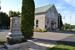
Havelock is a township in Le Haut-Saint-Laurent Regional County Municipality in southern Quebec, Canada. The population as of the 2021 Canadian census was 756. Neighbouring townships include Franklin to the west, St-Chrysostome to the north and Hemmingford to the east. Havelock's southern boundary is the Canada–United States border with New York State.

Contents

Located within Havelock is Covey Hill, one of the northernmost hills of the Adirondack Mountains and the highest point in Le Haut-Saint-Laurent Regional County Municipality. [5]

History

Named after Major-General Sir Henry Havelock, a British general who served in India, the township municipality was created in 1863 from the west end of Hemmingford Township. [1]

Geography

Communities

In addition to the namesake community, the following locations reside within the municipality's boundaries: [1]

Lakes & rivers

The following waterways pass through or are situated within the municipality's boundaries: [1]

Topographic features

Demographics

In the 2021 Census of Population conducted by Statistics Canada, Havelock had a population of 756 living in 352 of its 407 total private dwellings, a change of 2.2% from its 2016 population of 740. With a land area of 88.7 km2 (34.2 sq mi), it had a population density of 8.5/km2 (22.1/sq mi) in 2021. [4]

Canada census – Havelock community profile
2021 2016 2011
Population756 (+2.2% from 2016)740 (-2.1% from 2011)756 (-0.7% from 2006)
Land area88.70 km2 (34.25 sq mi)88.95 km2 (34.34 sq mi)88.92 km2 (34.33 sq mi)
Population density8.5/km2 (22/sq mi)8.3/km2 (21/sq mi)8.5/km2 (22/sq mi)
Median age52.8 (M: 51.6, F: 54.0)53.5 (M: 52.7, F: 54.2)51.1 (M: 51.1, F: 51.2)
Private dwellings407 (total)  352 (occupied)400 (total)  342 (occupied)416 (total) 
Median household income$60,400$47,872$.N/A
Notes: 2011 income data for this area has been suppressed for data quality or confidentiality reasons.
References: 2021 [6] 2016 [7] 2011 [8] earlier [9] [10]
Historical Census Data - Havelock, Quebec
YearPop.±%
1921 701    
1931 712+1.6%
1941 612−14.0%
1951 623+1.8%
1956 673+8.0%
1961 609−9.5%
YearPop.±%
1966 669+9.9%
1971 657−1.8%
1976 737+12.2%
1981 675−8.4%
1986 757+12.1%
1991 738−2.5%
YearPop.±%
1996 811+9.9%
2001 794−2.1%
2006 761−4.2%
2011 756−0.7%
2016 740−2.1%
2021 756+2.2%
Source: Statistics Canada [11]
Canada Census Mother Tongue - Havelock, Quebec [11]
CensusTotal
French
English
French & English
Other
YearResponsesCountTrendPop %CountTrendPop %CountTrendPop %CountTrendPop %
2011
750
500Steady2.svg 0.0%66.67%225Increase2.svg 2.3%30.00%5Increase2.svg n/a%0.66%20Decrease2.svg 20.0%2.67%
2006
745
500Decrease2.svg 9.1%67.11%220Decrease2.svg 2.2%29.53%0Decrease2.svg 100.0%0.00%25Increase2.svg n/a%3.36%
2001
790
550Increase2.svg 12.2%69.62%225Decrease2.svg 22.4%28.48%15Increase2.svg 50.0%1.90%0Decrease2.svg 100.0%0.00%
1996
810
490n/a60.49%290n/a35.80%10n/a1.24%20n/a2.47%

Arts and culture

Havelock Town Hall is a National Historic Site of Canada Lieu historique national du Canada de la Mairie-de-Havelock 03.JPG
Havelock Town Hall is a National Historic Site of Canada

The town is noted for its annual agricultural fair, Havelock Fair, held every September. It showcases the best the local countryside has to offer. It was founded in 1871 and is one of the oldest fairs in Canada. [12]

See also

Related Research Articles

Huntingdon County is an historical county in southwestern Quebec, Canada. It is named after the town and county of the same name in east central England. It is situated in the Montreal South Shore region of Montérégie, one of the roughly 12 regions of Quebec. The county was bounded entirely on its south by the Canada–US border, along its northwestern flank by Lake St-Francis of the Saint Lawrence River to its most northern point on the river at 45°13′ N and 74°13′ W, to the east by Saint-Jean County, with its easternmost point at 45°5.5' N and 73°31′ W and to the north from east to west by Napierville County, Châteauguay County, and Beauharnois County. On the other side of the Saint Lawrence River is Soulanges County, Quebec, the Township of Lancaster and the Township of Charlottenburgh in Glengarry County, Ontario, and the Township of Cornwall in Stormont County, Ontario.

<span class="mw-page-title-main">Senneterre</span> City in Quebec, Canada

Senneterre is a town in the Abitibi-Témiscamingue region of northwestern Quebec, Canada. It is in La Vallée-de-l'Or Regional County Municipality.

<span class="mw-page-title-main">Elgin, Quebec</span> Municipality in Quebec, Canada

Elgin is a rural municipality in Quebec, Canada. The population as of the 2021 Canadian census was 389. It is located southwest of Huntingdon and bounded by the Trout and Châteauguay rivers and the Canada–United States border.

<span class="mw-page-title-main">Hinchinbrooke, Quebec</span> Municipality in Quebec, Canada

Hinchinbrooke is a rural community in southern Quebec, Canada, in the Châteauguay Valley, in the MRC de Le Haut-Saint-Laurent. The population as of the 2021 Canadian census was 2,187.

<span class="mw-page-title-main">Ormstown</span> Municipality in Quebec, Canada

Ormstown is a municipality in Quebec, Canada, which is situated on the Châteauguay River in the heart of the Châteauguay Valley. It is approximately one hour southwest of Montreal and 20 minutes north of New York State in the United States. The population as of the 2021 Canadian census was 3,917.

<span class="mw-page-title-main">Hemmingford, Quebec (township)</span> Township municipality in Quebec, Canada

Hemmingford is a township municipality in south-west Quebec. The population as of the 2021 Canadian census was 1,995. The township completely surrounds the Village of Hemmingford. The two entities are locally referred to collectively as Hemmingford. The two share many things, such as the cost of the volunteer fire department, and both hold their councils and offices in the same building in the village.

<span class="mw-page-title-main">Hemmingford, Quebec (village)</span> Village municipality in Quebec, Canada

Hemmingford is a village municipality located in Les Jardins-de-Napierville Regional County Municipality of southern Quebec. The population as of 2021 was 829.

<span class="mw-page-title-main">Saint-Chrysostome, Quebec</span> Municipality in Quebec, Canada

Saint-Chrysostome is a municipality in south-west Quebec, Canada in the regional county municipality of Haut-Saint-Laurent in the Montérégie administrative region. The municipality was created by the amalgamation of Saint-Chrysostome village with the parish of Saint-Jean-Chrysostome on September 29, 1999. The population as of the 2021 Canadian census was 2,582.

<span class="mw-page-title-main">Franklin, Quebec</span> Municipality in Quebec, Canada

Franklin is a Canadian municipality located in the Montérégie region of Quebec along the Canada–US border. The population as of the 2021 Canadian census was 1,635.

<span class="mw-page-title-main">Beauharnois, Quebec</span> City in Quebec, Canada

Beauharnois is a city located in the Beauharnois-Salaberry Regional County Municipality of southwestern Quebec, Canada, and is part of the Greater Montreal Area. The city's population as of the Canada 2021 Census was 13,638. It is home to the Beauharnois Hydroelectric Power Station, as well as the Beauharnois Lock of the Saint Lawrence Seaway.

<span class="mw-page-title-main">Grande-Vallée, Quebec</span> Municipality in Quebec, Canada

Grande-Vallée is a municipality in the Gaspésie-Îles-de-la-Madeleine region of the province of Quebec in Canada.

<span class="mw-page-title-main">Sainte-Martine, Quebec</span> Municipality in Quebec, Canada

Sainte-Martine is a municipality in Beauharnois-Salaberry Regional County Municipality in the Montérégie region of Quebec, Canada. The population as of the 2021 Canadian census was 5,664. The municipality is made up of a large northern section and a small unattached southern area that was known as the municipality of Saint-Paul-de-Châteauguay until its merger with Sainte-Martine on September 9, 1999.

<span class="mw-page-title-main">Très-Saint-Sacrement</span> Parish municipality in Quebec, Canada

Très-Saint-Sacrement is a parish municipality located along the Châteauguay River in the Montérégie region of Quebec, Canada. The population as of the 2021 Canadian census was 1,189. Established in 1885, the municipality completely encloses the village of Howick, which was incorporated as a separate entity in 1915.

<span class="mw-page-title-main">Godmanchester, Quebec</span> Township municipality in Quebec, Canada

Godmanchester is a township municipality located in Le Haut-Saint-Laurent Regional County Municipality in the Montérégie region of Quebec, Canada. The population as of the 2021 Canadian census was 1,403 The southeast part of the township is mostly delineated by the Châteauguay River, while the south end borders with Franklin County, New York.

<span class="mw-page-title-main">Dundee, Quebec</span> Township municipality in Quebec, Canada

Dundee is a township municipality in Le Haut-Saint-Laurent Regional County Municipality in the Montérégie administrative region of Quebec, Canada. At the 2021 Canadian census, the population was 386. It is primarily an agricultural area consisting of dairy and grain farms.

<span class="mw-page-title-main">Lac-Chicobi</span> Unorganized territory in Quebec, Canada

Lac-Chicobi is an unorganized territory in the Canadian province of Quebec, located within the Abitibi Regional County Municipality. The area consists of two non-contiguous portions on either side of the incorporated municipality of Berry.

<span class="mw-page-title-main">Les Lacs-du-Témiscamingue</span> Unorganized territory in Quebec, Canada

Les Lacs-du-Témiscamingue is a large unorganized territory in the Abitibi-Témiscamingue region of Quebec, Canada. With a total area of 12,224.27 square kilometres (4,719.82 sq mi), it takes up over 60% of the eastern portion of the Témiscamingue Regional County Municipality.

<span class="mw-page-title-main">Laniel, Quebec</span> Unorganized territory in Quebec, Canada

Laniel is an unorganized territory in the Témiscamingue Regional County Municipality, Abitibi-Témiscamingue region, Quebec, Canada. It surrounds the northern portion of Lake Kipawa.

<span class="mw-page-title-main">Saint-Anicet</span> Municipality in Quebec, Canada

Saint-Anicet is a municipality in Le Haut-Saint-Laurent Regional County Municipality in the Montérégie administrative region of Quebec. The population as of the Canada 2021 Census was 2,754.

<span class="mw-page-title-main">Sainte-Anne-du-Lac</span> Municipality in Quebec, Canada

Sainte-Anne-du-Lac is a municipality and village in the Laurentides region of Quebec, Canada, part of the Antoine-Labelle Regional County Municipality.

References

  1. 1 2 3 4 5 6 "Banque de noms de lieux du Québec: Reference number 28191". toponymie.gouv.qc.ca (in French). Commission de toponymie du Québec.
  2. 1 2 "Répertoire des municipalités: Havelock". www.mamh.gouv.qc.ca (in French). Ministère des Affaires municipales et de l'Habitation. Retrieved 11 October 2023.
  3. Riding history for Beauharnois—Salaberry, Quebec from the Library of Parliament
  4. 1 2 3 "Havelock, Quebec (Code 2469005) Census Profile". 2021 census . Government of Canada - Statistics Canada.
  5. 1 2 "Covey Hill, Québec". Peakbagger.com. Retrieved 24 September 2012.
  6. "2021 Community Profiles". 2021 Canadian Census . Statistics Canada. February 4, 2022. Retrieved 2023-10-19.
  7. "2016 Community Profiles". 2016 Canadian Census . Statistics Canada. August 12, 2021. Retrieved 2023-10-11.
  8. "2011 Community Profiles". 2011 Canadian Census . Statistics Canada. March 21, 2019. Retrieved 2014-02-13.
  9. "2006 Community Profiles". 2006 Canadian Census . Statistics Canada. August 20, 2019.
  10. "2001 Community Profiles". 2001 Canadian Census . Statistics Canada. July 18, 2021.
  11. 1 2 1996, 2001, 2006, 2011 census
  12. Havelock Fair Homepage Archived 2012-09-06 at the Wayback Machine , retrieved 23 September 2012