Ormstown

Last updated

Ormstown
Ormstown rue Lambton.jpg
Ormstown Quebec location diagram.PNG
Location within Le Haut-Saint-Laurent RCM
Canada Southern Quebec location map.png
Red pog.svg
Ormstown
Location in southern Quebec
Coordinates: 45°08′N74°00′W / 45.13°N 74°W / 45.13; -74 [1]
CountryCanada
Province Quebec
Region Montérégie
RCM Le Haut-Saint-Laurent
ConstitutedJanuary 26, 2000
Government
  MayorChristine McAleer
   Federal riding Salaberry—Suroît
   Prov. riding Huntingdon
Area
  Total143.72 km2 (55.49 sq mi)
  Land142.24 km2 (54.92 sq mi)
Population
 (2021) [4]
  Total3,917
  Density27.5/km2 (71/sq mi)
  Pop (2016-21)
Increase2.svg 9.0%
  Dwellings
1,788
Time zone UTC−5 (EST)
  Summer (DST) UTC−4 (EDT)
Postal code(s)
Area code(s) 450 and 579
HighwaysQc138.svg R-138 Qc201.svg R-201
Website www.ormstown.ca OOjs UI icon edit-ltr-progressive.svg

Ormstown is a municipality in Quebec, Canada, which is situated on the Chateauguay River in the heart of the Chateauguay Valley. It is approximately one hour southwest of Montreal and 20 minutes north of New York State in the United States. The population as of the 2021 Canadian census was 3,917.

Contents

Ormstown has two elementary schools, one high school (Chateauguay Valley Regional), and two adult education facilities, several restaurants and churches. Ormstown is also well known for its numerous antique dealers and unique gift shops. There is a park north of the centre of town which is home to Ormstown Beach, an urban legend created and memorialized in the 1970s with "I've been to Ormstown Beach" bumper stickers. It is a popular summer activity to cycle along the Chateauguay River. The town has traces of an old dam, which was once the source of power for the mill. People living outside the town only gained access to electricity following World War II.

History

Settlement of the area began in the early 19th century and by 1820, it was populated by people from Scotland and the north of Ireland. There is uncertainty about the origin of the name Ormstown, possibly a distortion of "Ormiston", a Scottish village. Around 1860 it was also called Durham. [1]

In 1808, a sawmill was built, followed by a Presbyterian church in 1829 and a Anglican church in 1832. In 1836, the Ormstown Post Office opened, and in 1846, the Catholic parish was established under the name Saint-Malachie-d'Ormstown, in honour of Saint Malachy. [1]

In 1845, the Municipality of Ormstown was founded, but dissolved in 1847. In 1855, it was reestablished as the Parish Municipality of Saint-Malachie-d’Ormstown. In 1889, the main town centre split off to form the Village Municipality of Ormstown. [1]

In the 1950s, Ormstown became the site of a significant microwave radio relay station, part of the Trans Canada Telephone System. Initially, the system passed through the major cities of Canada via towers located on top of downtown telephone buildings. Subsequently, concerns were expressed that a disaster affecting any of those city cores, such as a war or uprising, would result in an interruption of the continuity of the transcontinental communications system. The solution was to locate a "bypass" microwave site outside each of those cities with links to the east and west, as well as a short link into the city. The Ormstown facility was the bypass point for Montreal, but had further significance as it also included a link to the AT&T Long Lines TD2 microwave system in the United States.

In 2000, the village municipality merged with the surrounding parish municipality of St-Malachie d'Ormstown to form the Municipality of Ormstown. [1]

Geography

Communities

In addition to the main population centre of Ormstown, the following locations reside within the municipality's boundaries: [1]

Lakes & Rivers

The following waterways pass through or are situated within the municipality's boundaries: [1]

Demographics

Population

Canada census – Ormstown community profile
2021 2016 2011
Population3,917 (+9.0% from 2016)3,595 (0.0% from 2011)3,595 (-1.5% from 2006)
Land area142.24 km2 (54.92 sq mi)142.79 km2 (55.13 sq mi)142.19 km2 (54.90 sq mi)
Population density27.5/km2 (71/sq mi)25.2/km2 (65/sq mi)25.3/km2 (66/sq mi)
Median age47.2 (M: 45.2, F: 50.0)49.0 (M: 47.4, F: 50.6)47.0 (M: 45.6, F: 47.7)
Private dwellings1,788 (total)  1,706 (occupied)1,641 (total)  1,542 (occupied)1,516 (total) 
Median household income$65,000$52,736$.N/A
Notes: 2011 income data for this area has been suppressed for data quality or confidentiality reasons.
References: 2021 [5] 2016 [6] 2011 [7] earlier [8] [9]
Historical Census Data - Ormstown, Quebec
YearPop.±%
1976 3,676    
1981 3,775+2.7%
1986 3,661−3.0%
1991 3,678+0.5%
1996 3,700+0.6%
YearPop.±%
2001 3,647−1.4%
2006 3,651+0.1%
2011 3,595−1.5%
2016 3,595+0.0%
2021 3,917+9.0%
Population amounts prior to 2000 are total of Ormstown (Village) and Saint-Malachie-d'Ormstown (Parish).
Source: Statistics Canada [10]

Language

Canada Census Mother Tongue - Ormstown, Quebec [10]
CensusTotal
French
English
French & English
Other
YearResponsesCountTrendPop %CountTrendPop %CountTrendPop %CountTrendPop %
2016
3,465
2,145Decrease2.svg 0.7%61.90%1,160Decrease2.svg 3.7%33.48%75Increase2.svg 15.4%2.16%70Increase2.svg 7.7%2.02%
2011
3,495
2,160Decrease2.svg 2.7%61.80%1,205Steady2.svg 0.0%34.48%65Increase2.svg 30.0%1.86%65Increase2.svg 18.2%1.86%
2006
3,530
2,220Decrease2.svg 1.1%62.89%1,205Increase2.svg 3.0%34.13%50Steady2.svg 0.0%1.42%55Decrease2.svg 21.4%1.56%
2001
3,535
2,245Increase2.svg 152.2%63.51%1,170Increase2.svg 103.5%33.10%50Increase2.svg 66.7%1.41%70Increase2.svg 600.0%1.98%
1996
1,505
890n/a59.14%575n/a38.21%30n/a1.99%10n/a0.66%

Attractions

Expo Ormstown

One of the town's main attractions is the Expo Ormstown—formally known as the Ormstown Fair—which was started in 1910. It is held annually during the second week of June, making it Quebec's earliest spring fair. Several competitions take place at the fair: farm animals, crafts, horticulture and baked goods are evaluated by judges and can be viewed by fair goers. Other competitions include a tractor pull, demolition derby, and equestrian events. Additionally, there are carnival rides, arcades, a petting zoo, and live musical performances. The Ormstown fair attracts people from all surrounding areas.

Government

Ormstown town hall Ormstown QC.JPG
Ormstown town hall

Jacques Lapierre was elected to fill the post of mayor on November 1, 2009, replacing interim mayor Luc Lavigueur. Lavigueur took over the post after former mayor John McCaig resigned for health reasons.

List of former mayors since formation of current municipality: [11]

  1. Madeleine Himbault Greig (2000–2001)
  2. John McCaig (2001–2008)
  3. Luc Lavigueur (2008–2009)
  4. Jacques Lapierre (2009–2013, 2017–2021)
  5. Jean Côté (2013–2014)
  6. Chrystian Soucy (2014–2017)
  7. Christine McAleer (2021–present)

Infrastructure

Transportation

exo du Haut-Saint-Laurent formerly provided commuter and local bus services, but these have been replaced by services provided by the Haut-Saint-Laurent Regional County Municipality. [12]

See also

Related Research Articles

<span class="mw-page-title-main">Delson</span> City in Quebec, Canada

Delson is an off-island suburb of Montreal, Quebec, Canada. It is situated 8 mi/13 km SSE of Montreal within the regional county municipality of Roussillon in the administrative region of Montérégie. The population as of the Canada 2021 Census was 8,328.

<span class="mw-page-title-main">Huntingdon, Quebec</span> City in Quebec, Canada

Huntingdon is a small town in Huntingdon County in the Haut-Saint-Laurent Regional County Municipality and the Montérégie region of the province of Quebec, Canada. The population as of the 2021 Canadian census was 2,556. The town is 75 kilometres (47 mi) southwest of Montreal, and 15 kilometres (9.3 mi) from the border with New York State.

<span class="mw-page-title-main">Mercier, Quebec</span> City in Quebec, Canada

Mercier is a suburban town in southwestern Quebec, Canada, in the Roussillon Regional County Municipality. It is located on the Châteauguay River, southwest of Montreal. The population as of the Canada 2021 Census was 14,626.

<span class="mw-page-title-main">Beauharnois—Salaberry</span> Federal electoral district in Quebec, Canada

Beauharnois—Salaberry is a former federal electoral district in Quebec, Canada, that was represented in the House of Commons of Canada from 1949 to 2015.

<span class="mw-page-title-main">Elgin, Quebec</span> Municipality in Quebec, Canada

Elgin is a rural municipality in Quebec, Canada. The population as of the 2021 Canadian census was 389. It is located southwest of Huntingdon and bounded by the Trout and Chateauguay rivers and the Canada–United States border.

<span class="mw-page-title-main">Hinchinbrooke, Quebec</span> Municipality in Quebec, Canada

Hinchinbrooke is a rural community in southern Quebec, Canada, in the Châteauguay Valley, in the MRC de Le Haut-Saint-Laurent. The population as of the 2021 Canadian census was 2,187.

<span class="mw-page-title-main">Saint-Malachie</span> Parish municipality in Quebec, Canada

Saint-Malachie is a village of about 1,500 people in the Bellechasse Regional County Municipality, part of the Chaudière-Appalaches administrative region. The Etchemin River goes through the municipality.

<span class="mw-page-title-main">Havelock, Quebec</span> Township municipality in Quebec, Canada

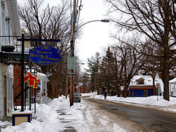
Havelock is a township in Le Haut-Saint-Laurent Regional County Municipality in southern Quebec, Canada. The population as of the 2021 Canadian census was 756. Neighbouring townships include Franklin to the west, St-Chrysostome to the north and Hemmingford to the east. Havelock's southern boundary is the Canada–United States border with New York State.

<span class="mw-page-title-main">Chateauguay River</span> River in United States, Canada

The Chateauguay River is a tributary of the South Shore of the St. Lawrence River, flowing in:

<span class="mw-page-title-main">Saint-Chrysostome, Quebec</span> Municipality in Quebec, Canada

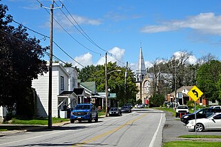
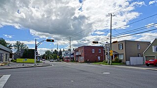
Saint-Chrysostome is a municipality in south-west Quebec, Canada in the regional county municipality of Haut-Saint-Laurent in the Montérégie administrative region. The municipality was created by the amalgamation of Saint-Chrysostome village with the parish of Saint-Jean-Chrysostome on September 29, 1999. The population as of the 2021 Canadian census was 2,582.

<span class="mw-page-title-main">Howick, Quebec</span> Municipality in Quebec, Canada

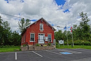
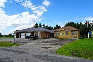
Howick is the third smallest municipality in the Canadian province of Quebec, located in Le Haut-Saint-Laurent Regional County Municipality. The population as of the 2021 Canadian census was 850. Situated along the English River in the heart of the Chateauguay Valley, it is approximately 50 minutes southwest of Montreal and 20 minutes north of the Canada–United States border.

<span class="mw-page-title-main">Sainte-Martine, Quebec</span> Municipality in Quebec, Canada

Sainte-Martine is a municipality in Beauharnois-Salaberry Regional County Municipality in the Montérégie region of Quebec, Canada. The population as of the 2021 Canadian census was 5,664. The municipality is made up of a large northern section and a small unattached southern area that was known as the municipality of Saint-Paul-de-Châteauguay until its merger with Sainte-Martine on September 9, 1999.

<span class="mw-page-title-main">Très-Saint-Sacrement</span> Parish municipality in Quebec, Canada

Très-Saint-Sacrement is a parish municipality located along the Chateauguay River in the Montérégie region of Quebec, Canada. The population as of the 2021 Canadian census was 1,189. Established in 1885, the municipality completely encloses the village of Howick, which was incorporated as a separate entity in 1915.

<span class="mw-page-title-main">Godmanchester, Quebec</span> Township municipality in Quebec, Canada

Godmanchester is a township municipality located in Le Haut-Saint-Laurent Regional County Municipality in the Montérégie region of Quebec, Canada. The population as of the 2021 Canadian census was 1,403 The southeast part of the township is mostly delineated by the Chateauguay River, while the south end borders with Franklin County, New York.

<span class="mw-page-title-main">Dundee, Quebec</span> Township municipality in Quebec, Canada

Dundee is a township municipality in Le Haut-Saint-Laurent Regional County Municipality in the Montérégie administrative region of Quebec, Canada. At the 2021 Canadian census, the population was 386. It is primarily an agricultural area consisting of dairy and grain farms.

<span class="mw-page-title-main">Saint-Anicet</span> Municipality in Quebec, Canada

Saint-Anicet is a municipality in Le Haut-Saint-Laurent Regional County Municipality in the Montérégie administrative region of Quebec. The population as of the Canada 2021 Census was 2,754.

<span class="mw-page-title-main">Sainte-Barbe, Quebec</span> Municipality in Quebec, Canada

Sainte-Barbe is a municipality of Quebec, located within Le Haut-Saint-Laurent Regional County Municipality in the Montérégie administrative region. The population as of the Canada 2021 Census was 1,609.

The Rivière aux Outardes Est is a tributary of the rivière aux Outardes. This cross-border river between Canada and the United States crosses:

The Rivière aux Outardes is a tributary of the Chateauguay River. It crosses the municipalities of Hinchinbrooke and Ormstown, in the Le Haut-Saint-Laurent Regional County Municipality, in the administrative region of Montérégie, in the province of Quebec, in Canada.

The La Guerre River is a tributary of the south shore of lake Saint-François which is crossed to the east by the Saint Lawrence river. This river flows through the municipalities of Sainte-Barbe and Saint-Anicet, in the Le Haut-Saint-Laurent Regional County Municipality, in the administrative region of Montérégie, in Quebec, in Canada.

References

  1. 1 2 3 4 5 6 7 "Banque de noms de lieux du Québec: Reference number 358447". toponymie.gouv.qc.ca (in French). Commission de toponymie du Québec.
  2. 1 2 "Répertoire des municipalités: Geographic code 69037". www.mamh.gouv.qc.ca (in French). Ministère des Affaires municipales et de l'Habitation.
  3. Riding history for Beauharnois—Salaberry, Quebec from the Library of Parliament
  4. 1 2 "Ormstown (Code 2469037) Census Profile". 2021 census . Government of Canada - Statistics Canada.
  5. "2021 Community Profiles". 2021 Canadian Census . Statistics Canada. February 4, 2022. Retrieved 2022-04-27.
  6. "2016 Community Profiles". 2016 Canadian Census . Statistics Canada. August 12, 2021. Retrieved 2023-10-12.
  7. "2011 Community Profiles". 2011 Canadian Census . Statistics Canada. March 21, 2019. Retrieved 2014-02-10.
  8. "2006 Community Profiles". 2006 Canadian Census . Statistics Canada. August 20, 2019.
  9. "2001 Community Profiles". 2001 Canadian Census . Statistics Canada. July 18, 2021.
  10. 1 2 1996, 2001, 2006, 2011 census
  11. "Répertoire des entités géopolitiques: Ormstown (municipalité) 26.1.2000 - ..." www.mairesduquebec.com. Institut généalogique Drouin. Retrieved 12 October 2023.
  12. Haut-Saint-Laurent, MRC du (2017-03-17). "Transport". MRC du Haut-Saint-Laurent. Retrieved 2022-03-28.