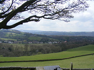
Bollington is a town and civil parish in Cheshire, England, to the east of Prestbury. In the Middle Ages, it was part of the Earl of Chester's manor of Macclesfield and the ancient parish of Prestbury. In 2011, it had a population of 8,310.

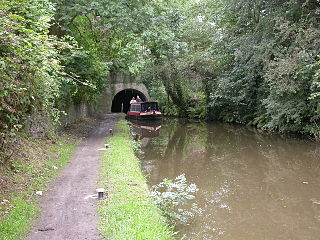
Disley is a village and civil parish in Cheshire, England. It is located on the edge of the Peak District in the Goyt valley, south of Stockport and close to the county boundary with Derbyshire at New Mills. The population at the 2011 Census was 4,294. To the north, the River Goyt and the Peak Forest Canal, which opened in 1800, pass along the edge of the village. Today, it is a dormitory village retaining a semi-rural character.

The River Goyt is a tributary of the River Mersey in North West England.

New Mills is a town in the Borough of High Peak, Derbyshire, England, 8 miles (13 km) south-east of Stockport and 13 miles (21 km) from Manchester at the confluence of the River Goyt and Sett. It is close to the border with Cheshire and above the Torrs, a 70 feet (21 m) deep gorge cut through carboniferous sandstone, on the north-western edge of the Peak District national park.

Baslow is a village in Derbyshire, England, in the Peak District, situated between Sheffield and Bakewell, just over 1 mile (1.6 km) north of Chatsworth House. It is sited by the River Derwent, which is spanned by a 17th-century bridge, alongside which is a contemporary toll house.

Whaley Bridge is a town and civil parish in the High Peak district of Derbyshire, England, on the River Goyt, 16 miles (26 km) southeast of Manchester, 7 miles (11 km) north of Buxton, 9 miles (14 km) east of Macclesfield and 28 miles (45 km) west of Sheffield. It had a population of 6,455 at the 2011 census, including Furness Vale, Horwich End, Bridgemont, Fernilee, Stoneheads and Taxal.

Marple is a town in the Metropolitan Borough of Stockport, Greater Manchester, England. It is on the River Goyt, 9 miles (14 km) south-east of Manchester, 9 miles (14 km) north of Macclesfield and 4 miles (6 km) south-east of Stockport. In 2011, it had a population of 23,686.

Woodley is a suburb in the Metropolitan Borough of Stockport, Greater Manchester, England. It is situated on the east side of the Peak Forest Canal, next to Bredbury, Romiley and the boundary with Tameside, at Gee Cross.

Romiley is a village in the Metropolitan Borough of Stockport, Greater Manchester, England. Historically part of Cheshire, it borders Marple, Bredbury and Woodley. At the 2011 census, the Romiley ward, which includes Compstall, Bredbury Green and a large part of Bredbury, had a population of 14,139.

Bugbrooke is a village and civil parish in Northamptonshire, England, on a ridge overlooking the valley of the River Nene.

Mellor is a village in Greater Manchester, England, lying between Marple Bridge and New Mills, Derbyshire.
Stockport Cricket Club is situated on Beech Road, Cale Green, Stockport in the North West of England. The club has three senior sides and a junior section. The first and second teams play in the Cheshire Cricket League, while the third team play in the Cheshire County Cricket League.

Marple Bridge is a district of Marple in the Metropolitan Borough of Stockport, Greater Manchester, England; it is sited on the River Goyt, which runs through the centre of the village.

Barrow is a civil parish, in the unitary authority of Cheshire West and Chester and the ceremonial county of Cheshire, England. The civil parish contains the village of Great Barrow and the hamlets of Little Barrow, Broomhill and Stamford Bridge. Great Barrow is situated about 4.5 miles east-north-east of Chester, 6 miles north-west of Tarporley and 6 miles south of Frodsham.

Elworth is a village in the county of Cheshire, located in the North West of England, and is a suburb of the town of Sandbach, located approximately one mile eastward.

Breadsall is a village and civil parish in the English county of Derbyshire, grid reference SK370397. The population of the civil parish at the 2011 census was 773. Breadsall Priory is nearby.

Mobberley is a village in Cheshire, England, between Wilmslow and Knutsford, which in 2001 had a population of 2,546, increasing to 3,050 at the 2011 Census.
Sandiacre Town Cricket Club is an amateur cricket club based in Sandiacre, Derbyshire, England. The club was established in 1877 and has won the ECB National Club Cricket Championship on 2 occasions: 2003 and 2014. The club currently play in the Derbyshire Premier Cricket League being Champions in 2002, 2004, 2012, 2015, 2017 and 2021.
The Cheshire County Cricket League is a cricket league based in England. It is the top level of competition for recreational club cricket in the Cheshire area, and is a designated ECB Premier League.

Mellor Mill, also known as Bottom's Mill, was a six-story cotton mill in Marple, Greater Manchester built by Samuel Oldknow in 1793. This was a six-storey, 42-foot (13 m) wide and 210-foot (64 m) long mill with additional three-storey wings making it 400 feet (120 m) in all. The mill was built for Samuel Oldknow and used to spin coarse counts. It was originally driven by the Wellington water wheel. The River Goyt, and with it the then county boundary between Derbyshire and Cheshire was diverted and a weir built, the leat fed a millpond that in later times was named the Roman Lakes. This in turn fed a second mill pond along with water from reservoir in Linnet Clough. Supplementary power was provided by a second exterior wheel known as the Waterloo wheel. The Mill reached its peak production in 1804, when 10,080 spindles were operating and around 550 people were employed. It was destroyed by fire in 1892.


