
Winkler County is a county in the U.S. state of Texas. As of the 2020 census, its population was 7,791. Its county seat is Kermit. The county was created in 1887 and organized in 1910. It is named for Clinton McKamy Winkler, a colonel in the Confederate Army.

Loving County is a county in the U.S. state of Texas. With a population of 64 per the 2020 census, it is the least-populous county in the United States with a permanent population. Its county seat and only community is Mentone. The county was originally created in 1887, and after being disorganized in 1897, was reorganized in 1931.

Kermit is a city in and the county seat of Winkler County, Texas, United States. The population was 5,708 at the 2010 census. The city was named after Kermit Roosevelt following a visit by his father, President Theodore Roosevelt, to the county.

Glenrio, formerly Rock Island, is an unincorporated community in both Deaf Smith County, Texas, and Quay County, New Mexico, United States. Located on the former U.S. Route 66, the ghost town sits on the Texas–New Mexico state line. It includes the Glenrio Historic District, which was listed on the National Register of Historic Places in 2007.
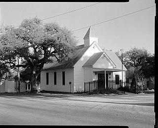
Wink-Loving Independent School District is a public school district based in Wink, Texas, United States in Winkler County, Texas. The district serves students in southern and western Winkler County along with all of Loving County.
Marysville is an unincorporated community in northwestern Cooke County, Texas, United States. It lies approximately three miles from the Texas-Oklahoma border.

State Highway 302 is a Texas state highway maintained by the Texas Department of Transportation (TxDOT). The 83.2-mile (133.9 km) route runs from U.S. Route 285 northwest of Pecos to Interstate 20 near Odessa. The route passes through Reeves, Loving, Winkler, and Ector counties. SH 302 has intersections with SH 115 and SH 18 in the Kermit area, and SH 158 east of Notrees. The route intersects Loop 338 and Spur 450 in West Odessa and then follows Loop 338 along the west side of Odessa until SH 302 terminates at I-20. SH 302 also intersects several Farm to Market Roads and an Interstate business route.
Porterville is a ghost town in Loving County, Texas, United States.
Salt Flat is a ghost town in northeastern Hudspeth County, Texas, United States. It lies along the concurrent U.S. Routes 62 and 180 north of the Census-designated place (CDP) of Sierra Blanca, the county seat of Hudspeth County. Its elevation is 3,730 feet (1,137 m). Although Salt Flat is unincorporated, it has a ZIP Code of 79847. The headquarters of the nearby Guadalupe Mountains National Park uses this ZIP Code although it is located closer to Pine Springs, which has no post office.
Driftwood is a census-designated place and unincorporated community in northern Hays County, Texas, United States. Per the 2020 census, the population was 106.
Wink High School is a public high school located in Wink, Texas USA and classified as a 2A school by the UIL and serves both Wink and Mentone in Loving County. It is part of the Wink-Loving Independent School District located in southwestern Winkler County and includes all of Loving County. In 2015, the school was rated "Met Standard" by the Texas Education Agency.
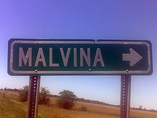
Malvina is an unincorporated community located in Bolivar County, Mississippi, United States, located approximately 3 miles (4.8 km) northwest of Symonds and approximately 9 miles (14 km) east of Rosedale.
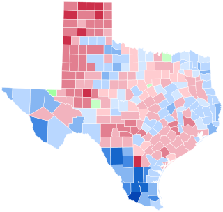
The 1992 United States presidential election in Texas took place on November 3, 1992, as part of the 1992 United States presidential election. Voters chose 32 representatives, or electors to the Electoral College, who voted for president and vice president.
Goforth is a ghost town in Hays County, Texas, United States.
Cedar Station is a ghost town in Terrell County, Texas, United States.
Pumpville is a ghost town in Val Verde County, Texas, United States.
Woody is a ghost town in Loving County, Texas, United States.
Alco is a ghost town in Angelina County, in the U.S. state of Texas. It is located within the Lufkin, Texas micropolitan area.
Granville is a ghost town in Angelina County, in the U.S. state of Texas. It is located within the Lufkin, Texas micropolitan area.


