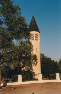
Helao Nafidi | |
---|---|
Local Authority | |
Coordinates: 17°27′30″S15°53′40″E / 17.45833°S 15.89444°E | |
Country | Namibia |
Region | Ohangwena Region |
proclaimed | 2004 |
Government | |
• Type | Local Authority Council |
• Mayor | Darius Shaalukeni |
• CEO | Inge Ipinge |
Area | |
• Total | 26.7 sq mi (69.1 km2) |
Population | |
• Total | 28,508 |
• Density | 1,100/sq mi (410/km2) |
Time zone | UTC+2 (SAST) |
Climate | Cwa |
Website | www.helao-nafidi.com |
Helao Nafidi is a town in Ohangwena Region in northern Namibia at the border to Angola. It has been established in 2004 as an amalgamation of several villages and settlements along the main road between Oshikango and Ohangwena [3] which are both also part of the town. Helao Nafidi has 19,375 inhabitants. [1] The town is separated into three urban areas, Oshikango in the north, bisected by the Namibian–Angolan border, and Omafo and Ohangwena south of it, with settlements and villages in the agricultural area between them. [4]
All the villages that have been combined to form the town (Onhuno, Ohangwena, Omafo, Engela and Oshikango) [5] still maintained their own village councils until the 2015 local authority election. [6]
The area that today is the town of Helao Nafidi was heavily affected by the South African Border War 1966 to 1989 between South Africa and its allied forces (mainly UNITA) and the Angolan government and South-West Africa People's Organisation (SWAPO). The border post at Oshikango, one of the oldest between Namibia and Angola, had been near destroyed in the guerrilla war, and the settlement appeared dilapidated until the mid-1990s. [4] After Namibian independence several settlements were proclaimed villages in 1996 in order to increase border trade. [7]
The border post at Oshikango is currently [update] the busiest Namibian border post with on average 500 people crossing per day. [4] This has brought business opportunities to the surrounding area. With the help of the European Union an Export Processing Zone was established there, consisting of 14 warehouses. Omafo, another suburb of Helao Nafidi, hosts Helao Nafidi Annual trade fair and expo. [7]
The parallel prevalence of land owned by the villages, the town, and land under traditional jurisdiction has led to uncertainties about ownership that had to be settled in court. [8] The case of Helao Nafidi, where traditional authorities and the town and village councils frequently disagree on what is in their respective jurisdiction, can be seen as an example of the clash between tradition and modernity in Namibian law. [4] [9]
In mid-2005, the second stage of the new Northern Railway began construction from Oshivelo to Oshikango. By mid-2006, it had reached Ondangwa. A train called Omugulugwombashe Star traveled weekly on this track until the locomotives broke down after a few rounds of service and were found unsuitable for Namibia’s railway network. [10] The railway extension to Ohangwena and Oshikango is under construction, and a short extension across the border was proposed in 2008 to bypass the congested border post. [11]
In October 2022, the town was equipped with Namibia Traffic System offices, which will handle the registration and licensing of vehicles, annual renewal of vehicle licences, renewal of driving licences, and testing and issuing of learners' licences. [12]
The Town council has various educational institutions ranging from primary schools to vocational educational institutions such as
In September 2022, The UNESCO Institute for Lifelong Learning has approved Helao Nafidi Town Council's membership to join the UNESCO Global Network of Learning Cities, the first town in Namibia to be admitted to the UNESCO Global Network of Learning Cities. [13]
Helao Nafidi is governed by a town council that has seven seats. [14]
The 2015 local authority election was won by SWAPO which gained six seats (2,261 votes). The remaining seat was won by the Rally for Democracy and Progress (RDP) with 272 votes. [6] Eliaser Nghipangelwa retained his position as mayor of the Helao Nafidi Town Council in 2015, deputised by Panduleni Hainghumbi. [15] SWAPO also won the 2020 local authority election. It obtained 1,635 votes and gained five seats. The Independent Patriots for Change (IPC), an opposition party formed in August 2020, obtained 690 votes and gained the remaining two seats. [16] New entrant Darius Shaalukeni from Swapo was elected as the new mayor of Helao Nafidi, deputised by Penexupifo Matias. [17]
Helao Nafidi is inhabited by the Kwanyama community, a subgroup of the Ovambo. Members of this community live on both sides of the border and speak the same language.
In the years 2005 and thereafter, foreign investors, mainly Chinese, have bought communal land in large quantities, leaving villagers without the means to raise livestock and farm. Some of the land transfers are thought to be unlawful, facilitated by corrupt town officials. The influx of Chinese businesspeople has been dubbed an "invasion". [4]
Ohangwena is one of the fourteen regions of Namibia, its capital is Eenhana. Major settlements in the region are the towns Eenhana and Helao Nafidi as well as the self-governed village of Okongo and the proclaimed settlements Ongenga and Omungwelume. As of 2020, Ohangwena had 150,724 registered voters.
Keetmanshoop is a town in the ǁKaras Region of southern Namibia, lying on the Trans-Namib Railway from Windhoek to Upington in South Africa. It is named after Johann Keetman, a German industrialist and benefactor of the city.
Omaruru is a town in the Erongo Region of central Namibia. The town has 14,000 inhabitants and encompasses 352 square kilometres (136 sq mi) of land. It is situated near Mount Erongo, on the usually dry Omaruru River. It is located on the main paved road from Swakopmund to Otjiwarongo. The name in the Otjiherero language means 'bitter milk', as Herero cattle herds used to graze on the local bush that turned their milk bitter.
Oshikango is a former village in northern Namibia and since 2004 part of the town of Helao Nafidi, although it still maintained its own village council for a number of years. Oshikango is still the name of the border post with Angola and the electoral constituency for this suburb. It is estimated to have grown from "a tiny cluster of shebeens around an open market into a thriving boomtown with around 5,000 to 8,000 inhabitants over a period of 10 years".
Henties Bay is a coastal town in the Erongo Region of western Namibia. It is located 72 kilometres (45 mi) north of Swakopmund and is a holiday and retirement settlement, with angling a popular activity. It also serves as a gateway to the seal colony of Cape Cross, which lies 46 kilometres (29 mi) to the north of the town. The town had 4,720 inhabitants in 2011, an increase from 3,285 in 2001. The mayor of Henties Bay is Lewies Vermaak.
Ruacana is a town in the Omusati Region of northern Namibia and the district capital of the Ruacana electoral constituency. It is located on the border with Angola on the river Kunene. The town is known for the picturesque Ruacana Falls nearby, and for the Ruacana Power Station.
Maltahöhe is a village in southern central Namibia close to the Swartrand escarpment, about 110 km west of Mariental in the Hardap Region. It has about 6,000 inhabitants and owns about 17,000 hectares of land. Maltahöhe has two suburbs, the Andreville location and the Blikkiesdorp informal settlement which has neither sewerage nor electricity supply.
Otavi is a town with 10,000 inhabitants in the Otjozondjupa Region of Namibia. Situated 360 km north of Windhoek, it is the district capital of the Otavi electoral constituency.
Eenhana is the capital town of the Ohangwena Region, northern Namibia, on the border with Angola. It also used to be a mission station of the Finnish Missionary Society.
Oniipa is a town in the Oshikoto Region of northern Namibia and the district capital of the Oniipa electoral constituency. It lies just outside Ondangwa.
Oshikango railway station is a terminal railway station on the Namibian-Angolan border serving the village of Oshikango and the town of Helao Nafidi. It is part of the TransNamib Railway railway network. The railway station was inaugurated on 5 July 2012 by the Namibian president Hifikepunye Pohamba.
Stampriet is a village in Hardap Region, Namibia. It is located 64 km north-east of Mariental and 1,177 metres (3,862 ft) above sea level, in a barren area on the upper reaches of the Auob River where humans and animals alike depend on borehole water. Stampriet is the administrative center of the Mariental Rural electoral constituency.
Engela is an electoral constituency in the Ohangwena Region of northern Namibia. It had 21,341 inhabitants in 2004 and 13,743 registered voters in 2020. It is named after the settlement of Engela, today part of the town Helao Nafidi. Engela is home to one of the biggest hospitals in Namibia, Engela State Hospital.
Ohangwena is a constituency in the Ohangwena Region of northern Namibia. It had 17,539 inhabitants in 2004 and 13,181 registered voters in 2020. It is named after the settlement of Ohangwena, today part of the town Helao Nafidi.
Ondobe is a constituency in the Ohangwena Region of Namibia. It had 32,726 inhabitants in 2004 and 16,286 registered voters in 2020.
Oshikango is a constituency in the town of Helao Nafidi in the Ohangwena Region of northern Namibia, on the border to Angola. It had 27,599 inhabitants in 2004 and 17,480 registered voters in 2020. It is named after the settlement of Oshikango, today part of the town Helao Nafidi.
Onhuno is a settlement in the Ohangwena Region of Namibia between Ongha and Ohangwena. Since the establishment of Helao Nafidi in 2004 it is a suburb of this town, although it still maintained its own village council until the 2015 local authority election.
Oshindobe is a village situated in the northern part of Namibia in the Ohangwena Region. The village is named after the lake Ondobe during its discovery as revealed by an elder. It is situated at the very edge of the Owambo region. Oshindobe is located on the Cuvelai-Etosha basin, which is part of transboundary catchment shared by Angola and Namibia. The climate in this village is semi-arid and impacted by high rainfall variability which leads to regular droughts and floods. The two main sources of water for this region emanate from Angola: 1) from the upper part of the Cuvelai Basin and 2) Epumbu-Omadenga water pipeline, which occasionally provides drinking water. In most cases, people are dependent on hand-dug wells, 'omifimas', and seasonal flows of shallow water (Efundja) in Oshana between Oshindobe Village and Eengwena. In 1992, Community people of Oshindobe village and Eengwena village managed to dig a lake between these two villages that will store water until the next rainy season, despite the lake facing higher evaporation rates. The Oshindobe village is also faced with soil degradation, loss of grazing area, and unequal land distribution.
Oshandi is a village situated in the northern Namibia in the Ondobe Constituency of Ohangwena Region. It has a clinic and Anglican church that were established in 1947 by Canadian citizen Mark Dirnardo, who was a carpenter who came up with the idea of creating the hospital and church. The first headman of Oshandi village was Haufuku Kanyanye, who was Oshivambo speaking and the current headman is Paulus Hashoongo who is the native of Oshandi village. Oshandi village is situated on the very edge of Ovamboland.
Odibo is a village in the north of Namibia close to the Angolan border known for its Anglican mission St Mary. It belongs to the Oshikango electoral constituency in the Ohangwena Region. Odibo is also an Archdeaconry in the Diocese of Namibia.