Hemlock Stone

Last updated

Hemlock Stone
Himlack Stone
The Hemlock Stone - geograph.org.uk - 622249.jpg
Nottinghamshire UK relief location map.jpg
Red pog.svg
Hemlock Stone
Location within Nottinghamshire
Coordinates: 52°56′34.93″N1°15′29.14″W / 52.9430361°N 1.2580944°W / 52.9430361; -1.2580944
LocationStapleford Hill, Stapleford, Nottinghamshire, England

The Hemlock Stone or Himlack Stone is an inselberg on Stapleford Hill at Stapleford, Nottinghamshire, England. [1]

Contents

Geology

The Hemlock Stone is an outcrop of New Red Sandstone, deposited more than 200 million years ago in the Triassic Period. Approximately 28 feet (8.5 m) high, it is formed of a layer of Nottingham Castle Sandstone overlying a layer of Lenton Sandstone. Both layers are members of the Sherwood Sandstone Group. The Nottingham Castle Sandstone is a medium- to coarse-grained sandstone in which the grains are strongly cemented together by baryte. The Lenton Sandstone is very fine-grained but less well cemented together. As a result, the lower part of the stone is more vulnerable to erosion than the upper part, resulting in differential erosion that has given the inselberg its current "waisted" shape. [2]

There are two geological theories as to what removed the surrounding sandstone layers of which the inselberg was once a part. In the 18th century the antiquarian William Stukeley (1687–1765) proposed that it had been left by quarrying of the surrounding stone. Certainly there are signs of past quarrying on and around Stapleford Hill. In 1908 the Ordnance Geological Survey (OGS) propounded that it was the result purely of natural differential erosion, particularly by ice in the Quaternary glaciation. The British Geological Survey, the OGS's modern successor, now supports Stukeley's theory. [2]

In October 2015 with the University of Nottingham's Geospatial Institute undertook further study, as part of their "Three Stones Project". Since, in the past, laser mapping had not completely covered the stone, they employed a drone equipped with laser mapping cameras. [3]

Black grime coats the Nottingham Castle Sandstone that forms the upper part of the inselberg, but there is none on the Lenton Sandstone below. The deposit is from industrial air pollution before the UK started to restrict air pollution, and illustrates the fact that the upper layer has eroded much more slowly than the lower. Wind erosion is continuing and will eventually destabilise the inselberg. [2] The stone is now protected by an iron fence, next to which is an explanatory sign.

Cultural responses

Eroded layers of Lenton Sandstone in the lower part of the Hemlock Stone Erosion patterns - geograph.org.uk - 622254.jpg
Eroded layers of Lenton Sandstone in the lower part of the Hemlock Stone

Medieval

In the Middle Ages it was claimed that the Devil threw the stone there from Castleton, Derbyshire, about 40 miles (64 km) away, because the ringing of church bells annoyed him. Quite apart from the fancifulness of the legend, there is no New Red Sandstone outcrop in that part of Derbyshire from which the stone could have come. [2]

Modern

On 3 June 2002 to celebrate the Golden Jubilee of Elizabeth II a large bonfire was lit on the top of Hemlock Stone as part of the worldwide chain of 2,006 beacons lit, watched by a crowd of an estimated 2,000 spectators.

The stone is referenced in D.H. Lawrence's novel Sons and Lovers.

Hemlock Happening

From the Golden Jubilee celebration developed an annual free festival, the Hemlock Happening, that is held one day each June. [4] It is organised by the communities of Stapleford and Bramcote and held in the Bramcote Walled Gardens near the stone. It usually lasts from 1 pm to 10:45 pm, showing the talents of local schools, groups and individuals and culminating in fireworks set off around the Stone at 10:30 pm. Some scheduled Hemlock Happenings are as follows:

  • 10 June 2006 – attended by about 800 people
  • 9 June 2007
  • 7 June 2008
  • 6 June 2009 – cancelled due to bad weather
  • 12 June 2010
  • 11 June 2011
  • 2 June 2012 – Queen's Diamond Jubilee special
  • 8 June 2013

Participating schools include George Spencer, St Johns Church of England and Bramcote Hills Primary School.

Related Research Articles

<span class="mw-page-title-main">Sherwood Forest</span> Royal forest in Nottinghamshire, England

Sherwood Forest is the remnants of an ancient royal forest in Nottinghamshire, England, having a historic association with the legend of Robin Hood.

<span class="mw-page-title-main">Nottingham</span> City and council area in Nottinghamshire, England

Nottingham is a city and unitary authority area in Nottinghamshire, East Midlands, England. It is located 110 miles (180 km) north-west of London, 33 miles (53 km) south-east of Sheffield and 45 miles (72 km) north-east of Birmingham. Nottingham is the legendary home of Robin Hood and to the lace-making, bicycle and tobacco industries. The city is also the county town of Nottinghamshire and the settlement was granted its city charter in 1897, as part of Queen Victoria's Diamond Jubilee celebrations.

<span class="mw-page-title-main">Nottinghamshire</span> County of England

Nottinghamshire is a ceremonial county in the East Midlands of England. The county borders South Yorkshire to the north-west, Lincolnshire to the east, Leicestershire to the south, and Derbyshire to the west. The largest settlement is the city of Nottingham (323,632).

<span class="mw-page-title-main">Beeston, Nottinghamshire</span> Town in Nottinghamshire, England

Beeston is a town in the Borough of Broxtowe, Nottinghamshire, England, it is 3 miles south-west of Nottingham. To its north-east is the University of Nottingham's main campus, University Park. The headquarters of pharmaceutical and retail chemist group Boots are 0.6 miles (1 km) east of the centre of Beeston, on the border with Broxtowe and the City of Nottingham. To the south lie the River Trent and the village of Attenborough, with extensive wetlands.

<span class="mw-page-title-main">Inselberg</span> Isolated, steep rock hill on relatively flat terrain

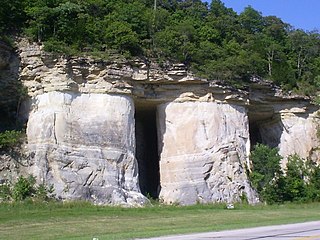
An inselberg or monadnock is an isolated rock hill, knob, ridge, or small mountain that rises abruptly from a gently sloping or virtually level surrounding plain. In Southern Africa a similar formation of granite is known as a koppie, an Afrikaans word from the Dutch diminutive word kopje. If the inselberg is dome-shaped and formed from granite or gneiss, it can also be called a bornhardt, though not all bornhardts are inselbergs. An inselberg results when a body of rock resistant to erosion, such as granite, occurring within a body of softer rocks, is exposed by differential erosion and lowering of the surrounding landscape.

<span class="mw-page-title-main">Borough of Broxtowe</span> Non-metropolitan district and borough in England

Broxtowe is a local government district with borough status in Nottinghamshire, England. It lies immediately west of the city of Nottingham, and most of the built-up areas of the borough form part of the Nottingham Urban Area. The council is based in Beeston and the borough also includes the towns of Eastwood, Kimberley and Stapleford and surrounding villages and rural areas.

<span class="mw-page-title-main">Sandiacre</span> Human settlement in England

Sandiacre is a village and civil parish in the borough of Erewash in Derbyshire, in the East Midlands region of England adjoining the border with Nottinghamshire. The population of the parish was 8,889 at the 2011 Census.

<span class="mw-page-title-main">St. Peter Sandstone</span>

The St. Peter Sandstone is an Ordovician geological formation. It belongs to the Chazyan stage of the Champlainian series in North American regional stratigraphy, equivalent to the late Darriwilian global stage. This sandstone originated as a sheet of sand in clear, shallow water near the shore of a Paleozoic sea and consists of fine-to-medium-size, well-rounded quartz grains with frosted surfaces. The extent of the formation spans north-south from Minnesota to Arkansas and east-west from Illinois into Nebraska and South Dakota. The formation was named by Owen (1847) after the Minnesota River, then known as the St. Peter River. The type locality is at the confluence of the Mississippi and Minnesota Rivers near Fort Snelling, Minnesota. In eastern Missouri, the stone consists of quartz sand that is 99.44% silica.

<span class="mw-page-title-main">Geology of the Capitol Reef area</span>

The exposed geology of the Capitol Reef area presents a record of mostly Mesozoic-aged sedimentation in an area of North America in and around Capitol Reef National Park, on the Colorado Plateau in southeastern Utah.

<span class="mw-page-title-main">Broxtowe (UK Parliament constituency)</span> Parliamentary constituency in the United Kingdom, 1983 onwards

Broxtowe is a parliamentary constituency in Nottinghamshire, England, represented in the House of Commons of the UK Parliament since 2019 by Darren Henry, a Conservative.

<span class="mw-page-title-main">Wollaton</span> Suburb of Nottingham, England

Wollaton is a suburb and former civil parish in the western part of Nottingham, in the Nottingham district, in the ceremonial county of Nottinghamshire, England. Wollaton has two wards in the City of Nottingham, with a total population of 24,693 at the 2011 census. It is home to Wollaton Hall, with its museum, deer park, lake, walks and golf course.

<span class="mw-page-title-main">Stapleford, Nottinghamshire</span> Town and civil parish in Nottinghamshire, England

Stapleford is a town and civil parish in the Borough of Broxtowe, Nottinghamshire, England, 6 miles (9.7 km) west of Nottingham. The population of the civil parish at the 2001 census was 14,991, at the 2011 census it was 15,241, and 15,453 at the 2021 census.

<span class="mw-page-title-main">Bramcote</span> Suburban village in Nottinghamshire, England

Bramcote is a suburban village and former civil parish in the Broxtowe district of Nottinghamshire, England, between Stapleford and Beeston. It is in Broxtowe parliamentary constituency. The main Nottingham–Derby road today is the A52, Brian Clough Way. Nearby are Beeston, Wollaton, Chilwell and Stapleford. One of the main roads between Nottingham and Derby used to pass through the village centre, entering a cutting that formed a blind bend. A country house to the north of the village became publicly owned and was demolished in 1968. Its grounds became a public area of park and hillside, now known as Bramcote Hills Park.

<span class="mw-page-title-main">Beeston and Stapleford Urban District</span> Urban district in Nottinghamshire, England

Beeston and Stapleford was an urban district in Nottinghamshire, England, from 1935 to 1974.

<span class="mw-page-title-main">Stan Heptinstall</span> English academic & local politician (born 1946)

Stanley Heptinstall is an Emeritus Professor of the University of Nottingham, Director of Platelet Solutions Ltd, and local government councillor on Nottinghamshire County Council.

<span class="mw-page-title-main">Stapleford Cross</span>

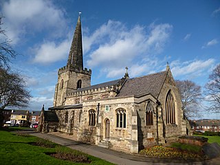
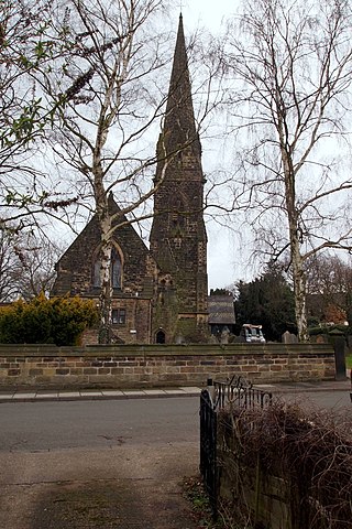
Stapleford Cross is an Anglo-Saxon high cross dating from the eleventh century, now located in the churchyard of St. Helen's Church, Stapleford, in Nottinghamshire, England.

<span class="mw-page-title-main">John Frederick Dodd</span> English architect

John Frederick Dodd LRIBA was an architect based in Long Eaton, Derbyshire.

<span class="mw-page-title-main">Derbyshire Dome</span> Geological formation of the Derbyshire Peak District

The Derbyshire Dome is a geological formation across mid-Derbyshire in England.

<span class="mw-page-title-main">Harthill Moor</span> Hill in the Peak District of England

Harthill Moor is a small upland area in the Derbyshire Peak District of central and northern England, lying between Matlock and Bakewell near the villages of Birchover and Elton. The moor is within the southern portion of Harthill civil parish. Its highest point is 272 metres (892 ft) above sea level. The River Bradford flows along the northern edge of the moor past Youlgreave and into the River Lathkill at Alport. Harthill Moor is a rich prehistoric landscape with several protected Scheduled Ancient Monuments.

References

  1. "The Hemlock Stone". Stapleford on the Web.
  2. 1 2 3 4 Howard, Andy (2002). "The Hemlock Stone" (PDF). Mercian Geologist. 15 (3). East Midlands Geological Society: 154. Retrieved 19 November 2014.
  3. "Mysterious Hemlock Stone scanned by drone". BBC News. 27 October 2015. Retrieved 14 April 2020.
  4. The Hemlock Happening Website

Further reading