Related Research Articles
The A77 road is a major road in Scotland. It runs in a southwesterly direction from the city of Glasgow, past the towns of Giffnock, Newton Mearns, Kilmarnock, Prestwick, Ayr, Girvan and Stranraer to the village of Portpatrick on the Irish Sea. It passes through the council areas of Glasgow City, East Renfrewshire, East Ayrshire, South Ayrshire and Dumfries and Galloway.

Girvan is a burgh and harbour town in Carrick, South Ayrshire, Scotland. Girvan is situated on the east coast of the Firth of Clyde, with a population of about 6,450. It lies 21 miles (34 km) south of Ayr, and 29 miles (47 km) north of Stranraer, the main ferry port from Scotland to Northern Ireland.

Stevenston is a town and parish in North Ayrshire, Scotland. Along with Ardrossan and Saltcoats it is one of the "Three Towns", all of similar size, on the Firth of Clyde coast; the easternmost parts of Stevenston are about 1⁄2 mile from western parts of Kilwinning, with the A78 trunk road running between the settlements.

Darvel (Scots: Dairvel, Scottish Gaelic: Darbhail) is a small town in East Ayrshire, Scotland. It is at the eastern end of the Irvine Valley and is sometimes referred to as "The Lang Toon".

Meikle Auchengree is a hamlet near Kilbirnie and Longbar in North Ayrshire, Scotland.
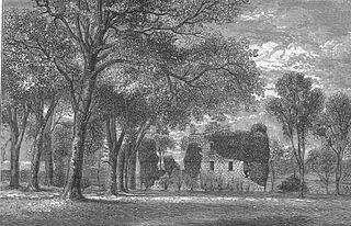
Hessilhead is in Beith, North Ayrshire, Scotland. Hessilhead used to be called Hazlehead or Hasslehead. The lands were part of the Lordship of Giffen, and the Barony of Hessilhead, within the Baillerie of Cunninghame and the Parish of Beith. The castle was situated at grid reference NS380532.

Colmonell is a small village and civil parish in the Stinchar Valley, South Ayrshire, Scotland. The nearest town is Girvan, 11 miles away.
The village or hamlet of Gatehead is located in East Ayrshire, Parish of Kilmaurs, Scotland. It is one and a quarter miles from Crosshouse and one and a half miles from Kilmarnock. In the 18th and 19th centuries the locality was a busy coal mining district. The settlement runs down to the River Irvine where a ford and later a bridge was located.
The hamlet of Auchentiber is in North Ayrshire, Parish of Kilwinning, Scotland. Auchentiber is four miles northeast of Kilwinning on the Lochlibo Road, 2+1⁄4 mi (3.5 km) from the hamlet of Burnhouse and 2+1⁄2 mi (4 km) from the village of Barrmill. Grid Ref. NS3647. Some new housing has been built, but the settlement is still very much a hamlet. The settlement is on the Lugton Water, which runs into the River Garnock after running through Montgreenan and Eglinton Country Park in Irvine.
Eglinton Country Park is located on the grounds of the old Eglinton Castle estate in Kilwinning, North Ayrshire, Scotland. Eglinton Park is situated in the parish of Kilwinning, part of the former district of Cunninghame, and covers an area of 400 ha ([98 acres ] of which are woodland. The central iconic feature of the country park is the ruined Eglinton Castle, once home to the Eglinton family and later the Montgomeries, Earls of Eglinton and chiefs of the Clan Montgomery. Eglinton Country Park is managed and maintained by North Ayrshire Council and its Ranger Service.

Montgreenan is an estate in North Ayrshire, Parish of Kilwinning, Scotland. The Lugton Water runs through the policies and farmland of Montgreenan. Nearby are the hamlets of Torranyard and Auchentiber.
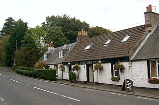
Failford is a hamlet in South Ayrshire, Scotland. It is 4 kilometres (2.5 mi) west of Mauchline, where the Water of Fail flows into the River Ayr.

Haugh or The Haugh is a small village or hamlet in East Ayrshire, Parish of Mauchline, Scotland. The habitation is situated about two and a half miles downstream from Catrine, on the north bank of the River Ayr. The River Ayr Way runs through the village.

Bloak was a hamlet or clachan in East Ayrshire, Parish of Stewarton, Scotland. The habitation was situated between Auchentiber and Stewarton on the B778. It was originally built as a row of housing for crofters and farm workers. The small school remained open for some years after the hamlet ceased to exist. Robinson gives the Scots word "blout" as meaning "an eruption of fluid", or a place that is soft or wet.

Hessilhead hamlet or Haselet is a small settlement or clachan in North Ayrshire, Scotland. It is situated to the east of the town of Beith and stands on the course of the Dusk Water that once drove the local mill. Hazlehead or Hasslehead are also previously used names for the estate that the hamlet was originally a part of.
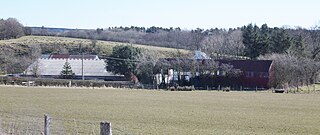
Dalmusternock (NS455417) was a dower house built and occupied by William Mure after his marriage and prior to inheriting the family seat of Rowallan Castle. The property is located near Fenwick, in the Barony of Rowallan, lying 3 miles north of Kilmarnock and 18 miles south of Glasgow, Parish of Fenwick, East Ayrshire, Scotland. The estate is recorded as Dalmunsternoch circa 1654; Dalmasternock circa 1747; Dalmusterknok 1775

Lendalfoot is a small village located on Carleton Bay, parish of Colmonell in the old district of Carrick, now South Ayrshire, about six miles south of Girvan, Scotland. This is mainly a farming district, lacking in woodland, with a low population density. The village sits astride the A77 that runs north to Girvan and south to Cairnryan and Stranraer. Carleton Hill rises to 520 feet or 158 metres from the road and is the site near its summit of earth banks, an ancient fort.

Minishant is a village bordering the A77 in the old county of Carrick, South Ayrshire, Scotland. It is located in Maybole Parish, 3+1⁄2 miles from Maybole and standing close to the River Doon. The village was originally named Culroy after the Culroy Burn that runs through it.

Meigle or Meagle is a hamlet on the Meigle Burn in North Ayrshire, Parish of Largs, Scotland. The settlement lies close to the road to Greenock and is named after the bay where the Skelmorlie Burn flows into the Firth of Clyde. Meigle once stood on the old toll road from Largs to Greenock. It lies 41 m (135 ft) above sea level. Skelmorlie Castle and glen lie nearby. The Meigle Burn has its confluence with the Skelmorlie Burns to the east of Skelmorlie Bridge. The modern spelling 'Meigle' will be used for consistency. There is also a village called Meigle in Perth & Kinross.

Lawthorn is a hamlet near Perceton in Strathannick, Irvine, North Ayrshire, Scotland. The settlement lies on the old Irvine to Stewarton toll road.
References
- 1 2 "OS1/3/7/40 | ScotlandsPlaces". scotlandsplaces.gov.uk. Retrieved 15 October 2022.
- ↑ "The Laggan Estate (Ayrshire), Heronsford". Imperial War Museums. 15 October 2022. Retrieved 15 October 2022.
{{cite web}}: CS1 maint: url-status (link) - ↑ Nicholls, Dominic (1 June 2016). "How Britain's 'sonic warriors' fooled German army into thinking D-Day forces were landing 80 miles away". The Daily Telegraph.
{{cite web}}: CS1 maint: url-status (link)
Coordinates: 55°06′36″N4°56′49″W / 55.110°N 4.947°W
