Loans, South Ayrshire

Last updated

Loans
Loans Main Street - looking west.JPG
Main Street, Loans
South Ayrshire UK location map.svg
Red pog.svg
Loans
Location within South Ayrshire
Population750 (mid-2020 est.) [1]
OS grid reference NS3451031739
Council area
Lieutenancy area
Country Scotland
Sovereign state United Kingdom
Post town TROON
Postcode district KA10
Dialling code 01292
Police Scotland
Fire Scottish
Ambulance Scottish
UK Parliament
Scottish Parliament
List of places
UK
Scotland
55°33′04″N4°37′30″W / 55.5511°N 4.6249°W / 55.5511; -4.6249 Coordinates: 55°33′04″N4°37′30″W / 55.5511°N 4.6249°W / 55.5511; -4.6249

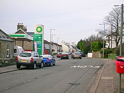
Loans is a village in South Ayrshire near Troon, Scotland. It is located in Dundonald parish on the A759 at the junction with the B746 and a minor road to Dundonald.

Contents

Etymology

Recorded as Loans, Lones, or Lons, [2] the name of the village may have no connection with lending and be derived from the green loans or loaning (a piece of soft, rough ground) around the Bushie and Craiksland Burns, which joined each other at the foot the old orchard at Crossburn. A 'loan' can simply refer to a 'lane' and as such is a common placename element, which would be particularly appropriate to Loans, which is at a crossroads. [3] Before the encloser of fields, a loan or strip of grass was left that ran through the arable part of a farm or farms, linking it with the common grazing ground of a clachan, serving both as a pasture and a driving road. [3] A lon can mean a loan of land granted by the king, from which an income is derived to benefit an establishment or simply the Land of King Robert. [2] [3]

History

The old school. Loans - Old School.JPG
The old school.

During feudal times, Robertloan House and Hillhouse were the seats of the local lairds. Fairs were held here in June and October of each year. In 1806 five small steadings comprised the settlement of Loans. [4]

The A78 formerly ran through the settlement when it followed the course of the Irvine to Ayr turnpike. [5] After the death of Colonel William Fullarton in 1808, the Fourth Duke of Portland purchased the Lands of Fullarton that included Loans, the Lady Isle and Crosbie.

A school had been established at the Darley prior to 1840, however it had closed by 1866. In 1877 a school was built in the village itself. Teachers included Miss Jessie A. Meikle, Miss Shaw, Miss Baird, and Miss Martha Meikle. [6] [7]

Some of the old houses in Loans were little better than smuggling vaults, having double walls and many cargoes from the Isle of Man and Northern Ireland ended up hidden in the village. [6] All around Loans, especially in sand hills, were 'brandy holes', being large pits the size of rooms used for storing brandy casks. [8]

The village smithy was once situated on the main street, as was the post office. [6]

The name Corseburn is first recorded at the time of the Highway Act of 1835. Crossburn Bridge was situated in the formation of the highway, constructed over what had previously been a ford of the Craiksland or Sculloch Burn crossed the highway as a ford until the Corseburn or Crossburn Bridge was built. [4]

The Loans toll, at the foot of Crossburn Avenue came into use during the early years of the 18th century. There were two toll bars, both made of pine. These gates were leased out together or as separate entities. The village tolls added to their income by selling whisky and ale. [4]

Cartographic evidence

Map showing Loans village in the early 19th century. Map of Dundonald and Newfield.jpg
Map showing Loans village in the early 19th century.

Blaeu's map of 1654 shows a settlement names "Lons" [9] In 1747 Loans is marked as such with four enclosed areas of land and dwellings with Scallachmill nearby on a road from Fullarton to Irvine. [10] By 1775 Loans is shown as a cluster of buildings on the Irvine to Ayr road with a road now also running to Dundonald. [11] By 1832 Loans is shown with a toll and two additional roads, both running towards Troon and the coast. [12] The 1857 OS Map shows a number of buildings at Sculloch Mill, Robertloan House and two toll bars and associated houses. [13] By 1897 the school and smithy are shown with a nursery with greenhouses established near the crossroads. [14]

Robertloan

Robertland was originally a dwelling in the medieval clachan of Loans, Robertloan being the old name for Loans. Robertloan House in the centre of the village was the home of William Dickie, last of the lairds who sold the estate to the Duke of Portland in 1861. Later associated with the Guthrie family, Robertloan was the headquarters of the Kilmarnock Dairy Institute in 1906. [4]

Leprosy

The old smithy. Loans - Old Smithy.JPG
The old smithy.

In the 14th century Robert the Bruce is thought to have suffered from leprosy, psoriasis or some other skin ailment and is reputed to have drunk from a brook at Prestwick's "Bruce's Well". The apparent healing effects of the waters caused him to establish a lazar house, or hospital for lepers. The king endowed the establishment with the income from the lands of Loans, ensuring its survival. The villagers of Loans were required to support eight lepers, each of whom was to have, annually, "eight bolls of meal and eight merks". The meal for the lepers was ground at the nearby Sculloch Mill. [4]

When the leper hospital closed and in the 1730s the endowment was taken over by the Wallaces of Craigie, who continued to meet the obligation, but it was later purchased by a writer from Edinburgh at a judicial sale, selling it on to the magistrates of Ayr for £300, who used it to provide for the inmates of the Ayr poorhouse. As late as 1882 three farmers in the Robertloan accepted responsibility for this ancient tax, and refunded the full assessment of meal and merks to their own tenants and employees. The endowment continued to be paid to the poor of Ayr and Prestwick until 1924, although leprosy had long ceased to exist in Scotland. [4]

Archaeology

A stone celt or axe was found in a drain at Loans. [15] An old field boundary and rig and furrow remnants have been found at Loans. [16] In the 1970s a grey flint flake was found in ploughed soil and over forty patinated and unpatinated flint blades were discovered nearby. [17] An earthwork is present (NS352323) in a nearby field, but it has been almost entirely ploughed out. Probably of a rectangular plan it may have been a medieval homestead settlement with a moat. [17]

Wardlaw Hill fort on the highest of the Clevens Hills lies above the Loans to Dundonald road and Kemp Law Dun is a vitrified fort dating from the Iron Age lying in Dundonald Woods. It was formed from a circular rampart and ditch. A mound in the centre was once an Ordnance Survey triangulation station. [18]

Micro-history

Old cheese press used as a mounting block. Loans - Cheese Press stone.JPG
Old cheese press used as a mounting block.

Highgrove Hotel, previously known as Dallam Towers, lies nearby on the road to Dundonald.

Crossburn House is dated 1832 on a stone gate pier. The rear wing is probably 18th century. [19]

The Old Loans Inn was a coaching inn that was renovated in 2009 and now provides hotel accommodation and fine dining. [20]

An old cheese press stone was used as a mounting block and is still located outside the old post office.

See also

Related Research Articles

Ayrshire Historic county in Scotland

Ayrshire is a historic county and registration county in south-west Scotland, located on the shores of the Firth of Clyde. Its principal towns include Ayr, Kilmarnock and Irvine and it borders the counties of Renfrewshire and Lanarkshire to the north-east, Dumfriesshire to the south-east, and Kirkcudbrightshire and Wigtownshire to the south. Like many other counties of Scotland it currently has no administrative function, instead being sub-divided into the council areas of North Ayrshire, South Ayrshire and East Ayrshire. It has a population of approximately 366,800.

Troon Town and sea port in Scotland

Troon is a town in South Ayrshire, situated on the west coast of Ayrshire in Scotland, about eight miles north of Ayr and three miles northwest of Glasgow Prestwick Airport.

Kyle, Ayrshire

Kyle is a former comital district of Scotland which stretched across parts of modern-day East Ayrshire and South Ayrshire. It is said to be named after Coel Hen, a king of the Britons, who was reputedly killed in battle in this area and is said to be buried in a cairn near Mauchline.

Central Ayrshire (UK Parliament constituency) Parliamentary constituency in the United Kingdom, 2005 onwards

Central Ayrshire is a constituency of the British House of Commons, located in the south-west of Scotland within the North Ayrshire and South Ayrshire council areas. It elects one Member of Parliament (MP) at least once every five years using the first-past-the-post system of voting.

Ayr (UK Parliament constituency) Parliamentary constituency in the United Kingdom, 1950–2005

Ayr was a county constituency of the House of Commons of the Parliament of the United Kingdom from 1950 to 2005. It elected one Member of Parliament (MP) by the first-past-the-post system of election.

Ayr (Scottish Parliament constituency) Constituency of the Scottish Parliament

Ayr is a burgh constituency of the Scottish Parliament (Holyrood) covering the town of Ayr in the council area of South Ayrshire. It elects one Member of the Scottish Parliament (MSP) via the plurality electoral system. It is also one of nine constituencies in the South Scotland electoral region which elects seven additional members to the Scottish Parliament via a proportional electoral system known as the Additional Members System which allows for greater accuracy in representation for the region as a whole.

Fullarton is a small area in Irvine, North Ayrshire. It is situated close to Irvine Bay and is next to several industrial estates, large supermarkets and retail stores and the town centre itself. Stagecoach Western buses operate the local bus services in the area. Fullarton is only 8 miles from Prestwick Airport and 25 miles from the city of Glasgow.

Lugton Human settlement in Scotland

Lugton is a small village or hamlet in East Ayrshire, Scotland with a population of 80 people. The A736 road runs through on its way from Glasgow, 15 miles (24.1 km) to the north, to Irvine in North Ayrshire. Uplawmoor is the first settlement on this 'Lochlibo Road' to the north and Burnhouse is to the south. The settlement lies on the Lugton Water which forms the boundary between East Ayrshire and East Renfrewshire as well as that of the parishes of Dunlop and Beith.

The village or hamlet of Gatehead is located in East Ayrshire, Parish of Kilmaurs, Scotland. It is one and a quarter miles from Crosshouse and one and a half miles from Kilmarnock. In the 18th and 19th centuries the locality was a busy coal mining district. The settlement runs down to the River Irvine where a ford and later a bridge was located.

Springside, North Ayrshire Village in North Ayrshire, Scotland, UK

Springside is a village in the parish of Dreghorn, in the council area of North Ayrshire, Scotland. It is three miles from Irvine, 1+12 miles west of Crosshouse, and four miles from Kilmarnock. In the 18th, 19th and mid-20th centuries, the locality was a highly industrialised coal mining district. The settlement is on the Garrier Burn, which forms the boundary with East Ayrshire. Springside had a population of around 1364 in 1991. The A71 now bypasses the village, 14 mile to the south.

Crosbie Castle and the Fullarton estate

Crosbie Castle and the Fullarton estate lie near Troon in South Ayrshire. The site was the home of the Fullarton family for several centuries. The lands were part of the feudal Barony of Corsbie Fullartoune (sic). The Crosbie Castle ruins were eventually used as an ice house after the new Fullarton House mansion was built. The mansion house was later demolished and the area set aside as a public park and golf course.

Littlestane Loch Former lake in Irvine, Scotland

Littlestane Loch, was situated in the mid-Ayrshire clayland near Stanecastle, Irvine, North Ayrshire, Scotland. It is nowadays (2011) only visible as an area of permanent water in the Scottish Wildlife Trust Sourlie Nature Reserve. The loch was natural, sitting in a hollow created by glaciation. The loch waters outflow was via the Red Burn that flows into the River Garnock. The site of Littlestane Loch site is partly built over and much of the site is now public open space lying within the Parish of Girdle Toll.

Symington, South Ayrshire Human settlement in Scotland

Symington is a conservation village in South Ayrshire, Scotland. It is located in Symington parish, covering 0.41 square kilometres, and lies close to the A77 road from Ayr to Glasgow. Its church, built in 1160, remains one of the finest examples of a Norman church in Scotland.

Galrigs Loch (South Ayrshire)

The Galrigs Loch was a substantial freshwater loch situated in low lying area between Newfield and Dundonald in South Ayrshire, Scotland. It was drained in the early 18th century.

Clevens Loch, Ayrshire

Clevens Loch was a substantial freshwater loch situated in a low-lying area below Clevance Farm and Langholm Farm in Dundonald parish, South Ayrshire, Scotland.

Torranyard Human settlement in Scotland

Torranyard is a small village or hamlet in North Ayrshire, Parish of Kilwinning, Scotland. It lies between the settlements of Auchentiber and Irvine on the A736 Lochlibo Road.

Irvine Harbour Port in Scotland

The harbours serving Irvine at Seagatefoot and Fullarton in North Ayrshire have had a long and complex history. Irvine's harbour was one of the most important ports in Scotland in the 16th century. Across from the main harbour at Fullarton on the River Irvine there was also terminal for the ICI-Nobel Explosives plant on the River Garnock. Much of the harbour went into decline in the 19th century when Glasgow, Greenock and Port Glasgow achieved higher prominence as sea ports. There was still some commercial sea traffic linked to local needs, though the harbour went into further terminal decline in the 20th century. The weir on the River Irvine forms the formal upper limit of the harbour.

Shewalton House and estate Human settlement in Scotland

Shewalton House and estate were composed of the 'Lands of Shewalton' and the laird's dwelling, originally a tower castle and later a mansion house on the River Irvine in the Shewalton area, two miles from Irvine and west of Drybridge village, East Ayrshire, Dundonald Parish, Scotland. In 1883 the Boyle's estate of Shewalton was 2,358 acres in extent in Ayrshire and was worth at that time £2,708 a year.

The Reed Loch was also known as Loch Green. As a curling pond it was probably known as the Fullarton House Pond, located as it was on the edge of the Fullarton House and Crosbie Castle estate curtilage, It was originally a shallow and overgrown freshwater loch, hence the name Reed Loch and its marshy appearance on Johnson's 1828 map. It was cleaned out and used as a curling pond in the latter part of the 19th century before falling out of use and being drained in the late 20th century.

References

Notes
  1. "Mid-2020 Population Estimates for Settlements and Localities in Scotland". National Records of Scotland. 31 March 2022. Retrieved 31 March 2022.
  2. 1 2 Gillespie, Page 260
  3. 1 2 3 Scots Dictionary Retrieved : 2012-12-16
  4. 1 2 3 4 5 6 Loans Local History
  5. Love (2003), Page 226
  6. 1 2 3 History of Loans
  7. Gillespie, Page 517
  8. Gillespie, Pages 565-566
  9. Blaeu's Map Retrieved : 2012-12-16
  10. Roy's Map Retrieved : 2012-12-16
  11. Armstrong's Map Retrieved : 2012-12-16
  12. Thomson's Map Retrieved : 2012-12-16
  13. 1857 OS Map Retrieved : 2012-12-16
  14. 1897 OS Map Retrieved : 2012-12-16
  15. Smith, Page 117
  16. RCAHMS Retrieved : 2012-12-15
  17. 1 2 RCAHMS Retrieved : 2012-12-14
  18. Campbell, Page 254.
  19. British Listed Buildings Retrieved : 2012-12-14
  20. Old Loans Inn Retrieved : 2012-12-17
Sources
  1. Allan, Shiela et al. (2003). Historic Prestwick and its surroundings. Ayr : AANHS. ISBN   0-9542253-1-7.
  2. Campbell, Thorbjørn (2003). Ayrshire. A Historical Guide. Edinburgh : Birlinn. ISBN   1-84158-267-0.
  3. Close, Robert (1992). Ayrshire and Arran: An Illustrated Architectural Guide. Pub. Roy Inc Arch Scot. ISBN   1-873190-06-9.
  4. Dobie, James D. (ed Dobie, J.S.) (1876). Cunninghame, Topographized by Timothy Pont 1604–1608, with continuations and illustrative notices. Glasgow: John Tweed.
  5. Gillespie, James H. (1939). Dundonald. A Contribution to parochial History. Glasgow : John Wylie & Co.
  6. Groome, Francis H. Ordnance Gazetteer of Scotland. London : Caxton.
  7. Love, Dane (2003). Ayrshire : Discovering a County. Ayr : Fort Publishing. ISBN   0-9544461-1-9.
  8. McMichael, George (c. 1881–1890). Notes on the Way Through Ayrshire and the Land of Burn, Wallace, Henry the Minstrel, and Covenant Martyrs. Hugh Henry : Ayr.
  9. Smith, John (1895). Prehistoric Man in Ayrshire. London : Elliot Stock.