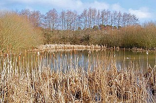
Ebblake Bog is a 11.3-hectare (28-acre) biological Site of Special Scientific Interest in Dorset and Hampshire, located west of Ringwood. It is part of Dorset Heathlands Ramsar site and Special Protection Area, and of Dorset Heaths Special Area of Conservation,

Ham Street Woods is a 175.2-hectare (433-acre) biological Site of Special Scientific Interest south of Ashford in Kent. It is a Nature Conservation Review site, Grade I, and an area of 97.1 hectares is a National Nature Reserve.
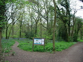
Staffhurst Wood is a 51-hectare (130-acre) biological Site of Special Scientific Interest south of Oxted in Surrey. It is a Nature Conservation Review site, Grade 2. An area of 38.1 hectares is a Local Nature Reserve, which is owned by Surrey County Council.

Sherrardspark Wood is a 74.9 hectares biological site of Special Scientific Interest in Welwyn Garden City, Hertfordshire. The site was notified in 1986 under the Wildlife and Countryside Act 1981.

Plashett Park Wood is a 157.6-hectare (389-acre) biological Site of Special Scientific Interest between Lewes and Uckfield in East Sussex.

Southerham Grey Pit is a 8.5-hectare (21-acre) geological Site of Special Scientific Interest south-east of Lewes in East Sussex. It is a Geological Conservation Review site.

Park Corner Heath is a 2.9-hectare (7.2-acre) biological Site of Special Scientific Interest about 1.2 miles (2 km) south of East Hoathly, adjacent to the A22 main road between Uckfield and Eastbourne in East Sussex. It is managed by Butterfly Conservation.

Fore Wood is a 20.9-hectare (52-acre) biological Site of Special Scientific Interest north-west of Hastings in East Sussex. It is part of the Royal Society for the Protection of Birds nature reserve of the same name.

Marline Valley Woods is a 55.1-hectare (136-acre) biological Site of Special Scientific Interest on the western outskirts of Hastings in East Sussex. An area of 40.3 hectares is a Local Nature Reserve owned by Hastings Borough Council and managed by the Sussex Wildlife Trust.
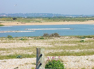
Dungeness, Romney Marsh and Rye Bay is a 10,172.9-hectare (25,138-acre) biological and geological Site of Special Scientific Interest which stretches from New Romney in Kent to Winchelsea in East Sussex. An area of 5,129.5 hectares is a Special Protection Area, an area of 3,141.1 hectares is a Special Area of Conservation, and an area of 6,377.6 hectares is a Ramsar Site, a wetland site designated of international importance under the Ramsar Convention. Part of the site is in the High Weald Area of Outstanding Natural Beauty, parts are Geological Conservation Review sites, part is a Local Nature Reserve, and part is a Royal Society for the Protection of Birds nature reserve, and part is a National Nature Reserve.

Darwell Wood is a 37.5-hectare (93-acre) biological Site of Special Scientific Interest north-west of Battle in East Sussex.

High Wood, Dunmow is a 41.5-hectare (103-acre) biological Site of Special Scientific Interest in Great Dunmow in Essex. The local planning authority is Uttlesford District Council.

Ten Wood is a 17.7-hectare (44-acre) biological Site of Special Scientific Interest east of Burrough Green in Cambridgeshire.
Brent Eleigh Woods is a 31.7-hectare (78-acre) biological Site of Special Scientific Interest south-east of Lavenham in Suffolk, England.

Thorpe Morieux Woods is a 45.2-hectare (112-acre) biological Site of Special Scientific Interest north of Thorpe Morieux in Suffolk. Part of it is Bull's Wood, a nature reserve managed by the Suffolk Wildlife Trust.

Harting Downs is a 336.3-hectare (831-acre) biological Site of Special Scientific Interest west of Midhurst in West Sussex. It is a Nature Conservation Review site, Grade I and an area of 206.6 hectares is a Local Nature Reserve which is owned and managed by the National Trust.

Lavington Common is a 31.2-hectare (77-acre) biological Site of Special Scientific Interest south-west of Petworth in West Sussex. It is a National Trust property.

Pads Wood is a 22.2-hectare (55-acre) biological Site of Special Scientific Interest west of Midhurst in West Sussex.
