Southerham Works Pit

Last updated
Southerham Works Pit
Site of Special Scientific Interest
Southerham Works Pit (3).jpg
Area of Search East Sussex
Grid reference TQ 426 096 [1]
InterestGeological
Area1.0 hectare (2.5 acres) [1]
Notification 1996 [1]
Location map Magic Map

Southerham Works Pit is a 1-hectare (2.5-acre) geological Site of Special Scientific Interest in Lewes in East Sussex. [1] [2] It is a Geological Conservation Review site. [3] [4]

Site of Special Scientific Interest conservation designation denoting a protected area in the United Kingdom

A Site of Special Scientific Interest (SSSI) in Great Britain or an Area of Special Scientific Interest (ASSI) in the Isle of Man and Northern Ireland is a conservation designation denoting a protected area in the United Kingdom and Isle of Man. SSSI/ASSIs are the basic building block of site-based nature conservation legislation and most other legal nature/geological conservation designations in the United Kingdom are based upon them, including national nature reserves, Ramsar sites, Special Protection Areas, and Special Areas of Conservation. The acronym "SSSI" is often pronounced "triple-S I".

Lewes Historic town in East Sussex, England

Lewes is the county town of East Sussex and by tradition of all of Sussex. Lewes remains the police and judicial centre for all of Sussex and is home to Sussex Police, Lewes Crown Court and HMP Lewes. It is a civil parish and is the centre of the Lewes local government district as well as the seat of East Sussex County Council at East Sussex County Hall. The population of Lewes is now around 17,000. The settlement is a traditional market town and centre of communications and, in 1264, it was the site of the Battle of Lewes. The town's landmarks include Lewes Castle, the remains of Lewes Priory, Bull House, Southover Grange and public gardens, and a 16th century timber-framed Wealden hall house known as Anne of Cleves House. Other notable features of the area include the Glyndebourne festival, the Lewes Bonfire and the Lewes Pound.

East Sussex County of England

East Sussex is a county in South East England. It is bordered by the counties of Kent to the north and east, Surrey to the north west and West Sussex to the west, and to the south by the English Channel.

This site exposes layers of the Chalk Group dating to the Upper Cretaceous between 90 and 87 million years ago. It is a key site for understanding the lithostratigraphy of the period and the environments of its chalk sea as well as the evolution and taxonomy of Upper Cretaceous fish. [5]

Chalk Group

The Chalk Group is the lithostratigraphic unit which contains the Late Cretaceous limestone succession in southern and eastern England. The same or similar rock sequences occur across the wider northwest European chalk 'province'. It is characterised by thick deposits of chalk, a soft porous white limestone, deposited in a marine environment.

Lithostratigraphy

Lithostratigraphy is a sub-discipline of stratigraphy, the geological science associated with the study of strata or rock layers. Major focuses include geochronology, comparative geology, and petrology. In general a stratum will be primarily igneous or sedimentary relating to how the rock was formed.

Taxonomy (biology) The science of identifying, describing, defining and naming groups of biological organisms

In biology, taxonomy is the science of defining and naming groups of biological organisms on the basis of shared characteristics. Organisms are grouped together into taxa and these groups are given a taxonomic rank; groups of a given rank can be aggregated to form a super-group of higher rank, thus creating a taxonomic hierarchy. The principal ranks in modern use are domain, kingdom, phylum, class, order, family, genus and species. The Swedish botanist Carl Linnaeus is regarded as the father of taxonomy, as he developed a system known as Linnaean taxonomy for categorizing organisms and binomial nomenclature for naming organisms.

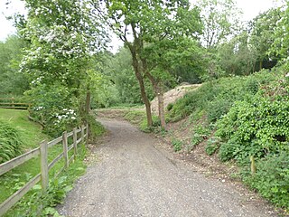
There is access to the southern end of the site from Southerham Lane.

Related Research Articles

Catton Grove Chalk Pit

Catton Grove Chalk Pit is a 0.6-hectare (1.5-acre) geological Site of Special Scientific Interest on the northern outskirts of Norwich in Norfolk. It is a Geological Conservation Review site.

Clock House Brickworks

Clock House Brickworks is a 35.9-hectare (89-acre) geological Site of Special Scientific Interest south of Capel in Surrey. It is a Geological Conservation Review site.

Seale Chalk Pit

Seale Chalk Pit is a 1.2-hectare (3.0-acre) geological Site of Special Scientific Interest west of Guildford in Surrey. It is a Geological Conservation Review site and part of the Seale Chalk Pit and Meadow 3-hectare (7.4-acre) private nature reserve, which is managed by the Surrey Wildlife Trust.

Smokejack Clay Pit

Smokejack Clay Pit is a 56-hectare (140-acre) geological Site of Special Scientific Interest east of Cranleigh in Surrey. It is a Geological Conservation Review site.

Southerham Grey Pit human settlement in United Kingdom

Southerham Grey Pit is a 8.5-hectare (21-acre) geological Site of Special Scientific Interest south-east of Lewes in East Sussex. It is a Geological Conservation Review site.

Southerham Machine Bottom Pit

Southerham Machine Bottom Pit is a 1.8-hectare (4.4-acre) geological Site of Special Scientific Interest in Lewes in East Sussex. It is a Geological Conservation Review site.

Seaford to Beachy Head

Seaford to Beachy Head is a 1,108.7-hectare (2,740-acre) biological and geological Site of Special Scientific Interest which stretches from Seaford to Eastbourne in East Sussex. It has several Geological Conservation Review sites. Part of it is a Nature Conservation Review site, Grade I. An area of 150 hectares is a Local Nature Reserve managed by the Sussex Wildlife Trust.

Harefield Pit is a 1.8-hectare geological Site of Special Scientific Interest in Harefield in the London Borough of Hillingdon. It is located in a disused, partially filled-in chalk quarry. It has two entries in the Geological Conservation Review database.

Kensworth Chalk Pit

Kensworth Chalk Quarry is a 131.3 hectare geological Site of Special Scientific Interest in Kensworth in Bedfordshire. It was notified under Section 28 of the Wildlife and Countryside Act 1981, and the local planning authority is Central Bedfordshire.

Bolter End Sand Pit

Bolter End Sand Pit is a 0.33 hectare geological Site of Special Scientific Interest in Bolter End in Buckinghamshire. It is a Geological Conservation Review site.

South Lodge Pit

South Lodge Pit is a 0.5 hectare geological Site of Special Scientific Interest in Taplow in Buckinghamshire. It is a Geological Conservation Review site.

Barrington Chalk Pit

Barrington Chalk Pit is a 97.1 hectare geological Site of Special Scientific Interest near Barrington in Cambridgeshire. It is a Geological Conservation Review site.

Folkestone Warren

Folkestone Warren is a 316.3-hectare (782-acre) biological and geological Site of Special Scientific Interest (SSSI) which runs along the coast between Folkestone and Dover in Kent. It is a Nature Conservation Review site and it contains three Geological Conservation Review sites and part of a fourth. An area of 83.6 hectares is a Local Nature Reserve,

Wouldham to Detling Escarpment

Wouldham to Detling Escarpment is a 311.2-hectare (769-acre) biological and geological Site of Special Scientific Interest which stretches from Wouldham to Detling, north of Maidstone in Kent. Part of it is a Geological Conservation Review site, and it is part of the North Downs Woodlands Special Area of Conservation and the Kent Downs Area of Outstanding Natural Beauty. It is a Nature Conservation Review site, Grade I and it includes three Kent Wildlife Trust nature reserves and a Local Nature Reserve,

Heacham Brick Pit

Heacham Brick Pit is a 0.8-hectare (2.0-acre) geological Site of Special Scientific Interest in Heacham, north of King's Lynn in Norfolk. It is a Geological Conservation Review site.

Grimston Warren Pit

Grimston Warren Pit is a 6.6-hectare (16-acre) geological Site of Special Scientific Interest east of King's Lynn in Norfolk. It is a Geological Conservation Review site.

Wells Chalk Pit

Wells Chalk Pit is a 4-hectare (9.9-acre) biological and geological Site of Special Scientific Interest on the eastern outskirts of Wells-next-the-Sea in Norfolk. It is a Geological Conservation Review site, and it is in the Norfolk Coast Area of Outstanding Natural Beauty.

St James Pit

St James' Pit is a 3.5-hectare (8.6-acre) geological Site of Special Scientific Interest in Norwich in Norfolk. It is a Geological Conservation Review site and part of Mousehold Heath Local Nature Reserve.

References

  1. 1 2 3 4 "Designated Sites View: Southerham Works Pit". Sites of Special Scientific Interest. Natural England. Retrieved 9 January 2019.
  2. "Map of Southerham Works Pit". Sites of Special Scientific Interest. Natural England. Retrieved 9 January 2019.
  3. "Southerham (Lime Kiln Quarries) (Mesozoic - Tertiary Fish/Amphibia)". Geological Conservation Review. Joint Nature Conservation Committee. Retrieved 8 January 2019.
  4. "Southerham Pit (Cenomanian, Turonian, Senonian, Maastrichtian)". Geological Conservation Review. Joint Nature Conservation Committee. Retrieved 8 January 2019.
  5. "Southerham Works Pit citation" (PDF). Sites of Special Scientific Interest. Natural England. Retrieved 9 January 2019.

Coordinates: 50°52′05″N0°01′30″E / 50.868°N 0.025°E / 50.868; 0.025

Geographic coordinate system Coordinate system

A geographic coordinate system is a coordinate system that enables every location on Earth to be specified by a set of numbers, letters or symbols. The coordinates are often chosen such that one of the numbers represents a vertical position and two or three of the numbers represent a horizontal position; alternatively, a geographic position may be expressed in a combined three-dimensional Cartesian vector. A common choice of coordinates is latitude, longitude and elevation. To specify a location on a plane requires a map projection.