High Rocks

Last updated

High Rocks
Site of Special Scientific Interest
High Rocks 4110.JPG
Location East Sussex
Kent
Grid reference TQ 559 383 [1]
InterestGeological
Area3.2 hectares (7.9 acres) [1]
Notification 1986 [1]
Location map Magic Map

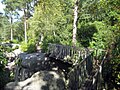
High Rocks is a 3.2-hectare (7.9-acre) geological Site of Special Scientific Interest west of Tunbridge Wells in East Sussex and Kent. [1] [2] It is a Geological Conservation Review site. [3]

Contents

Prehistory

The location was formed when a melting ice sheet at the end of the last ice age uncovered hardened silt deposited when the area was part of the Wealden Lake. There are traces of Middle Stone Age and Iron Age residents, including a 1st-century A.D. fort guarding against the Roman invasion. [4]

Recent history

After King James II visited Tunbridge Wells and made the woodland a resort in the 17th century, High Rocks became a tourist attraction which also offered a maze, a bowling green, gambling rooms and cold baths. The Aerial Walk, a series of bridges linking the tops of the crags, was built in the 19th century.

A halt served by the local railway was established in 1907, and was used until 1952. The Spa Valley Railway, a heritage railway, now connects the High Rocks pub beyond the High Rocks turnstiles to Tunbridge Wells, Groombridge and Eridge (on the London-Uckfield line of Southern Railway).

Geology and geomorphology

High Rocks is a key geomorphological site for sandstone weathering features developed on the highest cliffs in the Weald. The Ardingly Sandstone has suffered gentle deformation, and joints have opened out to form spectacular gulls (tension cracks) which are wide enough in places for a person to enter.

Open gulls are comparatively rare in Britain, except in the central Weald, and they are nowhere better revealed than in the numerous open passages at High Rocks. The Ardingly Sandstone is friable and poorly cemented, but the surface develops a protective crust and displays a variety of micro-weathering features, notably honeycombing and polygonal cracking. The origin of this cracking is problematic but may relate to freezing and thawing under periglacial conditions during the Pleistocene. This type of cracking is found in Britain only on the sandstone outcrops in the central Weald, and is most strikingly displayed at High Rocks.

Current use

The crags are visited by rock climbers and other members of the public. It is also frequently used for wedding receptions. Footpaths lead around the rocks, and it is possible to walk across the top of crags on footbridges. The main area is fenced in and there is a £5 entrance fee to enter the site. [5]

An unfenced and free access section of the ridge of rock outcrops can be reached by following the public footpath east of the pub, next to the railway bridge.

Related Research Articles

<span class="mw-page-title-main">Weald</span> Area of South East England

The Weald is an area of South East England between the parallel chalk escarpments of the North and the South Downs. It crosses the counties of Hampshire, Surrey, Sussex and Kent. It has three separate parts: the sandstone "High Weald" in the centre; the clay "Low Weald" periphery; and the Greensand Ridge, which stretches around the north and west of the Weald and includes its highest points. The Weald once was covered with forest, and its name, Old English in origin, signifies "woodland". The term is still used today, as scattered farms and villages sometimes refer to the Weald in their names.

<span class="mw-page-title-main">High Weald AONB</span>

The High Weald Area of Outstanding Natural Beauty is in south-east England. Covering an area of 1,450 square kilometres (560 sq mi), it takes up parts of Kent, Surrey, East Sussex, and West Sussex. It is the fourth largest Area of Outstanding Natural Beauty (AONB) in England and Wales. It has an attractive landscape with a mosaic of small farms and woodlands, historic parks, sunken lanes and ridge-top villages.

<span class="mw-page-title-main">Frant</span> Village in East Sussex, England

Frant is a village and civil parish in the Wealden District of East Sussex, England, on the Kentish border about three miles (5 km) south of Royal Tunbridge Wells.

<span class="mw-page-title-main">St Bees Head</span> Headland in cumbria

St Bees Head is a headland on the North West coast of the English county of Cumbria and is named after the nearby village of St Bees.

<span class="mw-page-title-main">Harrison's Rocks</span> Sandstone crag in England

Harrison's Rocks is a series of sandstone crags approximately 1.5 kilometres (1 mi) south of the village of Groombridge in the county of East Sussex. The site is a notable example of a periglacial tor landform developed in rocks of the Ardingly Sandstone Member of the Tunbridge Wells Sand Formation. It is popular with rock climbers, and is the largest of the cluster of local outcrops known by climbers as Southern Sandstone.

<span class="mw-page-title-main">Geography of Kent</span> Overview of the geography of Kent

Kent is the south-easternmost county in England. It is bounded on the north by the River Thames and the North Sea, and on the south by the Straits of Dover and the English Channel. The continent of Europe is 21 miles across the straits.

<span class="mw-page-title-main">Netherside Stream Outcrops</span>

Netherside Stream Outcrops is a 2.9-hectare (7.2-acre) geological Site of Special Scientific Interest north-east of Haslemere in Surrey. It is a Geological Conservation Review site.

<span class="mw-page-title-main">Eridge Green</span> Site of Special Scientific Interest in East Sussex

Eridge Green is a 8.4-hectare (21-acre) biological Site of Special Scientific Interest north-east of Crowborough in East Sussex. It is part of the 44 hectares Eridge Rocks nature reserve, which is managed by Sussex Wildlife Trust.

<span class="mw-page-title-main">High Weald Landscape Trail</span>

The High Weald Landscape Trail (HWLT) is a 145-kilometre (90 mi) route in England between Horsham, West Sussex and Rye, East Sussex, designed to pass through the main landscape types of the High Weald Area of Outstanding Natural Beauty (AONB). It does not follow the highest ground, and the eastern section is only a few feet above sea level. It keeps to the northern edge of the High Weald except in the west where it runs close to the southern edge for a short distance.

<span class="mw-page-title-main">Turners Hill SSSI</span>

Turners Hill SSSI is a 0.2-hectare (0.49-acre) geological Site of Special Scientific Interest in Turners Hill in West Sussex. It is a Geological Conservation Review site.

<span class="mw-page-title-main">Stone Farm Rocks</span>

Stone Farm Rocks or Stone Hill Rocks is a 0.6-hectare (1.5-acre) geological Site of Special Scientific Interest south of East Grinstead in West Sussex. It is a Geological Conservation Review site.

<span class="mw-page-title-main">Bowles Rocks</span> Climbing areas of England

Bowles Rocks is a sandstone crag in the county of East Sussex, on the border with Kent, approximately 8 kilometres (5 mi) south of the town of Royal Tunbridge Wells. It is popular with rock climbers due to the excellent, south-facing, quick-drying rock, the range of climbs and the ease of access. It is one of the cluster of local outcrops known as Southern Sandstone.

<span class="mw-page-title-main">Tunbridge Wells Sand Formation</span>

The Tunbridge Wells Sand Formation is a geological unit which forms part of the Wealden Group and the uppermost and youngest part of the unofficial Hastings Beds. These geological units make up the core of the geology of the Weald in the English counties of West Sussex, East Sussex and Kent.

<span class="mw-page-title-main">Southern Sandstone</span> Rock formation in southeast England

Southern Sandstone is a local name for the Ardingly Sandstone of southeast England, a soft sandstone of Cretaceous age separating the Tunbridge Wells Sands from the overlying Grinstead Clay. The outcrops in the Weald of Kent are the rock climbing crags closest to London and are probably the most heavily climbed in the UK.

The geology of West Sussex in southeast England comprises a succession of sedimentary rocks of Cretaceous age overlain in the south by sediments of Palaeogene age. The sequence of strata from both periods consists of a variety of sandstones, mudstones, siltstones and limestones. These sediments were deposited within the Hampshire and Weald basins. Erosion subsequent to large scale but gentle folding associated with the Alpine Orogeny has resulted in the present outcrop pattern across the county, dominated by the north facing chalk scarp of the South Downs. The bedrock is overlain by a suite of Quaternary deposits of varied origin. Parts of both the bedrock and these superficial deposits have been worked for a variety of minerals for use in construction, industry and agriculture.

<span class="mw-page-title-main">Rusthall Common</span>

Rusthall Common is a 2.7-hectare (6.7-acre) geological Site of Special Scientific Interest in Rusthall, a suburb of Tunbridge Wells in Kent. It is a Geological Conservation Review site. It is owned by the Manor of Rusthall and managed by Tunbridge Wells Commons Conservators.

<span class="mw-page-title-main">Pembury Cutting and Pit</span>

Pembury Cutting and Pit is a 1.6-hectare (4.0-acre) geological Site of Special Scientific Interest east of Tunbridge Wells in Kent. It is a Geological Conservation Review site.

<span class="mw-page-title-main">Philpot's and Hook Quarries</span>

Philpot's and Hook Quarries is a 2.6-hectare (6.4-acre) geological Site of Special Scientific Interest south-west of Sharpthorne in West Sussex. It is a Geological Conservation Review site.

<span class="mw-page-title-main">Perry Copse Outcrop</span>

Perry Copse Outcrop is a 0.2-hectare (0.49-acre) geological Site of Special Scientific Interest in Fernhurst in West Sussex. It is a Geological Conservation Review site.

<span class="mw-page-title-main">Wakehurst and Chiddingly Woods</span> Nature preserve in West Sussex, England

Wakehurst and Chiddingly Woods is a 155.9-hectare (385-acre) biological and geological Site of Special Scientific Interest south-east of Crawley in West Sussex, England. It is a Nature Conservation Review site, Grade I, and part of it is a Geological Conservation Review site.

References

  1. 1 2 3 4 "Designated Sites View: High Rocks". Sites of Special Scientific Interest. Natural England. Retrieved 8 February 2018.
  2. "Map of High Rocks". Sites of Special Scientific Interest. Natural England. Retrieved 8 February 2018.
  3. "High Rocks (Quaternary of South-East England)". Geological Conservation Review. Joint Nature Conservation Committee. Retrieved 11 January 2018.
  4. "High Rocks, Tunbridge Wells History". Penshurst Online. Retrieved 27 December 2011.
  5. "High Rocks National Monument" (PDF). The High Rocks. Archived from the original (PDF) on 3 September 2013. Retrieved 5 February 2013.

Coordinates: 51°06′47″N0°13′34″E / 51.113°N 0.226°E / 51.113; 0.226