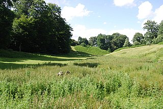
Knole Park is a 383.4-hectare (947-acre) biological Site of Special Scientific Interest in Sevenoaks in Kent. About 43 acres of the park belongs to the National Trust, as does Knole House, which sits within it. The remaining parkland is privately owned by the Knole Estate. It is in the Kent Downs Area of Outstanding Natural Beauty.

Ham Street Woods is a 175.2-hectare (433-acre) biological Site of Special Scientific Interest south of Ashford in Kent. It is a Nature Conservation Review site, Grade I, and an area of 97.1 hectares is a National Nature Reserve.

Park Gate Down or Parkgate Down is a 7-hectare (17-acre) biological Site of Special Scientific Interest south-east of Stelling Minnis in Kent. It is also a Special Area of Conservation and is managed by the Kent Wildlife Trust,

Ingrebourne Marshes are a 74.8 hectare biological Site of Special Scientific Interest in Hornchurch in the London Borough of Havering. Ingrebourne Valley Local Nature Reserve includes a small part of the SSSI west of the River Ingrebourne.

Langham Pond is a 26.7-hectare (66-acre) biological Site of Special Scientific Interest north of Egham in Surrey.

Whitmoor Common is a 166-hectare (410-acre) biological Site of Special Scientific Interest on the northern outskirts of Guildford in Surrey. It is part of the Thames Basin Heaths Special Protection Area and the 184.9-hectare (457-acre) Whitmoor and Rickford Commons Local Nature Reserve, which is owned by Surrey County Council and managed by the Surrey Wildlife Trust.

Wormsley Chalk Banks are six separate areas which together are a 14.1-hectare (35-acre) biological Site of Special Scientific Interest near Turville in Buckinghamshire and Oxfordshire. The site is in the Chilterns Area of Outstanding Natural Beauty.
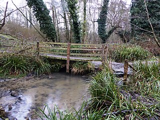
Seabrook Stream is a 24.1-hectare (60-acre) biological Site of Special Scientific Interest in Kent.

Charing Beech Hangers is a 52.6-hectare (130-acre) biological Site of Special Scientific Interest north of Ashford in Kent.
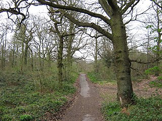
Darenth Wood is a 122.9-hectare (304-acre) biological Site of Special Scientific Interest east of Dartford in Kent.

Magpie Bottom is a 51.9-hectare (128-acre) biological Site of Special Scientific Interest north of Sevenoaks in Kent.
Medway Estuary and Marshes is a 4,748.8-hectare (11,735-acre) biological Site of Special Scientific Interest which stretches along the banks of the River Medway between Gillingham and Sheerness in Kent. It is a Nature Conservation Review site, Grade I, a Ramsar internationally important wetland site, and a Special Protection Area under the European Union Directive on the Conservation of Wild Birds.

Northward Hill is a 52.5-hectare (130-acre) biological Site of Special Scientific Interest Kent. It is a Nature Conservation Review site, Grade 2, and is also designated High Halstow National Nature Reserve The site is managed by the Royal Society for the Protection of Birds.

Oldbury and Seal Chart is a 212.4-hectare (525-acre) biological Site of Special Scientific Interest east of Sevenoaks in Kent, England. It is in the Kent Downs Area of Outstanding Natural Beauty, and part of it is Oldbury Hill, a National Trust property and Iron Age hill fort.

Orlestone Forest is a 347.6-hectare (859-acre) biological Site of Special Scientific Interest south of Ashford in Kent. It is a Nature Conservation Review site, Grade I.

Alex Farm Pastures is a 4.5-hectare (11-acre) biological Site of Special Scientific Interest south of Shadoxhurst in Kent.
Sandwich Bay to Hacklinge Marshes is a 1,790.1-hectare (4,423-acre) biological and geological Site of Special Scientific Interest which stretches between Deal and Sandwich in Kent. It includes two Geological Conservation Review sites, and most of it is a Nature Conservation Review site, Grade I. Part of it is a Ramsar site, a Special Area of Conservation, a Special Protection Area and a National Nature Reserve, It also includes a Kent Wildlife Trust nature reserve and a Local Nature Reserve,
Scotney Castle SSSI is a 112.5-hectare (278-acre) biological Site of Special Scientific Interest in the grounds of Scotney Castle, a National Trust property south-east of Tunbridge Wells in Kent.

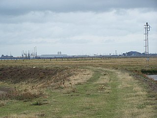
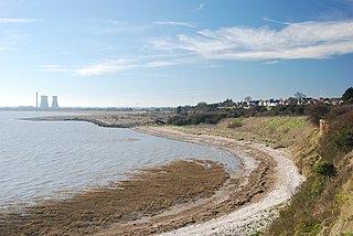
South Thames Estuary and Marshes is a 5,289-hectare (13,070-acre) biological Site of Special Scientific Interest which stretches between Gravesend and the mouth of the River Medway in Kent. Part of it is a Nature Conservation Review site, Grade I, and part is a Royal Society for the Protection of Birds nature reserve. It is part of the Thames Estuary and Marshes Ramsar internationally important wetland site and Special Protection Area under the European Union Directive on the Conservation of Wild Birds.
Hook Norton Cutting and Banks is a 6.7-hectare (17-acre) biological and geological Site of Special Scientific Interest south of Hook Norton in Oxfordshire. The site is in three areas, two of which are managed as a nature reserve called Hook Norton Cutting by Berkshire, Buckinghamshire and Oxfordshire Wildlife Trust. and are designated a Geological Conservation Review site.
