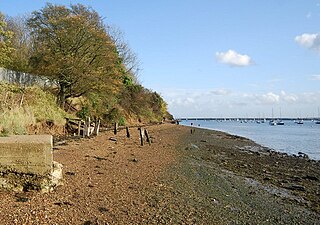
Brook Brick Pit is a 0.9-hectare (2.2-acre) geological Site of Special Scientific Interest west of Wormley Surrey. It is a Geological Conservation Review site.

Seale Chalk Pit is a 1.2-hectare (3.0-acre) geological Site of Special Scientific Interest west of Guildford in Surrey. It is a Geological Conservation Review site and part of the Seale Chalk Pit and Meadow 3-hectare (7.4-acre) private nature reserve, which is managed by the Surrey Wildlife Trust.

High Rocks is a 3.2-hectare (7.9-acre) geological Site of Special Scientific Interest west of Tunbridge Wells in East Sussex and Kent. It is a Geological Conservation Review site.

Brede Pit and Cutting is a 0.6-hectare (1.5-acre) geological Site of Special Scientific Interest in Brede in East Sussex. It is a Geological Conservation Review site.

Turners Hill SSSI is a 0.2-hectare (0.49-acre) geological Site of Special Scientific Interest in Turners Hill in West Sussex. It is a Geological Conservation Review site.

Stone Farm Rocks or Stone Hill Rocks is a 0.6-hectare (1.5-acre) geological Site of Special Scientific Interest south of East Grinstead in West Sussex. It is a Geological Conservation Review site.

Rusthall Common is a 2.7-hectare (6.7-acre) geological Site of Special Scientific Interest in Rusthall, a suburb of Tunbridge Wells in Kent. It is a Geological Conservation Review site. It is owned by the Manor of Rusthall and managed by Tunbridge Wells Commons Conservators.

Sturry Pit is a 0.7 hectares geological Site of Special Scientific Interest north-east of Canterbury in Kent. It is a Geological Conservation Review site.

Dryhill is an 11.7-hectare (29-acre) geological Site of Special Scientific Interest on the western outskirts of Sevenoaks in Kent. It is a Geological Conservation Review site, and an area of 9.5 hectares is a Local Nature Reserve

Sheppey Cliffs and Foreshore is a 303.6-hectare (750-acre) biological and geological Site of Special Scientific Interest which stretches between Minster and Leysdown-on-Sea in Kent, England. It includes five Geological Conservation Review sites. This site exposes Eocene London Clay with well-preserved fossil fauna and flora, which have been studied since the eighteenth century.

Southborough Pit is a 1.1-hectare (2.7-acre) geological Site of Special Scientific Interest in Tunbridge Wells in Kent. It is a Geological Conservation Review site.

Tower Hill to Cockham Wood is a 47.8-hectare (118-acre) biological and geological Site of Special Scientific Interest on the northern outskirts of Rochester in Kent. It contains two Geological Conservation Review sites.

Houlder and Monarch Hill Pits is a 0.7-hectare (1.7-acre) geological Site of Special Scientific Interest in Upper Halling in Kent, England. It is a Geological Conservation Review site.

Aylesford Pit is a 1.5-hectare (3.7-acre) geological Site of Special Scientific Interest north of Maidstone in Kent. It is a Geological Conservation Review site.

Philpot's and Hook Quarries is a 2.6-hectare (6.4-acre) geological Site of Special Scientific Interest south-west of Sharpthorne in West Sussex. It is a Geological Conservation Review site.

Wakehurst and Chiddingly Woods is a 155.9-hectare (385-acre) biological and geological Site of Special Scientific Interest south-east of Crawley in West Sussex, England. It is a Nature Conservation Review site, Grade I, and part of it is a Geological Conservation Review site.


