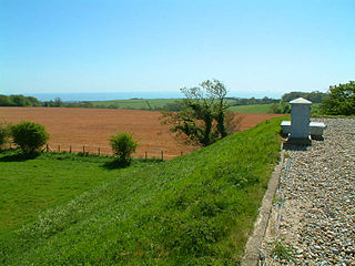
Folkestone to Etchinghill Escarpment is a 263.2-hectare (650-acre) biological and geological Site of Special Scientific Interest on the northern outskirts of Folkestone in Kent. It is a Special Area of Conservation. An area of 205 hectares is a Nature Conservation Review grassland site, Grade 2, and the 70-hectare (170-acre) Asholt Wood at its western end is a Grade 1 woodland site. The reserve has a Geological Conservation Review site.

Mole Gap to Reigate Escarpment is a 1,016.4-hectare (2,512-acre) biological and geological Site of Special Scientific Interest west of Reigate in Surrey. It is a Geological Conservation Review site and a Special Area of Conservation. Part of it is a Nature Conservation Review site, Grade I. Two small private nature reserves in the site are managed by the Surrey Wildlife Trust, Dawcombe and Fraser Down.

Turners Hill SSSI is a 0.2-hectare (0.49-acre) geological Site of Special Scientific Interest in Turners Hill in West Sussex. It is a Geological Conservation Review site.

West Hoathly SSSI is a 0.7-hectare (1.7-acre) geological Site of Special Scientific Interest in Sharpthorne in West Sussex. It is a Geological Conservation Review site.

The Crouch and Roach Estuaries are a 1729 hectare biological Site of Special Scientific Interest (SSSI) at the mouth of the Crouch and Roach rivers in Essex. The Crouch part of the SSSI stretches from near Battlesbridge to Foulness Island, and the Roach from Rochford to the junction with the Crouch. Part of the site is in the Mid-Essex Coast Special Protection Area under the EC Directive on the Conservation of Wild Birds, and a Ramsar wetland site of international importance. It is also part of the Essex Estuaries Special Area of Conservation. An area of 65 hectares is managed by the Essex Wildlife Trust as the Lion Creek and Lower Raypits nature reserve and 8 hectares at Woodham Fen, both of which are managed by the Essex Wildlife Trust. A small area is also a geological SSSI, The Cliff, Burnham-on-Crouch.
Stone SSSI is a 0.12-hectare (0.30-acre) geological Site of Special Scientific Interest in Stone in Buckinghamshire. It is listed by the Joint Nature Conservation Committee as a Geological Conservation Review site.

The Naze SSSI is a 22 hectare geological Site of Special Scientific Interest on The Naze peninsula north of Walton-on-the-Naze in Essex. It is a Geological Conservation Review site both for its Pleistocene fossils and for its birds. It is part of The Naze Nature Reserve, which is managed by the Essex Wildlife Trust.

The Naze Nature Reserve is a 45 hectare nature reserve on The Naze peninsula north of Walton-on-the-Naze in Essex. It is managed by the Essex Wildlife Trust,. Part of it, The Naze SSSI, is a geological Site of Special Scientific Interest and a Geological Conservation Review site.

Dryhill is an 11.7-hectare (29-acre) geological Site of Special Scientific Interest on the western outskirts of Sevenoaks in Kent. It is a Geological Conservation Review site, and an area of 9.5 hectares is a Local Nature Reserve

Wouldham to Detling Escarpment is a 311.2-hectare (769-acre) biological and geological Site of Special Scientific Interest which stretches from Wouldham to Detling, north of Maidstone in Kent. Part of it is a Geological Conservation Review site, and it is part of the North Downs Woodlands Special Area of Conservation and the Kent Downs Area of Outstanding Natural Beauty. It is a Nature Conservation Review site, Grade I and it includes three Kent Wildlife Trust nature reserves and a Local Nature Reserve,

Warnham SSSI is a 28.5-hectare (70-acre) geological Site of Special Scientific Interest north of Horsham in West Sussex. It is a Geological Conservation Review site.
