
Bramerton Pits is a 0.7-hectare (1.7-acre) geological Site of Special Scientific Interest north of the village of Bramerton in Norfolk on the southern banks of the River Yare. It is a Geological Conservation Review site.

Swanscombe Skull Site or Swanscombe Heritage Park is a 3.9-hectare (9.6-acre) geological Site of Special Scientific Interest in Swanscombe, north-west Kent, England. It contains two Geological Conservation Review sites and a National Nature Reserve. The park lies in a former gravel quarry, Barnfield Pit, which is the most important site in the Swanscombe complex, alongside several other nearby pits.

Thorpe Park No 1 Gravel Pit is a 42.5-hectare (105-acre) biological Site of Special Scientific Interest (SSSI) east of Virginia Water in Surrey. It is part of the Thorpe Park theme park.

Wansunt Pit is a 1.9-hectare (4.7-acre) geological Site of Special Scientific Interest in Dartford Heath between Crayford in the London Borough of Bexley and Dartford in Kent. It is also a Geological Conservation Review site. It is important geologically because it exposes the Dartford Heath Gravel, and the relationship of this exposure to the Swanscombe sequence and the Thames Terraces is a controversial issue in Thames Pleistocene studies. The site is part of Braeburn Park, a nature reserve managed by the London Wildlife Trust.

Hillcollins Pit or Furneux Pelham Gravel Pit is a 0.2-hectare (0.49-acre) geological Site of Special Scientific Interest near Furneux Pelham in Hertfordshire. The local planning authority is East Hertfordshire District Council. it was identified as a site of national importance in the Geological Conservation Review in 1988.

Little Heath Pit is a 0.3-hectare (0.74-acre) geological Site of Special Scientific Interest at Little Heath near Potten End in Hertfordshire. It is part of the Ashridge Estate, owned by the National Trust, and the local planning authority is Dacorum Borough Council. It is listed in the Geological Conservation Review.

Highlands Farm Pit is a 0.6-hectare (1.5-acre) geological Site of Special Scientific Interest in Henley-on-Thames in Oxfordshire. It is a Geological Conservation Review site.

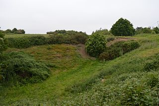
Ardleigh Gravel Pit is a 1.2-hectare (3.0-acre) geological Site of Special Scientific Interest south of Ardleigh in Essex. It is a Geological Conservation Review site.

Wivenhoe Gravel Pit is a 2.1-hectare (5.2-acre) geological Site of Special Scientific Interest north of Wivenhoe in Essex. It is a Geological Conservation Review site.

Holland-on-Sea Cliff is a 0.1-hectare (0.25-acre) geological Site of Special Scientific Interest in Holland-on-Sea, north-west of Clacton-on-Sea in Essex. It is a Geological Conservation Review site.
St Osyth Pit is a 0.1-hectare (0.25-acre) geological Site of Special Scientific Interest north of St Osyth in Essex. It is a Geological Conservation Review site.

Newney Green Pit is a 0.07-hectare (0.17-acre) geological Site of Special Scientific Interest west of Writtle in Essex. It is a Geological Conservation Review site.

Holton Pit is a 1.6-hectare (4.0-acre) geological Site of Special Scientific Interest east of Halesworth in Suffolk. It is a Geological Conservation Review site.

Pembury Cutting and Pit is a 1.6-hectare (4.0-acre) geological Site of Special Scientific Interest east of Tunbridge Wells in Kent. It is a Geological Conservation Review site.

Southborough Pit is a 1.1-hectare (2.7-acre) geological Site of Special Scientific Interest in Tunbridge Wells in Kent. It is a Geological Conservation Review site.

Houlder and Monarch Hill Pits is a 0.7-hectare (1.7-acre) geological Site of Special Scientific Interest in Upper Halling in Kent, England. It is a Geological Conservation Review site.

Aylesford Pit is a 1.5-hectare (3.7-acre) geological Site of Special Scientific Interest north of Maidstone in Kent. It is a Geological Conservation Review site.

Broome Heath Pit is a 1.2-hectare (3.0-acre) geological Site of Special Scientific Interest east of Ditchingham in Norfolk. It is a Geological Conservation Review site and part of Broome Heath Local Nature Reserve

Briton's Lane Gravel Pit is a 21.5-hectare (53-acre) geological Site of Special Scientific Interest east of Sheringham in Norfolk. It is a Geological Conservation Review site and it is in the Norfolk Coast Area of Outstanding Natural Beauty.
