Bonnyrigg is a town in Midlothian, Scotland, which is eight miles southeast of Edinburgh city centre, between the Rivers North and South Esk. The town had a population of 14,663 in the 2001 census which rose to 15,677 in the 2011 census, both figures based on the 2010 definition of the locality which, as well as Bonnyrigg and the adjacent settlement of Lasswade, includes Polton village, Poltonhall housing estate and modern development at Hopefield. The estimated population for 2018 is 18,120, the highest of any town in Midlothian. Along with Lasswade, Bonnyrigg is a twin town with Saint-Cyr-l'École, France.

Musselburgh is the largest settlement in East Lothian, Scotland, on the coast of the Firth of Forth, 5 miles (8 km) east of Edinburgh city centre. It has a population of 21,100.

Murrayfield is an area to the west of Edinburgh city centre in Scotland. It is to the east of Corstorphine and north of Balgreen, Saughtonhall and Roseburn. The A8 road runs east–west through the south of the area. Murrayfield is often considered to include the smaller neighbouring areas of Ravelston and Roseburn.

Bargeddie is a village in North Lanarkshire, Scotland, just inside the suburban fringe of Glasgow, 8 miles (13 km) east of the city centre, and close to the junction of the M73 and M8 motorways. The nearest major town is Coatbridge, 2 miles (3 km) to the east.

Swanston is a village and residential area on the southern edge of Edinburgh, Scotland, noted for its picturesque thatched cottages set around an informal village green. Because of its relatively isolated position at the foot of the Pentland Hills, it has remained largely unaffected by commercial or suburban development.
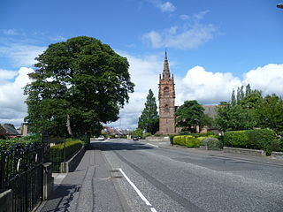
Craiglockhart is a suburb in the south west of Edinburgh, Scotland, lying between Colinton to the south, Morningside to the east Merchiston to the north east, and Longstone and Kingsknowe to the west. The Water of Leith is also to the west.

The Central Belt of Scotland is the area of highest population density within Scotland. Depending on the definition used, it has a population of between 2.4 and 4.2 million, including multiple Scottish cities; Greater Glasgow, Ayrshire, Falkirk, Edinburgh, Lothian and Fife.
The Pentland Hills are a range of hills southwest of Edinburgh, Scotland. The range is around twenty miles in length, and runs southwest from Edinburgh towards Biggar and the upper Clydesdale.
Silverknowes is a district of Edinburgh, Scotland. Silverknowes lies to the northwest of the city. The district contains over 2000 homes, ranging in size from bungalow to semi-detached housing, much of it built during the mid-twentieth century.

Shieldhall is a district in the Scottish city of Glasgow. It is situated directly south of the River Clyde and is part of the wider Govan area.
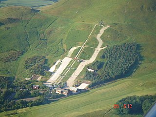
The Midlothian Snowsports Centre, formerly the Hillend Ski Centre, is the second longest dry ski slope in Europe, situated near Hillend near Edinburgh, South East Scotland. It is a national training centre for Scottish Olympians, with 29 having been trained there as of 2010, including Finlay Mickel, a former British number one downhill skier.

Abbeyhill is an area of Edinburgh, the capital of Scotland.
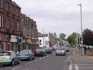
Monifieth is a town and former police burgh in the council area of Angus, Scotland. It is situated on the north bank of the Firth of Tay on the east coast. In 2016, the population of Monifieth was estimated at 8,110, making it the fifth largest town in Angus.

Lasswade is a village and civil parish in Midlothian, Scotland, on the River North Esk, nine miles south of Edinburgh city centre, contiguous with Bonnyrigg and between Dalkeith to the east and Loanhead to the west. Melville Castle lies to the north east. The Gaelic form is Leas Bhaid, meaning the "clump at the fort."
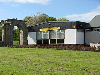
Danderhall is a village in Midlothian, Scotland, just outside Edinburgh but inside the Edinburgh City Bypass.

Craigmarloch is a private residential area of the town of Cumbernauld in North Lanarkshire, Scotland. It was the last such area that the Cumbernauld Development Corporation (CDC) laid out and began to construct. The area is designed to be like a village, with features such as: a village green, a main street, focal points, gateways, water features and recreational and community facilities. The responsibility for the development of the area passed from the CDC to North Lanarkshire Council in 1996.
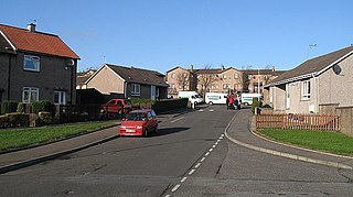
Wellwood is a small village to the north of Dunfermline, Fife, Scotland. It was named after the Wellwoods who used to own coalmines in the area. It has a leisure centre and a golf course (Canmore). It is nearby the Town Loch and also is partially bordered by Queen Anne High School. It was formerly known as Hawkiesfauld.

The City of Edinburgh Council is the local government authority covering the City of Edinburgh council area. Almost half of the council area is the area of Edinburgh, capital of Scotland. With a population of 526,470 in mid-2019, it is the second most populous local authority area in Scotland.

Caerketton Hill is a hill in the Pentland Hills range of Scotland. Standing at 478 m, it is at the northeast end of the approximately 25 km (16 mi) long chain of hills on the border between the City of Edinburgh council area and Midlothian. The nearest settlements are Currie, three miles to the west, and Loanhead, four miles to the east. Edinburgh's southern boroughs start about two kilometers north. The nearest hills are Allermuir Hill to the west and Woodhouselee Hill to the south. The Boghall Burn rises on the southern flank and eventually drains into the Firth of Forth via North Esk and Esk.


