Desh is a region adjacent to the Western Ghats between the Godavari River and Krishna River, a part of Deccan Plateau, in the states of Maharashtra, Karnataka, and Andhra Pradesh. The region is hilly and slopes towards the east, and is drained by the upper reaches of the Godavari and Krishna rivers and their tributaries.
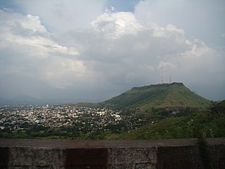
Satara is a city located in the Satara District of Maharashtra state of India, near the confluence of the river Krishna and its tributary, the Venna. The city was established in the 16th century and was the seat of the Chhatrapati of the Maratha Kingdom, Shahu I.

Satara district is a district of Maharashtra state in western India with an area of 10,480 km2 (4,050 sq mi) and a population of 3,003,741 of which 14.17% were urban. Satara is the capital of the district and other major towns include Medha, Wai, Karad, Malkapur, Koregaon, Rahimatpur, Dahiwadi, Koynanagar, Phaltan, Lonand, Mahabaleshwar, Panchgani, Vaduj and Mhaswad. This district comes under Pune Administrative Division along with Pune, Sangli, Solapur and Kolhapur. The district of Pune bounds it to the north, Raigad bounds it to the north-west, Solapur the east, Sangli to the south, and Ratnagiri to the west.
Shirur is an administrative subdivision of the Pune district in the Indian state of Maharashtra. It is located on the eastern boundary of the district, on the banks of the Ghod River. The town is also called Ghodnadi to distinguish it from other locations that have the same name. Ghodnadi in Marathi Language means Ghod River.
Jaoli is a tehsil, a taluka in subdivision of Satara district in the Indian state of Maharashtra.
Bhoite is a Maratha clan. mainly in the state of Maharashtra in India but it also appears in Indian states bordering Maharashtra.
Tadawale Sammat Wagholi is a small town and gram panchayat in Koregaon taluka, Satara district, in the Indian province of Maharashtra.
Nimbalkar is a Maratha clan descent from Nimbraj Parmar, direct descendant of Jagdeva Parmar. Nimbalkar derives its surname from the forest of Nimbalak in Phaltan taluka, Satara district, Maharashtra, India.Nimbalkars are infamously known for their matrimonial alliance with Chhatrapati Shivaji.Sayee bai Nimbalkar the princess of phaltan was married to shivaji as his first wife and mother of his first son.Nimbalkars are ranked as Saptakuli Maratha,which is why they are in general category.Their gotra is Vashishta and their clan godess is Mata Tulja Bhavani and Mahakaleshwar is their clan god.
Jawali is a small village located in the Mahadeva Mountain range of Phaltan Tehsil of the Satara district of the Indian state of Maharashtra.
Aradgaon is a village in Phaltan Tehsil, Satara district, Maharashtra.
Sakharwadi is a town and Gram panchayat of Phaltan tehsil, Satara district, Maharashtra, India. It is situated at about 15 kilometres (9.3 mi) north-east of Phaltan city and approximately 60 kilometres (37 mi) north-west of Satara city.
Khandala is a town and taluka in the Satara district in the Indian state of Maharashtra.

Phaltan State was one of the non-salute Maratha princely states of British India. It was ruled by the Nimbalkar clan of the Marathas. It was under the central division of the Bombay Presidency, under the states of the Kolhapur-Deccan Residency, Satara Agency, and later the Deccan States Agency. Its capital was Phaltan town, located in present-day Maharashtra.
Wagholi is a village in Koregaon takula of Satara district of Maharashtra, India. It plays an important role in the economic, social, cultural, and educational lives of people in Koregaon, and Satara Districts.
Madhavrao Khanderao Bagal, also called Bhai Madhavrao Bagal, was a noted writer, artist, journalist, social reformer, political activist, orator and freedom fighter from Kolhapur.
Banawadi is a census village of Satara district in the Indian state of Maharashtra. It is situated near to the Satara Phaltan state highway, about 21 km north of Satara, about 108 km from Pune and 220 km from Mumbai.

Vaduj is a major town in Satara district of Maharashtra, India. It is the headquarters of Khatav Taluka. It is located on the banks of the Yerala River, and is around 58 kilometres (36 mi) away from the district capital Satara, and 165 kilometres (103 mi) away from Pune. It is the biggest town in Khatav Taluka, with a population of around 17,636 people. Recently, its status was changed to Nagar Panchayat.
Garavadi (Ramnagar) is a census village in the Satara district, located in the India state of Maharashtra. There are a total of approximately 240 families residing within its borders. The village is located in the Khatav Tehsil of Satara district in Maharashtra, India. It is 32 km away from the sub-district headquarters of Vaduj, and 54 km away from the district headquarters of Satara. Research from 2009 shows that Garavadi village is also classified as a gram panchayat. According to the India Census in 2011, the village was recorded to have a population of 997, 478 of which were males, and the other 519 females.

Vele is a village in the Western region of Maharashtra state in India. It is located in the Satara district of Maharashtra. Before it was a part of Bombay State and Princely state of Satara. It is located adjacent to Kanher Dam built on Venna River. There is a big temple of Bhairava at the village entrance. Also there are number of temples in closed vicinity of village. Surrounded by greenery and farms, agriculture is the main occupation in the village with more than 80% of the total area being used for agricultural activities. Though agriculture constitutes a mainstay of the economy of this village, besides a sizeable population working at various plum government positions does bolster the financial position.
Lonand is a city and municipal council in Satara district, Maharashtra. It is 227km from Mumbai, 81km from Pune, 47km from Wai & Satara,179km from Sangli and 30km from Phaltan.