
Adams County is a county located in the U.S. state of Mississippi. As of the 2020 census, the population was 29,538. The county seat is Natchez.
Tishomingo County is a county located in the northeastern corner of the U.S. state of Mississippi. As of the 2020 census, the population was 18,850. Its county seat is Iuka.

Coahoma County is a county located in the U.S. state of Mississippi. As of the 2020 census, the population was 21,390. Its county seat is Clarksdale.

Alcorn County is a county located in the northeastern portion of the U.S. state of Mississippi. As of the 2020 census, the population was 34,740. Its county seat is Corinth. The county is named in honor of Governor James L. Alcorn.

Corinth is a city in and the county seat of Alcorn County, Mississippi, United States. The population was 14,573 at the 2010 census. Its ZIP codes are 38834 and 38835. It lies on the state line with Tennessee.

Bay Springs is a city in and the western county seat of Jasper County, Mississippi, United States. The population was 1,670 at the 2020 census, down from 1,786 at the 2010 census. State highways 15 and 18 intersect at the city. It is part of the Laurel, Mississippi micropolitan area.

Alcorn State University is a public historically black land-grant university adjacent to Lorman, Mississippi. It was founded in 1871 and was the first black land grant college established in the United States. The university is a member-school of the Thurgood Marshall College Fund.
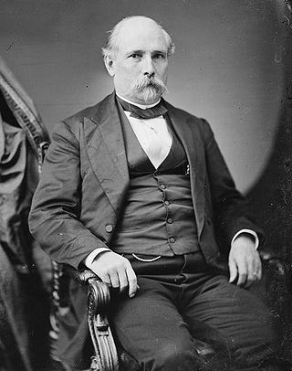
James Lusk Alcorn was a governor, and U.S. senator during the Reconstruction era in Mississippi. A Moderate Republican and Whiggish scalawag, he engaged in a bitter rivalry with Radical Republican Adelbert Ames, who defeated him in the 1873 gubernatorial race. Alcorn was the first elected Republican governor of Mississippi.
Lorman is an unincorporated community located in Jefferson County, Mississippi, United States. Lorman is approximately 8 miles (13 km) north of Fayette, near Highway 61 on Mississippi Highway 552.
Wenasoga, also known as Sogie, is an unincorporated community in northern Alcorn County, Mississippi, United States. It is situated northwest of Corinth near the Tennessee border.
Alcorn is an unincorporated community in Claiborne County, Mississippi, United States. It is the common name given to sites without a name but are around or close to Alcorn State University. Alcorn State University is officially in Lorman, Mississippi by zip code in Jefferson County, Mississippi. A post office operated under the name Alcorn from 1906 to 1954.
Eagles Nest is an unincorporated community located in Coahoma County, Mississippi, United States. Eagles Nest is approximately 2 miles (3.2 km) south of Jonestown and approximately 11 miles (18 km) west of Belen. Eagles Nest is named for the former plantation of James L. Alcorn, which in turn received its name from an eagle's nest that was built near the site. The community is located on the former Louisville, New Orleans and Texas Railway. A post office operated under the name Eagles Nest from 1887 to 1909.

Jacinto, founded in 1836, was named after the Battle of San Jacinto in the Texas Revolution. Jacinto was located in the geographic center of the original Tishomingo County, Mississippi. Within ten years of its founding, Jacinto became a flourishing town with stores, hotels, schools, churches and taverns, serving as the center of government and commerce for the county.

The 1996 United States presidential election in Mississippi took place on November 5, 1996. All fifty states and the District of Columbia, were part of the 1996 United States presidential election. Mississippi voters chose seven electors to the Electoral College, which selected the president and vice president. Mississippi was won by the Republican nominee, Kansas Senator Bob Dole, who was running against incumbent Democrat President Bill Clinton of Arkansas. Clinton ran a second time with former Tennessee Senator Al Gore as Vice President, and Dole ran with former New York Congressman Jack Kemp.
Roseacres is an unincorporated community in Coahoma County, Mississippi, United States.
Danville is a ghost town in Alcorn County, Mississippi, United States.
Kendrick is an unincorporated community in the U.S. state of Mississippi, in Alcorn County. Kendrick is located about 7 miles (11 km) east of the seat of Alcorn County, Corinth, 6 miles (10 km) south of the Tennessee border, and 18 miles (29 km) west of the Alabama border. A post office operated under the name Kendrick from 1889 to 1943.

Biggersville is a census-designated place and unincorporated community in Alcorn County, Mississippi, United States. It lies along U.S. Route 45 six miles south of Corinth in the northeastern part of the state. Biggersville is home to Biggersville High School and several small businesses. It was first named as a CDP in the 2020 Census which listed a population of 205.
Boneyard is a ghost town in Alcorn County, Mississippi, United States. It was located 8.9 mi (14.3 km) miles west of Corinth.

Mississippi Highway 356 is a 16.6-mile-long (26.7 km) east-west state highway in North Mississippi. It connects the communities of Hinkle, Pisgah, and Jacinto with the town of Rienzi.


