The geography of Switzerland encompasses the geographical features of Switzerland, a mountainous and landlocked country located in Western and Central Europe. Switzerland is world-famous for the beauty and uniqueness of its landscapes. It is surrounded by 5 countries: Austria and Liechtenstein to the east, France to the west, Italy to the south and Germany to the north. Switzerland has a maximum north–south length of 220 kilometres (140 mi) and an east–west length of about 350 kilometres (220 mi).

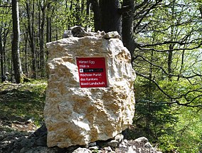
The canton of Basel-Landschaft is one of the 26 cantons of Switzerland. The capital is Liestal. It shares borders with the Swiss cantons of Basel-Stadt, Solothurn, Jura and Aargau, and with the French région of Grand Est and the German state of Baden-Württemberg.

The canton of Basel-Stadt is one of the 26 cantons of Switzerland, and the smallest of the cantons by area. The city of Basel and the municipalities of Bettingen and Riehen form its territory.
Lörrach is a Landkreis (district) in the southwest of Baden-Württemberg, Germany. Neighboring districts are Breisgau-Hochschwarzwald and Waldshut. To the west it borders the French département Haut-Rhin; to the south the Swiss cantons Basel-Stadt, Basel-Landschaft and Aargau.

The canton of Solothurn or canton of Soleure is a canton of Switzerland. It is located in the northwest of Switzerland. The capital is Solothurn.

The Birs is a 73-kilometre (45 mi) long river in Switzerland that flows through the Jura region and ends as a tributary to the Rhine between Basel and Birsfelden. It is the most important river of the Swiss Jura.

Neuwiller is a commune in the Haut-Rhin department in Alsace in north-eastern France. It is surrounded to the north, east and south by the Swiss canton of Basel-Landschaft, and is roughly 7 km from Basel itself.

Schloss Ebenrain is a former country residence in Sissach, in the canton of Basel-Country, Switzerland. Built in 1774-1776, it is considered the most significant late baroque residence in northwestern Switzerland. It is now a public facility and the site of an agricultural school. It is listed as a Swiss cultural property of national significance.

The Waldenburg railway is a narrow-gauge light rail system in the canton of Basel-Landschaft. The 13.1-kilometre (8.1 mi) long single-track line runs from Liestal, the capital of the canton, to Waldenburg, with stops in Bubendorf, Hölstein, Niederdorf, and Oberdorf. It connects to SBB train services in Liestal railway station.

The International School of the Basel Region AG is an English-speaking school for students from ages 3–19 (PYP1-DP2). ISB is an authorised International Baccalaureate (IB) World School, and offers the following programmes:
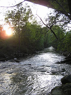
The Ergolz is the main river in the canton of Basel-Landschaft, Switzerland. It rises on Mount Geisflue in the Faltenjura mountains in the upper region of Basel-Landschaft, on the border with Aargau and Solothurn, and joins the Rhine at Augst. Among the tributaries of the Ergolz are Eibach, Homburgerbach, Diegterbach, Frenke, Orisbach, Röserenbach and Violenbach.

The Belchenflue is a mountain of the Jura, located on the border between the Swiss cantons of Basel-Landschaft and Solothurn, south of Eptingen. The nearby Belchenflue Pass links the two cantons.

The Geissflue is a hill of the eastern Jura Mountains, located between the Swiss cantons of Basel-Landschaft and Solothurn. The border with the canton of Aargau runs east of the summit on the Geissfluegrat.
The Vogelberg is a mountain of the Jura, located north of Mümliswil in the Swiss canton of Solothurn. It lies east of the Passwang Pass. The border with the canton of Basel-Landschaft runs north of the mountain. The Vogelberg is the easternmost summit above 1,200 metres in the Jura Mountains.

The Wisenberg is a wooded mountain of the Jura Mountains, located between Häfelfingen and Wisen in northern Switzerland. The summit lies within the canton of Basel-Landschaft, near the border with the canton of Solothurn. The Wisenberg is both the northernmost and easternmost summit above 1,000 metres in the Jura Mountains.
The Ruchen is a mountain of the Jura, located on the border between the Swiss cantons of Basel-Landschaft and Solothurn. It lies between Langenbruck and Eptingen. The Ruchen is the easternmost summit above 1,100 metres in the Jura Mountains. East of the Ruchen is the Belchenflue.

Frenkendorf-Füllinsdorf railway station is a railway station in the municipality of Frenkendorf, in the Swiss canton of Basel-Landschaft. It is an intermediate stop on the Hauenstein line and is served by local trains only. The station is located in Frenkendorf, across the Ergolz river from Füllinsdorf.