The geography of Switzerland encompasses the geographical features of Switzerland, a mountainous and landlocked country located in Western and Central Europe. Switzerland's natural landscape is marked by its numerous lakes and mountains. It is surrounded by 5 countries: Austria and Liechtenstein to the east, France to the west, Italy to the south and Germany to the north. Switzerland has a maximum north–south length of 220 kilometres (140 mi) and an east–west length of about 350 kilometres (220 mi).

The Weissenstein is a mountain of the Jura, located north of Solothurn in the Swiss canton of Solothurn. The culminating point of the chain is distinguished by the name Röti. It is the easternmost summit above 1,300 metres in the Jura Mountains.

The Chasseral is a mountain of the Jura Mountains, overlooking Lake Biel in the Swiss canton of Bern. With an elevation of 1,606 metres above sea level, the Chasseral is the highest summit in the canton of Bern outside the Alps. It is also both the northernmost and easternmost mountain reaching over 1,500 metres in the Jura Mountains. West of the summit is located the Chasseral Ouest, where runs the border with the canton of Neuchâtel. The Chasseral Pass is located further on the west.

Mont Gelé is a mountain of the Pennine Alps, part of the Municipality Riddes and overlooking Verbier in the Swiss canton of Valais. Located on the range north of Mont Fort, its summit is the tripoint between the municipalities of Bagnes, Riddes and Nendaz. It is one of the two mountains named Mont Gelé in the valley of Bagnes, the other being located on the Italian border.

Mont Tendre is a mountain of the Jura, located between the valley of Joux and the basin of Lake Geneva in the canton of Vaud. With an elevation of 1,679 metres above sea level, it is the highest summit of the Swiss portion of the Jura Mountains and, therefore, the highest summit of Switzerland outside the Alps. It is also the most isolated mountain of the canton. It is found in the community of Montricher.

The A16, a motorway in north-central Switzerland, is a divided freeway connecting the border to France to the A5 motorway, 84 kilometres (52 mi) to the south on the Swiss plateau.

The Hasenmatt is a mountain of the Jura range, located north of Grenchen and Solothurn in the Swiss canton of Solothurn. Reaching a height of 1,445 metres above sea level, it is the highest summit in the canton of Solothurn. The Hasenmatt is also the easternmost summit above 1,400 metres of the Jura Mountains.
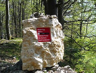
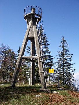
The Hinteri Egg is a mountain of the Jura, located south of Reigoldswil in the Swiss canton of Basel-Landschaft, close to the border with the canton of Solothurn.

The Hage is a mountain in the Randen range between the Jura and the Swabian Jura, located between Beggingen and Merishausen in the Swiss canton of Schaffhausen. Reaching a height of 912 metres above sea level, it is the highest point of the canton.

The Geissfluegrat is a minor summit east of the Geissflue, in the eastern Jura Mountains. It is located between the Swiss cantons of Aargau and Solothurn. With an elevation of 908 metres above sea level, the Geissfluegrat is the highest point in Aargau. It is also the easternmost summit above 900 metres in the Jura Mountains.

Mont-Terri Castle is a ruined medieval castle above a prehistoric hillfort on Mont Terri, located in the municipality of Cornol of the Canton of Jura in Switzerland. It is a Swiss heritage site of national significance.

Mont Pèlerin is a mountain of the Swiss Plateau, overlooking Lake Geneva in the canton of Vaud. It lies north of Chardonne, over Vevey, the border with the canton of Fribourg running at the eastern foot of the mountain.
Mont Racine is a peak in the Jura Mountains, located between La Sagne and Les Geneveys-sur-Coffrane in the canton of Neuchâtel.

The Chasseral Ouest is a prominence west of the Chasseral, in the Jura Mountains. It is located on the border between the Swiss cantons of Neuchâtel and Bern. The Chasseral Ouest reaches an elevation of 1,552 metres above sea level and is the highest point of the canton of Neuchâtel.
Mont Terri is one of the mountains of the Jura Mountains range. It is located south of Cornol in the Canton of Jura. The mountain can be located 140 km west of Zurich.

Mont Soleil is a mountain of the Jura Mountains, located north of Saint-Imier in the canton of Bern, Switzerland. The summit reaches to 1,291 metres (4,236 ft) and the area can be easily accessed by a funicular from Saint-Imier, reaching a height of 1,180 m (3,870 ft).

Mont Risoux is a large wooded crest of the Jura Mountains, located between France and Switzerland. The culminating point, lying on the border between the department of Doubs and the canton of Vaud, is named Gros Crêt.

Mont d'Or is a mountain of the Jura, located in the French department of Doubs and extending into the Swiss canton of Vaud. Its main summit is 1,463 metre-high and lies within France, 500 metres north of the border with Switzerland. The mountain is located between Jougne, France and Vallorbe, Switzerland.