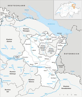
The canton of St. Gallen, also canton of St Gall, is a canton of Switzerland. The capital is St. Gallen.

Thurgau, anglicized as Thurgovia, more formally the Canton of Thurgau, is one of the 26 cantons forming the Swiss Confederation. It is composed of five districts and its capital is Frauenfeld.
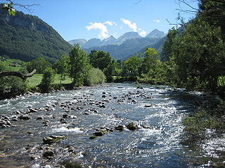
Thur is a 131-kilometre-long (81 mi) river in north-eastern Switzerland. Its source is near the mountain Säntis in the south-east of the canton of St. Gallen. In this canton it flows through the Toggenburg region and the town Wil. After Wil it flows through the canton of Thurgau and its capital Frauenfeld. The final 19 kilometres (12 mi) of the Thur are in the canton of Zürich. It flows into the river Rhine on the border with Germany, south of Schaffhausen.

Ballenberg is an open-air museum in Switzerland that displays traditional buildings and architecture from all over the country. Located near Brienz in the municipality of Hofstetten bei Brienz, Canton of Bern, Ballenberg has over 100 original buildings that have been transported from their original sites. It is a Swiss heritage site of national significance.

THURBO is a railway company in eastern Switzerland, jointly owned by Swiss Federal Railways (90%) and the canton of Thurgau.
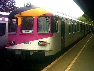
The Wil–Kreuzlingen railway is a largely single-track standard-gauge line in northeastern Switzerland. It was built by the Mittelthurgaubahn; MThB), which was a Swiss private railway based in Weinfelden. It was liquidated in 2003, including its subsidiary Lokoop, and its activities and the infrastructure it owned were mainly taken over by a Swiss Federal Railways (SBB) subsidiary, Thurbo, which was originally formed as a joint venture between the MThB and the SBB.

Eastern Switzerland is the common name of the region situated to the east of Glarus Alps, with the cantons of Schaffhausen, Thurgau, St. Gallen, Appenzell Ausserrhoden, Appenzell Innerrhoden, and Glarus. The north of canton of Graubünden is usually considered to be part of Eastern Switzerland as well.

The Ringelspitz is a mountain of the Glarus Alps, located on the border between the Swiss cantons of St. Gallen and Graubünden. Reaching a height of 3,248 metres above sea level, it is the highest summit in the canton of St. Gallen. It is split between three municipalities: Pfäfers, Trin and Tamins (Graubünden).

The Altmann is a mountain in the Appenzell Alps, located on the border between the cantons of Appenzell Innerrhoden and St. Gallen. It is situated in the massif of the Alpstein north of Wildhaus, a few kilometres from the Säntis.

The German-speaking part of Switzerland comprises about 65 percent of Switzerland.

The S35 is a regional railway line of the Zürich S-Bahn on the ZVV, in the cantons of Zürich, Thurgau and St. Gallen.

The S30 is a regional railway line of the Zürich S-Bahn on the ZVV. It connects the cantons of Zürich and Thurgau, Switzerland, with some services extending to the canton of St. Gallen.
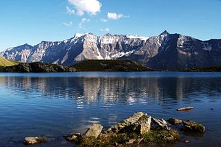
The Tristelhorn is a mountain of the Glarus Alps, located on the border between the Swiss cantons of St. Gallen and Graubünden. Reaching a height of 3,114 metres above sea level, it is one of the highest summits in the canton of St. Gallen.
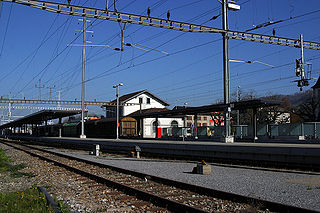
Weinfelden railway station is a railway station in the Swiss canton of Thurgau and the municipality of Weinfelden. The station is located on the Winterthur–Romanshorn railway line, at its junctions with the Mittelthurgau-Bahn lines to Wil and Konstanz.
The University of Applied Sciences of Eastern Switzerland is a governing body of the four Universities of Applied Science in Eastern Switzerland. They are located in St. Gallen, Rapperswil, Chur and Buchs.
St. Katharinental railway station is a railway station in Diessenhofen, in the Swiss canton of Thurgau. It is an intermediate stop on the Lake line and is served by local trains only. It takes its name from the former Dominican monastery of St. Katharinental, located 650 metres (2,130 ft) north of the station.
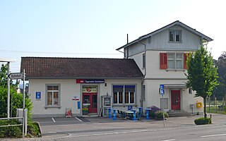
Tägerwilen-Gottlieben railway station is a railway station in Tägerwilen, in the Swiss canton of Thurgau. It is an intermediate stop on the Lake line and is served by local trains only. It is one of two stations within the municipality of Tägerwilen; the other, Tägerwilen Dorf, is located 950 metres (3,120 ft) away on the Wil–Kreuzlingen line.
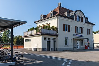
Neukirch-Egnach railway station is a railway station in Egnach, in the Swiss canton of Thurgau. It is an intermediate stop on the Bodensee–Toggenburg line and is served by local trains only. The station is approximately 800 metres (2,600 ft) from the Egnach station on the Lake line.

The S1 is a railway service of the St. Gallen S-Bahn that provides half-hourly service between Schaffhausen and Wil, in the Swiss cantons of Zürich, Thurgau, Schaffhausen, and St. Gallen. THURBO, a joint venture of Swiss Federal Railways and the canton of Thurgau, operates the service.


