John William Salter was an English naturalist, geologist, and palaeontologist.
The Hirnantian is the final internationally recognized stage of the Ordovician Period of the Paleozoic Era. It was of short duration, lasting about 1.4 million years, from 445.2 to 443.8 Ma. The early part of the Hirnantian was characterized by cold temperatures, major glaciation, and a severe drop in sea level. In the latter part of the Hirnantian, temperatures rose, the glaciers melted, and sea level returned to the same or to a slightly higher level than it had been prior to the glaciation.
In geology, Caradoc Series is the name introduced by Roderick Murchison in 1839 for the sandstone series of Caer Caradoc in Shropshire, England. It is the fifth of the six subdivisions of the Ordovician System, comprising all those rocks deposited worldwide during the Caradocian Age.

The geology of Wales is complex and varied; its study has been of considerable historical significance in the development of geology as a science. All geological periods from the Cryogenian to the Jurassic are represented at outcrop, whilst younger sedimentary rocks occur beneath the seas immediately off the Welsh coast. The effects of two mountain-building episodes have left their mark in the faulting and folding of much of the Palaeozoic rock sequence. Superficial deposits and landforms created during the present Quaternary period by water and ice are also plentiful and contribute to a remarkably diverse landscape of mountains, hills and coastal plains.

Flexicalymene Shirley, 1936. is a genus of trilobites belonging to the order Phacopida, suborder Calymenina and Family Calymenidae. Flexicalymene specimens can be mistaken for Calymene, Gravicalymene, Diacalymene and a few other Calymenina genera. They are used as an index fossil in the Ordovician. Ohio and North America are particularly known for being rich with Flexicalymene fossils.

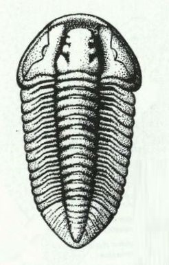
Gravicalymene Shirley, 1936, is a genus of trilobites belonging to the order Phacopida, suborder Calymenina and family Calymenidae. Species included in this genus have previously been allocated to Calymene Brongniart 1822,Flexicalymene Shirley, 1936. and Sthenarocalymene Siveter 1977.

Rhos-y-gwaliau is a small hamlet in Meirionnydd, Gwynedd, North Wales, about 1.5 miles (2.4 km) south-east of Bala. It is home to the Rhos y Gwaliau Outdoor Activity Centre and a now disused Victorian chapel, built for the Calvinistic Methodists.

The Blue Lias is a geological formation in southern, eastern and western England and parts of South Wales, part of the Lias Group. The Blue Lias consists of a sequence of limestone and shale layers, laid down in latest Triassic and early Jurassic times, between 195 and 200 million years ago. The Blue Lias is famous for its fossils, especially ammonites.

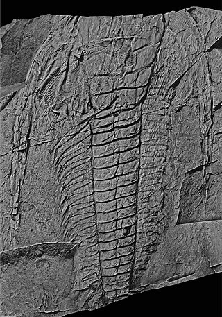
Plumulites is an extinct genus of machaeridians, extinct annelid group.

Trinodus is a very small to small blind trilobite, a well known group of extinct marine arthropods, which lived during the Ordovician, in what are now the Yukon Territories, Virginia, Italy, Czech Republic, Poland, Denmark, Sweden, Svalbard, Ireland, Scotland, Wales, Iran, Kazakhstan and China. It is one of the last of the Agnostida order to survive.
The Lexington Limestone is a prominent geologic formation that constitutes a large part of the late Ordovician bedrock of the inner Bluegrass region in Kentucky. Named after the city of Lexington, the geologic formation has heavily influenced both the surface topography and economy of the region.
The Beaverfoot Formation is a stratigraphic unit of Late Ordovician to Early Silurian (Llandovery) age. It is present on the western edge of the Western Canada Sedimentary Basin in the Rocky Mountains of British Columbia and Alberta, and the Purcell Mountains of British Columbia. It consists of carbonate rocks, and was named for the Beaverfoot Range at Pedley Pass southeast of Golden, British Columbia by L.D. Burling in 1922.
The Skoki Formation is a stratigraphic unit of Early to Middle Ordovician age that is present on the western edge of the Western Canada Sedimentary Basin in the Canadian Rockies of Alberta and British Columbia. It was named for Skoki Mountain near Lake Louise in Banff National Park by Charles Doolittle Walcott in 1928. The Skoki Formation is fossiliferous and includes remains of brachiopods and other marine invertebrates, as well as conodonts and oncolites.
The Survey Peak Formation is a stratigraphic unit of latest Cambrian to earliest Ordovician age. It is present on the western edge of the Western Canada Sedimentary Basin in the Canadian Rockies of Alberta and British Columbia. It was named for Survey Peak near Mount Erasmus in Banff National Park by J.D. Aitken and B.S. Norford in 1967. The Survey Peak Formation is fossiliferous and includes remains of trilobites and other marine invertebrates, as well as conodonts, stromatolites, and thrombolites.
The Mount Whyte Formation is a stratigraphic unit that is present on the western edge of the Western Canada Sedimentary Basin in the southern Canadian Rockies and the adjacent southwestern Alberta plains. It was deposited during Middle Cambrian time and consists of shale interbedded with other siliciclastic rock types and limestones. It was named for Mount Whyte in Banff National Park by Charles Doolittle Walcott, the discoverer of the Burgess shale fossils, and it includes several genera of fossil trilobites.

The Dent Group is a group of Upper Ordovician sedimentary and volcanic rocks in north-west England. It is the lowermost part of the Windermere Supergroup, which was deposited in the foreland basin formed during the collision between Laurentia and Avalonia. It lies unconformably on the Borrowdale Volcanic Group. This unit was previously known as the Coniston Limestone Group or Coniston Limestone Formation and should not be confused with the significantly younger Coniston Group.

The Nod Glas Formation is an Ordovician lithostratigraphic group in Mid Wales. The rock of the formation is made up of pyritous, graptolitic mudstone that is generally black in colour. It weathers to a soft, very well cleaved and coal-like material. The formation runs from Conwy in the north, down to Cardigan Bay in the area around Aberdyfi and Tywyn, though it is not a continuous over this area.
The geology of the Yorkshire Dales National Park in northern England largely consists of a sequence of sedimentary rocks of Ordovician to Permian age. The core area of the Yorkshire Dales is formed from a layer-cake of limestones, sandstones and mudstones laid down during the Carboniferous period. It is noted for its karst landscape which includes extensive areas of limestone pavement and large numbers of caves including Britain's longest cave network.
The geology of Pembrokeshire in Wales inevitably includes the geology of the Pembrokeshire Coast National Park which extends around the larger part of the county's coastline and where the majority of rock outcrops are to be seen. Pembrokeshire's bedrock geology is largely formed from a sequence of sedimentary and igneous rocks originating during the late Precambrian and the Palaeozoic era, namely the Ediacaran, Cambrian, Ordovician, Silurian, Devonian and Carboniferous periods, i.e. between 635 and 299 Ma. The older rocks in the north of the county display patterns of faulting and folding associated with the Caledonian Orogeny. On the other hand, the late Palaeozoic rocks to the south owe their fold patterns and deformation to the later Variscan Orogeny.
Dudleyaspis is an extinct genus of Lower to Middle Devonian odontopleurid trilobites that lived in a shallow sea that lay between Euramerica and Gondwana. It was named in 1949 by Prantl & Pribyl.


