
Kandahar is a hamlet in Rural Municipality of Big Quill No. 308, Saskatchewan, Canada. Listed as a designated place by Statistics Canada, the hamlet had a population of 20 in the Canada 2016 Census. Located on Highway 16 near Wynyard, Saskatchewan, the community was named by Canadian Pacific Railway executives in the late 19th century for a British military victory in Kandahar, Afghanistan. The hamlet is too small to be enumerated on its own, so its population belongs to the Rural Municipality of Big Quill No. 308. It is located near the south shore of Big Quill Lake, the largest inland body of salt water in Canada.
Melfort is a city in Saskatchewan, Canada, located approximately 95 kilometres (59 mi) southeast of Prince Albert, 172 kilometres (107 mi) northeast of Saskatoon and 280 kilometres (170 mi) north of Regina.
Moisés Ville is a small town (comuna) in the province of Santa Fe, Argentina, founded on 23 October 1889 by Eastern European and Russian Jews escaping pogroms and persecution. The original name intended for the town was Kiryat Moshe honoring Baron Maurice Moshe Hirsch, but the land agent who registered the settlement translated it to the French-like Moïsesville which was later hispanized to the current Moisés Ville. The town is located about 177 km (110 mi) from the provincial capital, in the San Cristóbal Department and 616 km (383 mi) from Buenos Aires. It had 2,425 inhabitants at the 2010 census [INDEC].
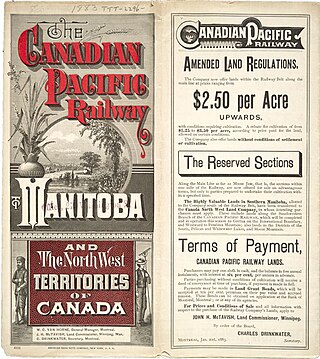
A block settlement is a particular type of land distribution which allows settlers with the same ethnicity to form small colonies. This settlement type was used throughout western Canada between the late 19th and early 20th centuries. Some were planned and others were spontaneously created by the settlers themselves. As a legacy of the block settlements, the three Prairie Provinces have several regions where ancestries other than British are the largest, unlike the norm in surrounding regions.

The Northern Woods and Water Route is a 2,400-kilometre (1,500 mi) route through northern British Columbia, Alberta, Saskatchewan and Manitoba in Western Canada. As early as the 1950s, community groups came together to establish a northern travel route; this was proposed as the Northern Yellowhead Transportation Route. The Northern Woods and Water Route Association was established in 1974, and encouraged promotion of the route with the promise of an increase in tourist travel. The route was designated in 1974 and is well signed throughout its component highways. The route starts at Dawson Creek as the Spirit River Highway and ends at the Perimeter of Winnipeg, Manitoba, after running through the northern regions of the western provinces. From west to east, the Northern Woods and Water Route (NWWR) incorporates portions of British Columbia Highway 49; Alberta Highways 49, 2A, 2, & 55; Saskatchewan Highways 55 & 9; Manitoba Provincial Road 283 and Trunk Highways 10, 5, 68 & 6. The halfway point of the NWWR is approximately at Goodsoil, Saskatchewan.

Langenburg is a town in the Rural Municipality of Langenburg No. 181, located within the Saskatchewan Association of Rural Municipalities SARM Division No. 1 and Census Division No. 5, in the Canadian province of Saskatchewan.

St. Walburg is a town in west-central Saskatchewan's prairie region on Highway 26. St. Walburg is surrounded by the Rural Municipality of Frenchman Butte No. 501. The Bronson Provincial Forest is about 10 kilometres (6.2 mi) to the north.

Bender Hamlet, Manitoba was a Baron Maurice de Hirsch sponsored Jewish farm colony in the Rural Municipality of Armstrong, part of the Interlake region in the province of Manitoba. The centre of the settlement was located at quarter section North West 36Township 19, Range 1 west of the Principal Meridian (NW36-19-1W).

Bellegarde is a French-speaking hamlet in the Rural Municipality of Storthoaks No. 31 in the Canadian province of Saskatchewan. It was established in 1898. Bellegarde is located just south of Highway 13, near the Manitoba border and in south-eastern Saskatchewan. Being a hamlet with fewer than 100 people, the population is counted within the population count of the rural municipality.

Kenaston is a village in the Canadian province of Saskatchewan within the Rural Municipality of McCraney No. 282 and Census Division No. 11. Kenaston is located on Highway 11 at the junction of Highway 15 and is also near Highway 19. This is a scenic area of Saskatchewan situated within the rolling Allan Hills. Kenaston is located between Danielson Provincial Park and Blackstrap Provincial Park.

The Red Coat Trail is a 1,300-kilometre (810 mi) route that approximates the path taken in 1874 by the North-West Mounted Police in their March West from Fort Dufferin to Fort Whoop-Up.

Chamberlain is a township in the Canadian province of Ontario, located within the Timiskaming District.

Maidstone is a town in west central Saskatchewan, Canada about 57 km east of Lloydminster and 84 km west of North Battleford at the junction of Highway 16 and Highway 21. The community was named after Maidstone, Kent, England.

Armstrong is a rural municipality in the province of Manitoba in Western Canada. It lies in the southern area of the Interlake and was named after James William Armstrong, a Manitoba politician.
Chortitz is a hamlet in Coulee Rural Municipality No. 136, Saskatchewan, Canada. Listed as a designated place by Statistics Canada, the hamlet had a population of 26 in the Canada 2006 Census. The hamlet is located on Highway 379, about 25 km south of Swift Current.
The Rural Municipality of Lipton No. 217 is a rural municipality (RM) in the Canadian province of Saskatchewan within Census Division No. 6 and SARM Division No. 1.
This is a list of elections in Canada in 2014. Included are provincial, municipal and federal elections, by-elections on any level, referendums and party leadership races at any level.
Cymric is an unincorporated community in the Rural Municipality of Last Mountain Valley No. 250, Saskatchewan, Canada. It is located along Highway 20 between Duval and Govan, it is also serviced by the Canadian Pacific Railway and located at mile 62.3 on the rail line running between Regina and Lanigan.
Shaarey Zedek Synagogue is the oldest synagogue in Winnipeg, Manitoba, Canada. Formed in 1880, the congregation's first building was constructed by Philip Brown and several others in 1890. Architect Charles Henry Wheeler designed the original Synagogue on King Street (1889–90).

Various agricultural settlements in Argentina housed Eastern European Jews fleeing persecution in hopes of establishing a new life in the wake of the Kiev Pogroms. German Jewish philanthropist Baron Maurice de Hirsch created the settlements to build a future for Eastern European Jewry around the world. After seeing an increase in antisemitism, Hirsch hoped to bring targeted Jews a more substantial solution than charity. As a result, Hirsch created the Jewish Colonisation Association to pursue this goal and used all his fortune to establish colonies in the Argentine Empire. Colonies included Mauricio, Moisesville, Villa Clara, San Antonio. Common struggles included finding funding and arable land, as well as leadership issues. Today, as a result, many of the colonies have lost their Jewish culture.


