During this period Harringay emerged from the mist of prehistory as a thickly forested area of southern England. By 1750 most of the forest had been cleared for agriculture, although settlement was still sparse.
About 60 million years ago the area lay in a sea bed of clay, 180 metres deep in water. Once Britain's land mass emerged from beneath the water, the area was part of the hinterland of the swamps and marshes of the Thames. Plenty of fossil evidence has been discovered that shows mammoths, hippos, hyenas and rhinoceros once roamed thereabouts.[1] In the Ice Age, Harringay was at the edge of a huge glacial mass that reached as far south as Muswell Hill.[2] There is evidence of both Stone Age and Bronze Age activity in the immediate vicinity; Stone Age implements, estimated as 200,000 years old, were unearthed in the Finsbury Park Area and near Stoke Newington.[3] A 4,000-year-old bronze dagger, now in the possession of the British Museum, was found in Hornsey.[2]
Prior to the Romans' arrival, Harringay was part of a large area covering Essex and Middlesex which was home to a Celtic tribe called Trinobantes. Led by Imanuentius at the time of the Roman invasion, they fought with the Iceni tribe under Boudica against the Romans in AD61. The two tribes lost, sustaining casualties in excess of 80,000. Whatever their record in battle, they were a well organised society. On his arrival Julius Caesar found an 'elaborate and well-organised tribal civilisation. Its population was exceedingly large and the ground thickly studded with homesteads'.[1]
The Roman invasion of Britain started in the middle of the 1st century BC and drew Harringay into the wider world. With the Romans' main settlement just 5 miles to the south, there is good evidence that Green Lanes was established a major road to the north in Roman times.[3][4] Of direct archaeological evidence of settlement in the vicinity at the time there is little. The only significant find was a hoard of 3rd and 4th century gold coins found between Hornsey and Muswell Hill in 1928.[2]
The Dark Ages of the 5th & 6th centuries saw the Saxon invasions and, it is likely, the arrival of Haering, the chieftain whose name still lives on today in local placenames. Haering's settlement at Harringay can be visualised as “a clearing which he made, protected by a hedge in a wild and wooded undulating district, part of the forest in the province of Middlesex”.[5] In 604 when the Diocese of London was refounded the area came under the Kingdom of Essex. One hundred years later when the 'province of Middlesex' is first recorded, it came under the Kingdom of Mercia, the dominant kingdom of Britain for many years. For a short period, from 874–886, it was taken during the Viking raids and was subject to Danish rule until it was reconquered by King Alfred.
It was at this time that the western part of modern Harringay became part of the Hundred of Ossulstone and that its parochial and manorial history was established.[2] The area to the east became part of the neighbouring Hundred of Edmonton.
Note: To enable distinction between two separate entities in this section. Hornsey is used when referring to the lands of Harringay Manor (a.k.a. Hornsey Manor). Harringay is used in reference to the area covered by present-day Harringay Town.
Characteristics of the landscape and land use
At the dawn of the post-Conquest period, Harringay was very probably still mostly thickly wooded, part of a huge forest that still covered most of Middlesex. The land to the west of Harringay bordered on the Bishop of London's hunting grounds of Great Hornsey Park and retained their natural state well into the middle of this period. Amongst those who hunted in the park was the keen hunter Henry VIII.
To the east of the Great Park the forests were gradually pushed back through the Middle Ages and the land was being put to agricultural use. In 1390 forest covered half of the total area of Hornsey. By the middle of the seventeenth century, farmland covered two-thirds.[7] By the fifteenth century the landscape of Harringay was dominated by pasture, but there were some fields given over to cereal crops and a little woodland remained. An inspection of Hornsey Manor by the King's reeve in 1283 notes wages for herdsmen and ploughmen and recorded activities including ploughing, sowing winnowing chaff and spreading clay. The value of oats and wheat were noted and animals such as pigs, plough-oxen, horses, cattle listed.[8] Some five hundred years later Rocque's map of 1745 noted the particular agricultural uses to which the land had been set. These may well have been established hundreds of years before. His maps show that most of the lands in the west of modern-day Harringay were given over to pasture; those in the east, with the exception of a strip along Green Lanes, were in arable use.[9] Milne's land use map of Middlesex, drawn up in 1800 shows half this arable land had become pasture over the preceding fifty years.[10]
At the turn of the 17th century then, it is possible with some accuracy to picture Harringay. The slopes of 'Harringay Park' were pastureland cross-hatched with hedgerows, dotted with trees and copses and most likely scattered with livestock. Bordering these lands and running for a good part of the length along the western side of Harringay's Green Lanes was open common land known as 'Beans Green'. North of that was the open common land of 'Ducketts Common', which survives today. Across the muddy roadway in the northern portion of East Harringay lay more pasture. The southern portion was fringed with yet more pasture, but beyond on most of the land of East Harringay that lay cultivated fields, probably sown with oats. Meandering down the hill roughly beneath present-day Effingham and Fairfax Roads ran Stonebridge Brook; reaching Green Lanes, it followed the road south for a way, then continued east running just to the north of St Ann's Road. Further south, where the Sainsbury's development is today, rose a second brook, Hermitage Brook, snaking northeast towards the River Lea. Beyond, on a knoll to the southwest, in the southern part of today's Finsbury Park, stood one of the last remnants of the forests, Hornsey Wood which survived throughout the period.
Settlement
The predominance of pasture rather than arable farming in this area of Middlesex kept it thinly populated, with settlement mainly confined to a few villages and hamlets. Records show little settlement in Harringay during this period. By the end of the eighteenth century the villages of Hornsey, Crouch End and Muswell Hill had been established. To the north and northwest lay the hamlets of Wood Green and West Green; to the South, Stoke Newington. But, only three buildings were recorded in all Harringay up till nearly the end of the eighteenth century. On the site where Harringay House was to be built in 1792 (at the top of the hill between present-day Hewitt and Allison Roads) a fine Tudor mansion reputedly stood[11] The last owner of the land, Ida Cozens, sold it in 1789 to Edward Gray, a linen draper of Cornhill.[12] The only known occupants of the house and the last people to live in it were the Cozens family. The house itself was apparently pulled down in 1750. Further to the east, behind where Warwick Road is today, opposite the end of Kimberley Gardens was 'Hangers Barne'. The first record of the building is on Dorset's 1619 map. However, it may have been constructed many years earlier. Although it is not clear whether it was a house or purely an agricultural building, the fact that it is marked and named on the 1619 map suggests the former. It was most likely associated with the great oat fields all around it. Tottenham manor records also describe a hermitage in the vicinity. Although the precise location is uncertain, the records locate it between (present-day) St. Ann's Road and the manor boundary (where Hermitage Road is today). Evidence suggests that it stood just to the South of the site of today's Sainsbury's; the name of Hermitage Road echoing its past purpose.[13]
On the southern edge of Brown's Wood[14] (subsequently Hornsey Wood), within the present-day boundaries of Finsbury Park, there was a house called Copt Hall which had been the manor house for the Manor of Brownswood. It contained a hall, parlour, kitchen, cellar, and two chambers, besides outbuildings.[15] First mentioned in records in 1649, the building was unoccupied by 1664.[16] 18th century records suggest that it subsequently became a small roadside public house.[17]
Other development
Whilst there was little building associated with settlement, one major engineering project in the early 17th century did impact on the area. Between 1609 and 1613, Sir Hugh Myddleton constructed the New River. This ambitious project was designed to bring fresh water from Hertfordshire into London. Many landowners along its 38-mile length objected to its construction fearing, amongst other things, a drop in land value. In its early form, some of the stretch which snaked through Harringay was constructed in wooden aqueducts lined with lead and supported by strong timbers and brick piers. Improvements in canal making in the 18th century led to these sections being replaced with clay-banked canals.[18]
Land ownership
The ownership of the land in Harringay through this period followed typical, but different patterns in the eastern and western portions. At the beginning of the period the land on both sides of Green Lanes was owned by a Lord of the Manor under the system of Manorialism. Whilst land ownership remained in relatively few hands across the period, its tenure changed many times through royal seizure and various forms of Land tenure including subinfeudation, freehold and copyhold.
Since the Church was the largest landholder in the country, it is not surprising that it figured large in the ownership of Harringay's lands. Most of the western part of Harringay was part of the Bishop of London's Manor of Hornsey. Through subinfeudation, 'Fernfields' or 'Fernefelde' Manor was created from part of the southwestern part of that manor. Though its precise boundaries are unknown, records show that it included much of northern part of western Harringay. Soon after the conquest Fernefelde was granted to the Knights Templar to support their crusades in the Holy Lands. Thereafter it passed through other holy orders until by the mid-sixteenth century it was granted to one Thomas Fisher. By the end of the 18th century some of the manor formed part of Edward Gray's Harringay Park Estate.[2][7]
The Harringay lands directly to the south of Fernfields, roughly from the line of Duckett Road today and south beyond present-day Seven Sisters Road were part of the Manor of Brownswood.[19] This was another subinfeudated manor of Hornsey. Initially owned by a prebend in St Paul's Cathedral, by 1569 the manor had been passed to John Harrington. Thereafter it changed hands a number of times – much of it eventually to become in modern times Finsbury Park or part of western Harringay.
To the east of Green Lanes, the lands were originally part of Tottenham Manor. Seized from Waltheof II by William the Conqueror, the Manor was held for about for 150 years to the end of the 13th century by the Kings of Scotland. Death and feuding within that great family led to subdivision of the manor into three smaller manors in 1254. Harringay lands were within a manor called Pembrokes. The lands of this manor stretched from the southern boundary of Tottenham Manor, near Hermitage Road today, north to West Green and east to Tottenham High Road. The three parts of Tottenham were reunited by John Gedney in the early 15th century but were still often referred to by the names they took on during the period of manorial division.[6] As with western Harringay, the Church was a holder of large areas of land in Tottenham. This included a very large plot of land which ran from St Ann's Road in the north to Hermitage Road in the south and was roughly bounded by Green Lanes and Hermitage Road from east to west. This land was granted to the Hospitaliers of St John's of Jerusalem shortly after the Norman Conquest. The income from the land would have initially supported their hospital in the Holy Land, tending for the casualties of the crusades and pilgrims to the Holy Land. With Henry VIII'sdissolution of the monasteries in the mid-sixteenth century, the land passed to the Crown.[13] In the Dorset map of 1619, the land consisted of eleven fields. These fields are probably the area referred to in contemporary documents as the 'Great Hanger'[20] Sold by the Crown as farm land, it is known that at least some of this land became part of St John's Farm.[21] Of the southern part of this land, it is known that some was retained in public ownership until it was developed in relatively recent times - rating records show some of the southern area as common land owned by the Parish and Manor of Tottenham up to the late nineteenth century.
The land along Green Lanes to the north of St. Ann's Road, was agricultural and, in 1619, was in the ownership of a certain J. Bolton. The triangle of land between the current St. Ann's and Salisbury Roads was known as 'Hales Field'. (Salisbury Road was not laid out till the late 19th century, however).
Communications
Green Lanes had been established long before Domesday. In 1710 an Act of Parliament authorised the introduction of a turnpike on the road at Hornsey, although tolls were not levied until 1739. The Stamford Hill and Green Lanes Turnpike Trust finally erected a toll gate on Green Lanes by Duckett's Common, near Turnpike Lane in 1765. For the next 27 years this was the only tollgate on Green Lanes, at which time the Manor House toll gate was set up, along with others outside of the Harringay area. The other main road through Harringay was along the route of present-day St Ann's Road. Known for most of this period as Chisley Lane, it joined Green Lanes, Harringay to another of the great northbound roads out of London – Ermine Street or Tottenham High Road. Chisley Lane was a favoured haunt of the famous highwayman Dick Turpin. One further route developed prior to 1750 and is marked on Rocque's map of 1754. This shows a trackway leading from Hornsey to Hornseywood House. Some of this track follows the course of today's Wightman Road.
Historical highlights
Whilst no major historical events can be traced with any certainty to Harringay lands, several events were recorded in Harringay Park. This could be a reference to Harringay lands or, perhaps more likely, to the Great Hornsey Park around Highgate.
1388 – During the reign of King Henry V the Lollards gathered in Harringay Park to rebel against the King. However, they were slaughtered by Henry's forces before they launched their attack.[23]
1483 – When short-lived Edward V was brought to London, after his father's death, the Lord Mayor of London and 500 citizens met him in Harringay Park, and accompanied him into London.[22]
1485 – Henry VII was met in Harringay Park on his return from victory and conducted into London in celebration.[22]
Summary
Through this period, Harringay had been transformed from a mainly forested area to a pastoral one. It remained sparsely inhabited. Beyond the clearance of the forests, few infringements were made into Harringay lands save for the New River, the building of which presaged the more drastic developments to come.
See also
Parish of Hornsey for the local government unit of which Harringay was part from the 17th century to 1867.
1 2 3 4 5 6 Madge, Stephen J. (1938). The Early Records of Harringay alias Hornsey. Public Libraries Committee Hornsey.
1 2 T. F. T. Baker & C. R. Elrington (Editors) (1985). A History of the County of Middlesex, Volume 8: Islington and Stoke Newington Parishes. Victoria County History.{{cite book}}: |last= has generic name (help)
↑ Margary & Parrott, I.D. & E.V. (1964). Roman roads in the South-East Midlands. Gollancz. ASINB0000CM4C0.
↑ Madge, Stephen J. (1936). The Origin of the Name of Hornsey. Public Libraries Committee Hornsey.
1 2 T. F. T. Baker & R. B. Pugh (Editors) (1976). A History of the County of Middlesex, Volume 5: Hendon, Kingsbury, Great Stanmore, Little Stanmore, Edmonton Enfield, Monken Hadley, South Mimms, Tottenham. Victoria County History.{{cite book}}: |last= has generic name (help)
1 2 T. F. T. Baker & C. R. Elrington (Editors) (1980). A History of the County of Middlesex, Volume 6: Friern Barnet, Finchley, Hornsey with Highgate. Victoria County History.{{cite book}}: |last= has generic name (help)
↑ Madge, Stephen J. (1939). The Mediaeval Records of Harringay alias Hornsey. Public Libraries Committee Hornsey.
↑ Rocque, John (1746). Exact Survey of the Cities of London, Westminster, and the Borough of Southwark, and the Country Near Ten Miles Around Begun in 1741 and ended in 1745.
↑ Milne, Thomas (1800). Land Use Map of London and Environs in 1800.
↑ Sherrington, R.O. (1904). Story of Hornsey. F.E. Robinson & Co. Whilst Sherrington cites William Keane (see reference note 14 in History of Harringay (1750–1880)) as his reference for evidence of a Tudor House, Keane himself mentions only the fancy of a Norman castle on the site. Sadly scant evidence exists for either.
↑ Middlesex Deeds Registers, Book 6. No. 91. Accessed at London Metropolitan Archives. 1789.
1 2 Roe, William James (1952). Tottenham, Edmonton and Enfield Historical Notebook. Percy Press.
↑ "1741 – 1745, Map of Ten Miles Around London, John Rocque, 1746
↑ T. F. T. Baker & R.B. Pugh (Editors) (1976). A History of the County of Middlesex, Volume 6: Friern Barnet, Finchley, Hornsey with Highgate. Victoria County History.{{cite book}}: |last= has generic name (help)
↑ Hayes, Hugh (Comp.) (2001). A Park for Finsbury. Friends of Finsbury Park. ISBN0-9540637-0-8.
↑ "Ambulator". 1774.{{cite journal}}: Cite journal requires |journal= (help) quoted in Walford, Edward (1878). Old and New London: Volume 5. Victoria County History.
↑ Robinson, William (1840). History and Antiquities of the Parish of Tottenham, 2 Vols, 2 Ed. Nicholls & Son.
↑ Hornsey Enclosure Map. 1815. London Metropolitan Archives
↑ The western part of St Ann's Road, used to be known as 'Hanger Lane' – the road leading to the hanger. A 'Hanger' was a wooded hillside. The only likely place for a hanger was the slopes of Western Harringay, wooded until later medieval times. The most likely candidates for fields known as 'Great Hanger' therefore are those closest to the hanger itself – the fields where the 'Gardens' stand today.
↑ Couchman, Harriet (Mrs. J.W. Couchman) (1909). Reminiscences of Tottenham.
1 2 3 Lysons, Daniel (1795). The Environs of London: volume 3. T Cadell and W Davies.
↑ Hilton, Geoff (2005). John Strecche Canon of Kenilworth: the Life and Times of a Medieval Historian.
Related Research Articles
Hornsey is a district of north London, England, in the London Borough of Haringey. It is an inner-suburban, for the most part residential, area centred 10 km (6.2 mi) north of Charing Cross. It adjoins green spaces Queen's Wood to the west and Alexandra Park to the north, and lies in the valley of the now-culverted River Moselle. The central core of the area is known as Hornsey Village.
Muswell Hill is a suburban district of the London Borough of Haringey, north London. The hill, which reaches over 100 m (330 ft) above sea level, is situated 5+1⁄2 miles north of Charing Cross.
Wood Green is a suburban district in the borough of Haringey in London, England. Its postal district is N22, with parts in N8 or N15. The London Plan identifies it as one of the metropolitan centres in Greater London, and today it forms a major commercial district of north London.
The London Borough of Haringey is a London borough in north London, classified by some definitions as part of Inner London, and by others as part of Outer London. It was created in 1965 by the amalgamation of three former boroughs. It shares borders with six other London boroughs. Clockwise from the north, they are: Enfield, Waltham Forest, Hackney, Islington, Camden, and Barnet.
Seven Sisters is a district of Tottenham, north London, England, at the eastern end of Seven Sisters Road, which runs from Tottenham High Road to join the A1 in Holloway.
Crouch End is an area of North London, approximately five miles (8 km) from the City of London in the western half of the borough of Haringey. It is within the Hornsey postal district (N8). It has been described by the BBC as one of "a new breed of urban villages" in London. In 2023, it was voted the best place to live in London by the Sunday Times, saying "A creative edge and friendly neighbours give this lofty northern enclave social capital in the capital".
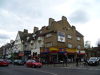
Harringay is a district of north London, England, within the London Borough of Haringey. It is centred on the section of Green Lanes running between the New River, where it crosses Green Lanes by Finsbury Park, and Duckett's Common, near Turnpike Lane.
Harringay Green Lanes railway station is on the Gospel Oak to Barking line in Harringay, north London. It is 4 miles 61 chains (7.7 km) from St Pancras and is situated between Crouch Hill and South Tottenham.
Manor House is a district in the London Borough of Hackney. Located in North London, it lies immediately east of Finsbury Park, west of Stamford Hill and south of Harringay.
Tottenham is a constituency in Greater London represented in the House of Commons of the Parliament of the United Kingdom since 2000 by the current Foreign Secretary, David Lammy of the Labour Party. Lammy has also served as the Shadow Foreign Secretary from 2021 to 2024 in the Shadow Cabinet of Keir Starmer, in which he previously served as Shadow Secretary of State for Justice and Shadow Lord Chancellor from 2020 to 2021. Tottenham was re-created as a parliamentary constituency in 1950, having previously existed from 1885 to 1918.
Green Lanes is a main road in North London which forms part of the A105 road. Covering a distance of 6.3 miles (10.1 km) between Newington Green and Winchmore Hill, it is one of the longest streets in the capital, passing through the N16, N4, N8, N13 and N21 postcode areas.
Hornsey was an ancient parish in the county of Middlesex. It was both a civil parish, used for administrative purposes, and an ecclesiastical parish of the Church of England.
Lordship Lane connects Wood Green (N22) with Tottenham High Road (N17). It lies in the London Borough of Haringey and forms part of the A109 road.
The history of Harringay tells the story of the development of the district of London five miles from its centre, affected by, but not always part of, the great city's history.
West Green is a district in north London, England, in the United Kingdom; within the London Borough of Haringey. It is located 5.7 miles (9.22 km) north of Charing Cross.
This significant period in Harringay's history witnessed the transition from a purely pastoral society and set the stage for the upheavals of the late 19th century.
The advance of late Victorian urbanisation during the last twenty years of the 19th century swept away the 18th and early 19th-century houses, their grounds and the farmland. By 1900 Harringay was completely urbanised.
Tottenham is a town in north London, England, within the London Borough of Haringey. It is located in the ceremonial county of Greater London. Tottenham is centred 6 mi (10 km) north-northeast of Charing Cross, bordering Edmonton to the north, Walthamstow, across the River Lea, to the east, and Stamford Hill to the south, with Wood Green and Harringay to the west.
Stroud Green in London, England, is a suburb adjacent to Finsbury Park in the northern part of Greater London. While most of the area is in the London Borough of Haringey, a very small part is in the London Borough of Islington. The Stroud Green Road not only forms the boundary between the two boroughs but is also the area's principal thoroughfare and a busy local shopping street, with many popular restaurants and bars.
Duckett's Green is an area of north London, England in the United Kingdom and part of the London Borough of Haringey. It is an inner-suburban area located 5.8 miles (9.4 km) north of Charing Cross.
This page is based on this Wikipedia article Text is available under the CC BY-SA 4.0 license; additional terms may apply. Images, videos and audio are available under their respective licenses.