Offenbach is a Kreis (district) in the south of Hesse, Germany and is part of the Frankfurt/Rhine-Main Metropolitan Region. Neighbouring districts are Main-Kinzig, Aschaffenburg, Darmstadt-Dieburg, Groß-Gerau and the cities of Darmstadt, Frankfurt and Offenbach.
Bergstraße is a Kreis (district) in the south of Hesse, Germany. It is at the northern end of the Bergstraße route. Neighboring districts are Groß-Gerau, Darmstadt-Dieburg, Odenwaldkreis, Rhein-Neckar-Kreis, the urban district Mannheim, the Rhein-Pfalz-Kreis, and the urban district of Worms. Kreis Bergstraße belongs both to the Rhine Neckar Area and the Rhein-Main Region.
Groß-Gerau is a Kreis (district) in the south of Hesse, Germany. Neighboring districts are Main-Taunus, district-free Frankfurt, Darmstadt-Dieburg, Bergstraße, Alzey-Worms, Mainz-Bingen, and the district-free cities Mainz and Wiesbaden.
The Fulda District is a Kreis (district) in the north-east of Hesse, Germany. Neighboring districts are Hersfeld-Rotenburg, Wartburgkreis, Schmalkalden-Meiningen, Rhön-Grabfeld, Bad Kissingen, Main-Kinzig, Vogelsbergkreis.
Main-Taunus is a Kreis (district) in the middle of Hessen, Germany and is part of the Frankfurt/Rhine-Main Metropolitan Region as well as the Frankfurt urban area. Neighboring districts are Hochtaunuskreis, district-free Frankfurt, Groß-Gerau, district-free Wiesbaden, Rheingau-Taunus. It is the second most densely populated rural district in Germany.
The Wetteraukreis is a Kreis (district) in the middle of Hesse, Germany. Neighbouring districts are Landkreis Gießen, Vogelsbergkreis, Main-Kinzig-Kreis, district-free Stadt Frankfurt, Hochtaunuskreis and Lahn-Dill-Kreis.
Rheingau-Taunus is a Kreis (district) in the west of Hesse, Germany. Rheingau-Taunus-Kreis is part of the Darmstadt region; its main administrative seat is Bad Schwalbach. Outposted sections of the local administration are located in Idstein and Rüdesheim am Rhein.
Lahn-Dill is a Kreis (district) in the west of Hesse, Germany. Neighboring districts are Siegen-Wittgenstein, Marburg-Biedenkopf, Gießen, Wetteraukreis, Hochtaunuskreis, Limburg-Weilburg, Westerwaldkreis.
Limburg-Weilburg is a Kreis (district) in the west of Hesse, Germany. Neighboring districts are Lahn-Dill, Hochtaunuskreis, Rheingau-Taunus, Rhein-Lahn, Westerwaldkreis.
Mainz-Bingen is a district (Kreis) in the east of Rhineland-Palatinate, Germany. Neighboring districts are Rheingau-Taunus, the district-free cities Wiesbaden and Mainz, the districts Groß-Gerau, Alzey-Worms, Bad Kreuznach, and Rhein-Hunsrück.
Neckar-Odenwald-Kreis is a Landkreis (district) in the north of Baden-Württemberg, Germany. Neighboring districts are Main-Tauber-Kreis, Hohenlohe-Kreis, Heilbronn, Rhein-Neckar-Kreis, Odenwaldkreis (Hesse) and Landkreis Miltenberg (Bavaria). The district is part of the Rhine-Neckar Metropolitan Region.

Bischofsheim is a municipality in Groß-Gerau district in Hesse, Germany with a population of more than 13,000.

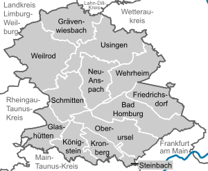
Usingen is a small town in the Hochtaunuskreis in Hessen, Germany. Until 1972, this residential and school town was the seat of the former district of Usingen.
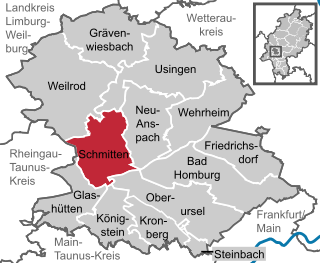
Schmitten im Taunus is a municipality in the Hochtaunuskreis in Hessen, Germany.

Grävenwiesbach is a municipality in the Hochtaunuskreis in Hesse, Germany.

Bad Camberg is, with 14,500 inhabitants, the second largest town in Limburg-Weilburg district in Hesse, Germany, as well as the southernmost town in the Regierungsbezirk of Gießen. It is located in the eastern Taunus in the Goldener Grund some 30 km north of Wiesbaden, 18 km southeast of Limburg an der Lahn, and 44 km northwest of Frankfurt, as well as on the German Timber-Frame Road. Bad Camberg is the central community of the Goldener Grund with good infrastructure, and a lower centre partly with a middle centre's function.
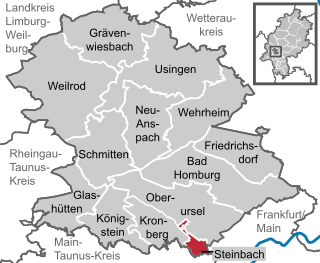
Steinbach is a town in the Hochtaunuskreis that borders Frankfurt am Main to the east. Other neighbouring towns are Oberursel, Kronberg im Taunus and Eschborn. It is in the German state of Hesse.
The Taunus Railway in the High Taunus is a railway route between Frankfurt (Main) Hauptbahnhof and Brandoberndorf via Bad Homburg, Usingen and Grävenwiesbach. It was operated from 1993 to 1995 by the Frankfurter Verkehrsverbund as the T-Bahn and subsequently by the Rhein-Main-Verkehrsverbund as line 15. It is listed in table 637 of the Deutsche Bahn timetable. The Friedrichsdorf–Brandoberndorf line, which has the infrastructure number of 9374, forms part of the old Friedrichsdorf–Wetzlar line, which was known as the Taunusbahn. The line is owned by the Verkehrsverband Hochtaunus. The infrastructure is managed by HLB Basis AG on behalf of the VHT.

Usingen station is the station of Usingen in the German state of Hesse) and the operations centre of the Taunus Railway from Brandoberndorf via Grävenwiesbach and Usingen to Bad Homburg. The entrance building is heritage-listed.

Grävenwiesbach station is the station of Grävenwiesbach on the edge of the Hochtaunuskreis in the German state of Hesse. It is located on the southern outskirts of the town centre. Previously, the station was a junction station that served trains running on the Weil Valley Railway to Weilburg via Weilmünster, on the Taunus Railway to Bad Homburg and on the Solms Valley Railway to Wetzlar.