
The Godavari is India's second longest river after the Ganga river and drains the third largest basin in India, covering about 10% of India's total geographical area. Its source is in Trimbakeshwar, Nashik, Maharashtra. It flows east for 1,465 kilometres (910 mi), draining the states of Maharashtra (48.6%), Telangana (18.8%), Andhra Pradesh (4.5%), Chhattisgarh (10.9%) and Odisha (5.7%). The river ultimately empties into the Bay of Bengal through an extensive network of distributaries. Measuring up to 312,812 km2 (120,777 sq mi), it forms one of the largest river basins in the Indian subcontinent, with only the Ganga and Indus rivers having a larger drainage basin. In terms of length, catchment area and discharge, the Godavari is the largest in peninsular India, and had been dubbed as the Dakshina Ganga.

Uttara Kannada is a district in the Indian state of Karnataka. It is a major coastal district of Karnataka, and is the third largest district in Karnataka. It is bordered by the state of Goa and Belagavi districts to the north, Dharwad District and Haveri District to the east, Shivamogga District, and Udupi District to the south, and the Laccadive Sea to the west.

The Konkan is a stretch of land by the western coast of India, bound by the river Daman Ganga at Damaon in the north, to Anjediva Island next to Karwar town in the south; with the Arabian Sea to the west and the Deccan plateau to the east. The hinterland east of the coast has numerous river valleys, riverine islands and the hilly slopes known as the Western Ghats; that lead up into the tablelands of the Deccan. The region has been recognised by name, since at least the time of Strabo in the third century CE. It had a thriving mercantile port with Arab tradesmen from the 10th century. The best-known islands of Konkan are Ilhas de Goa, the site of the Goa state's capital at Panjim, and the Seven Islands of Bombay, on which lies Mumbai, the capital of Maharashtra and the headquarters of the Konkan Division.

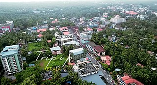
The Kerala backwaters are a network of brackish lagoons and canals lying parallel to the Arabian Sea of the Malabar coast of Kerala state in south-western India. It also includes interconnected lakes, rivers, and inlets, a labyrinthine system formed by more than 900 km (560 mi) of waterways, and sometimes compared to bayous. The network includes five large lakes linked by canals, both man made and natural, fed by 38 rivers, and extending virtually half the length of Kerala state. The backwaters were formed by the action of waves and shore currents creating low barrier islands across the mouths of the many rivers flowing down from the Western Ghats range. In the midst of this landscape there are a number of towns and cities, which serve as the starting and end points of backwater cruises. There are 34 backwaters in Kerala. Out of it, 27 are located either closer to Arabian Sea or parallel to the sea. The remaining 7 are inland navigation routes.
Vatakara,, , French: Bargaret, is a Municipality, Taluk and a major town in the Kozhikode district of Kerala state, India. The municipality of Vatakara covers an area of 23.33 km2 (9.01 sq mi) and is bordered by Mahé to the north and Payyoli to the south. It is the headquarters of Vatakara taluk, which consists of 22 panchayats. During the reign of the Kolathiris and Zamorins, Vatakara was known as Kadathanadu. During the British Raj, it was part of the North Malabar region of Malabar District in the state of Madras. The historic Lokanarkavu temple, made famous by the Vadakkan Pattukal, is situated in Vatakara. A new tardigrade species collected from Vadakara coast has been named after Kerala State; Stygarctus keralensis.

Kumta is a town and taluk in the Uttara Kannada district of Karnataka, India. It is one of the important stations along the Konkan Railway line running between Mumbai and Mangalore.
Gokarna is a small temple town located in the Uttara Kannada district of Karnataka state in southern India, It has a population of around 20,000. Shiva is the most worshipped deity in the town. Gokarna's main temple, Mahabaleshwara, is dedicated to Shiva. The temple houses what is believed by some to be the earliest Shiva lingam (Atmalinga).

The Indian State of Karnataka is located between 11°30' North and 18°30' North latitudes and between 74° East and 78°30' East longitude.It is situated on a tableland where the Western Ghats and Eastern Ghats converge into the complex, in the western part of the Deccan Peninsular region of India. The State is bounded by Maharashtra and Goa States in the north and northwest; by the Lakshadweep Sea in the west; by Kerala in the south-west and Tamil Nadu in the south and south-east, Andhra Pradesh in the south-east and east and Telangana in the north-east. Karnataka extends to about 850 km (530 mi) from north to south and about 450 km (280 mi) from east to west.
Chandgad is a Small city and tehsil headquarters of chandgad taluka, of Kolhapur district that is in the Indian state of Maharashtra.
Karnataka's coastline called Karavali stretches 300 km between Mangalore in Dakshina Kannada district and Karwar in Uttara Kannada district. The coastline of Karnataka has been along the eastern shore of Arabian Sea. Karnataka has one major and ten minor ports in this coastal belt. Kali, Belekeri, Gangavali, Aghanashini Sharavathi, Sharabi, Kollur, Gangolli, Sitanadi, Gurpur and Netravati are the important rivers in this belt which empty into the Arabian sea. Sea erosion, migration of river mouths, siltation of ports and harbours are some of the problems common to this belt.

Purathur is a sandy coastal village and a Grama Panchayat in Tirur Taluk, Malappuram district in the state of Kerala, India. Bharathappuzha river and Tirur River merges together in Purathur and join with the Arabian Sea at Padinjarekara Azhimukham, which is also the southernmost tip of Purathur Gram panchayat. Opposite to Padinjarekara Azhimukham is Ponnani port. The village is located at the southernmost tip of Tirur Taluk and is bordered by historically important Ponnani port in Ponnani Municipality of Ponnani taluk to south.

Tadadi (Tadari) is one of the ports in Uttara Kannada, Karnataka, India. It is near Gokarna in Kumta taluk.
Biguina is a community or village in the commune of Bassila in the Donga Department of northwestern Benin. It is located near the border with Togo and it sits on Benin's Route Nationale 3, one of the two main north-south highways in the country.

Sanoor is a village in the southern state of Karnataka, India. During the British Raj, the village was headed by the Patels (Patler). Since independence, it has been administered by a mandala Panchayati raj. The nearest court is in Karkala, 5 kilometres (3.1 mi) from the village center. Sanoor has several primary schools and a government pre-university college. The Tulu language is widely spoken; other languages spoken in the village are Konkani and Kannada. The Bunt and Billava were early ethnic communities, with the Marathi, Konkani and Brahmins arriving later. With Portuguese settlement, villagers converted to Catholicism. Local Muslims belong to the Moplah community, are known as Beary and speak the Beary dialect of Tulu. The Beary, living in the region for over a thousand years, may be descended from Arab traders.

Aghanashini is a small village situated on the southern banks of River Aghanashini in the state of Karnataka, India., The river Aghanashini originates at 'Shankara Honda' in the Sirsi city. It is one of the virgin rivers of the world. The water from this river flows unobstructed through the western ghats range and then joins the Arabian Sea.
Kombavilai is a village located in Agasteeswaram Taluk, Kanyakumari District, Tamil Nadu, India. The village is surrounded by paddy fields, coconut groves, element enriched and beautiful sea shore. Further, this village has a pleasant climate throughout the year and benefited by both north east and south west monsoons. The people are living harmoniously with religious diversity of worshiping Hindu Goddess Devi Mutharamman, Esakiamman, Swamy Sriman Ayya Narayanaswamy and Christians as minor population. Nearly two hundred people live here and most of the people are educated; kombavilai has an average literacy rate of 90%, far higher than the national average of 59.5%: male literacy is 91%, and female literacy is 89%. The Holy place of Swamythoppu pathy (Ayyavazhi) is located near Muhilankudierrupu, 7 km away
Bagaya is a settlement in Senegal in the department Bignona, in the region Ziguinchor Region, in the Casamance area. Bagaya belongs to the rural community of Balinghore in the arrondissement of Tendouck. It is located on the road from Bignona to Elana between Mandégane and Diatock.
Halady, also spelled Haladi, is a small village located in Kundapura Taluk, Udupi District, Karnataka, 22 km from Taluk Centre Kundapura. Halady village consists of Halady 76 and Halady 28, which are two portions of the village.

Tandulwadi Fort is located near Saphale, 104 km north of Mumbai. Tandulwadi is not a fully built up fort, but a series of structures spread over the top of the mountain. The fort dates back 800 years and was primarily used as a watch tower over the surrounding plains. At a height of 1524 feet, it has views of the surrounding towns of Saphale, the Zanzorli lake, and the confluence of the Surya and Vaitarna rivers.
The Aghanashini River is a river located in India about 29 km south east of Anjediva Island. The village of Aghanashini is to be found at the mouth of the river. The river Aghanashini originates at Shankara Honda in the Sirsi city of Uttara Karnataka. The water from this river flows unobstructed through the Western Ghats range and then joins the Laccadive Sea. Karnataka's one of the famous watarfall unchalli waterfalls situated on this river.

