Hollick-Kenyon, Edmonton

Last updated
Hollick-Kenyon
Neighbourhood
Edmonton agglomeration-blank.svg
Red pog.svg
Hollick-Kenyon
Location of Hollick-Kenyon in Edmonton
Coordinates: 53°37′26″N113°25′23″W / 53.624°N 113.423°W / 53.624; -113.423
CountryFlag of Canada (Pantone).svg  Canada
Province Flag of Alberta.svg  Alberta
City Edmonton
Quadrant [1] NW
Ward [1] Dene
Sector [2] Northeast
Area [3] [4] Pilot Sound
Government
[5]
  Administrative body Edmonton City Council
  Councillor Aaron Paquette
Area
[6]
  Total1.53 km2 (0.59 sq mi)
Elevation
687 m (2,254 ft)
Population
 (2012) [7]
  Total5,211
  Density3,405.9/km2 (8,821/sq mi)
  Change (2009–12)
Increase2.svg19.3%
  Dwellings
1,815

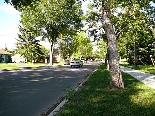
Hollick-Kenyon is a residential neighbourhood located in north east Edmonton, Alberta, Canada. The neighbourhood is named for aviator Herbert Hollick-Kenyon.

Contents

According to the 2001 federal census, substantially all residential development in the neighbourhood occurred after 1990. [8]

Nine out of every ten residences (91%), according to the 2005 municipal census, are single-family dwellings. The remaining one in ten residences (9%) are duplexes. [9] A substantial (97%) number of residences are owner-occupied. [10]

It is bounded on the north by 167 Avenue, on the south by 153 Avenue, on the west by 59A Street, and on the east by 50 Street.

Demographics

In the City of Edmonton's 2012 municipal census, Hollick-Kenyon had a population of 5,211 living in 1,815 dwellings, [7] a 19.3% change from its 2009 population of 4,367. [11] With a land area of 1.53 km2 (0.59 sq mi), [6] it had a population density of 3,405.9 people/km2 in 2012. [7] [6]

Surrounding neighbourhoods

Related Research Articles

Mayfield is a neighbourhood in west Edmonton, Alberta, Canada named for famed Canadian aviator and bush pilot Wop May.

Sherwood is a small neighbourhood in west Edmonton, Alberta, Canada. Originally part of the Town of Jasper Place, it became a part of Edmonton when Jasper Place amalgamated with Edmonton in 1964.

Oxford is a residential neighbourhood in the Palisades area of north west Edmonton, Alberta, Canada.
<span class="mw-page-title-main">Holyrood, Edmonton</span> Neighbourhood in Edmonton, Alberta, Canada

Holyrood is a residential neighbourhood in the Bonnie Doon area of south east Edmonton, Alberta, Canada. The name, Holyrood, is an anglicisation of the Scots haly ruid.

<span class="mw-page-title-main">Idylwylde, Edmonton</span> Neighbourhood in Edmonton, Alberta, Canada

Idylwylde is a residential neighbourhood in south east Edmonton, Alberta, Canada.

Kenilworth is a residential neighbourhood in south east Edmonton, Alberta, Canada located just to the north of Whyte Avenue.

Terrace Heights is a roughly triangle-shaped residential neighbourhood in south east Edmonton, Alberta, Canada.

Allendale is a residential neighbourhood located in south west Edmonton, Alberta, Canada. The neighbourhood is named for the Allen family, who owned a farm there. It was annexed by the City of Strathcona in 1907.

Carter Crest is a triangle-shaped residential neighbourhood in south west Edmonton, Alberta, Canada. It is bounded on the north west by Terwillegar Drive, on the north east by Rabbit Hill Road, and on the south by a utility corridor located just north of 29 Avenue.

Potter Greens is a post 1990 residential neighbourhood in west Edmonton, Alberta, Canada.

<span class="mw-page-title-main">La Perle, Edmonton</span> Neighbourhood in Edmonton, Alberta, Canada

La Perle is a residential neighbourhood in west Edmonton, Alberta, Canada. The neighbourhood is named for a resident who operated a general store in the area in the early. 20th century.

Kildare is a mixed residential/commercial neighbourhood in northeast Edmonton, Alberta, Canada. It is named after Kildare in Ireland.

Matt Berry is a residential neighbourhood in north east Edmonton, Alberta, Canada. It is named for aviator Arthur Massey ("Matt") Berry.

Dovercourt is a residential neighbourhood in north west Edmonton, Alberta, Canada. While the area was originally annexed by the City of Edmonton in 1913, residential development did not occur until after the end of World War II.

Belmont is a residential neighbourhood located in the Clareview area of north east Edmonton, Alberta, Canada.

Rosslyn is a residential neighbourhood in north west Edmonton, Alberta, Canada. The neighbourhood has good access to shopping services at Northgate Centre and North Town Mall.

<span class="mw-page-title-main">Prince Charles, Edmonton</span> Neighbourhood in Edmonton, Alberta, Canada

Prince Charles is a residential neighbourhood in north west Edmonton, Alberta. The area was named in honour of Charles III, then known as Prince Charles.

Killarney is a residential neighbourhood located in north east Edmonton, Alberta, Canada. While the area became part of Edmonton in 1913, residential development did not occur until the 1950s and 1960s.

Hodgson is a newer residential neighbourhood located in south west Edmonton, Alberta, Canada, with all residential development occurring after 2001.

<span class="mw-page-title-main">Henderson Estates, Edmonton</span> Neighbourhood in Edmonton, Alberta, Canada

Henderson Estates is a residential neighbourhood in south west Edmonton, Alberta, Canada overlooking the North Saskatchewan River valley. The neighbourhood is bounded on the north by Rabbit Hill Road and on the east by Riverbend Road. The southern boundary is an undeveloped strip of land about 29 Avenue.

References

  1. 1 2 "City of Edmonton Wards & Standard Neighbourhoods" (PDF). City of Edmonton. Archived from the original (PDF) on May 7, 2015. Retrieved February 13, 2013.
  2. "Edmonton Developing and Planned Neighbourhoods, 2011" (PDF). City of Edmonton. Archived from the original (PDF) on October 6, 2014. Retrieved February 13, 2013.
  3. "The Way We Grow: Municipal Development Plan Bylaw 15100" (PDF). City of Edmonton. 2010-05-26. Archived from the original (PDF) on May 2, 2015. Retrieved February 13, 2013.
  4. "City of Edmonton Plans in Effect" (PDF). City of Edmonton. November 2011. Archived from the original (PDF) on October 17, 2013. Retrieved February 13, 2013.
  5. "City Councillors". City of Edmonton. Retrieved February 13, 2013.
  6. 1 2 3 "Neighbourhoods (data plus kml file)". City of Edmonton. Retrieved February 22, 2013.
  7. 1 2 3 "Municipal Census Results – Edmonton 2012 Census". City of Edmonton. Retrieved February 22, 2013.
  8. City of Edmonton. Census 2001. HOLLICK-KENYON
  9. Duplexes include triplexes and fourplexes.
  10. City of Edmonton. Census 2005. HOLLICK-KENYON
  11. "2009 Municipal Census Results". City of Edmonton. Retrieved February 22, 2013.