Holmbridge | |
---|---|
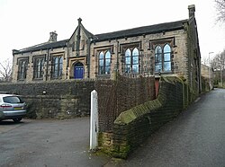
Former National School, Bank Top Lane, Holmbridge | |
Location within West Yorkshire | |
Metropolitan borough | |
District | |
Shire county | |
Metropolitan county | |
Region | |
Country | England |
Sovereign state | United Kingdom |
Post town | Holmfirth |
Postcode district | HD9 |
Dialling code | 01484 |
Police | West Yorkshire |
Fire | West Yorkshire |
Ambulance | Yorkshire |
UK Parliament | |
Holmbridge is a small village on the A6024 to the southwest of Holmfirth and south of Huddersfield in West Yorkshire, England. It is in the parish of Holme Valley and the metropolitan borough of Kirklees. [1]
In the 1950s, it was a site in the Survey of English Dialects.
On 6 July 2014, Stage 2 of the 2014 Tour de France from York to Sheffield, passed through the village. [2]
The village has one pub, the Bridge Tavern, one church, the Parish Church of St David, and a Village / Parish Hall. [3]
Holmfirth is a town in the Metropolitan Borough of Kirklees, West Yorkshire, England, on the A635 and A6024 in the Holme Valley, at the confluence of the River Holme and Ribble, 6 miles (9.7 km) south of Huddersfield and 14 miles (23 km) west of Barnsley. It mostly consists of stone-built cottages nestled on the eastern slopes of the Pennine hills. The boundary of the Peak District National Park is 2 miles (3.2 km) south-west of the town.
Mirfield is a town and civil parish in Kirklees, West Yorkshire, England. Historically part of the West Riding of Yorkshire, it is on the A644 road between Brighouse and Dewsbury. At the 2011 census it had a population of 19,563. Mirfield forms part of the Heavy Woollen District.
Oxenhope is a village and civil parish near Keighley in the metropolitan borough of Bradford, West Yorkshire, England. It was historically part of the West Riding of Yorkshire. The population was 2,476 at the time of the 2001 census which had increased to 2,626 at the 2011 Census. Oxenhope railway station is the terminus for the Keighley and Worth Valley Railway.
Holme-next-the-Sea is a small village and civil parish in the English county of Norfolk. It is situated on the north Norfolk coast some 5 km north-east of the seaside resort of Hunstanton, 30 km north of the town of King's Lynn and 70 km north-west of the city of Norwich.
Bradfield is a civil parish in the City of Sheffield, in South Yorkshire, England.
Blubberhouses is a small village and civil parish located in the Washburn Valley in the borough of Harrogate in North Yorkshire, a county in the north of England. The population as at the 2011 Census was less than 100, so details were included in the civil parish of Fewston. In 2015, North Yorkshire County Council estimated the population of the village and parish to be 40. Blubberhouses is situated to the south of the Yorkshire Dales National Park, and to the north of a Roman road and Fewston Reservoir on the A59 road linking Harrogate to Skipton.
Easington, also known as Easington Village, is a village and civil parish in eastern County Durham, England. It is located at the junction of the A182 and B1283, leading north-west to Hetton-le-Hole and south east to Horden.
Kettlewell is a village in Upper Wharfedale, North Yorkshire, England. Historically part of the West Riding of Yorkshire, it lies 6 miles (10 km) north of Grassington, at the point where Wharfedale is joined by a minor road which leads north-east from the village over Park Rash Pass to Coverdale. Great Whernside rises to the east. The population of the civil parish was 322 at the 2011 census, with an estimated population of 340 in 2015.
Honley is a large village in West Yorkshire, England. Historically part of the West Riding of Yorkshire, it is situated near to Holmfirth and Huddersfield, and on the banks of the River Holme in the Holme Valley. According to the 2011 Census it had a population of 6,474, a growth of 577 from the 2001 Census
Masham is a market town and civil parish in North Yorkshire, England. It had a population of 1,205 at the 2011 census.
Rowland's Castle is a village and civil parish in the East Hampshire district of Hampshire, England. It is 2.9 miles (4.7 km) north of Havant, on the Hampshire/West Sussex border.
Muker is a village and civil parish at the western end of Swaledale in North Yorkshire, England, within the district of Richmondshire.
Holme Moss is high moorland on the border between the Holme Valley district of Kirklees in West Yorkshire and the High Peak district of Derbyshire in England. Historically on the boundary between the West Riding of Yorkshire and Cheshire, it is just inside the boundary of the Peak District National Park. The A6024 road between Holmfirth and Longdendale crosses the moor near its highest point close to Holme Moss transmitting station's prominent mast.
Holme-on-Spalding-Moor is a large village and civil parish in the East Riding of Yorkshire, England. It is situated approximately 7 miles (11 km) north-east of Howden and 5 miles (8 km) south-west of Market Weighton. It lies on the A163 road where it joins the A614 road.
Colwick is a village, civil parish, in the Borough of Gedling in Nottinghamshire, England. It is situated to the east of Nottingham's city boundary, and forms the Colwick ward. At the time of the 2011 census, the village had a population of 2,829.
Holme is a village and civil parish in Cambridgeshire, England. Holme lies approximately 7 miles (11 km) south of Peterborough, near Conington and Yaxley. Holme is situated within Huntingdonshire which is a non-metropolitan district of Cambridgeshire as well as being a historic county of England. The parish contains the lowest point in Great Britain, 2.75 metres (9.0 ft) below sea level.
Easington is a village in the Loftus civil parish and is part of the North York Moors National Park. It is in the borough of Redcar and Cleveland, North Yorkshire, England. The village is situated on the A174 road, 1 mile (1.6 km) east of Loftus, 8 miles (13 km) east of Guisborough, and 10 miles (16 km) north-west of Whitby.
Holme is a small rural village 2.5 miles (4 km) southwest of the town of Holmfirth and 9.7 miles (16 km) from Tintwistle on the edge of the Pennines in England. Between Holmbridge and Lane Village in West Yorkshire close to the border with Derbyshire. It lies on the boundary of the Peak District National Park, with some properties split to lie partially outside of it.
Killinghall is a village and civil parish in the Harrogate district of North Yorkshire, England. The civil parish population taken at the 2011 census was 4,132.
Holme St Cuthbert is a small village and civil parish in the county of Cumbria, United Kingdom. The village is located approximately 23 miles to the south-west of Carlisle, Cumbria's county town, and was historically in the county of Cumberland.