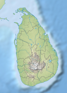
Horton Plains National Park is a national park in the central highlands of Sri Lanka that was designated in 1988. It is located at an elevation of 2,100–2,300 m (6,900–7,500 ft) and encompasses montane grassland and cloud forest. It is rich in biodiversity and many species found here are endemic to the region. It is also a popular tourist destination and is situated 8 kilometres (5.0 mi) from Ohiya, 6 kilometres (3.7 mi) from the world-famous Ohiya Gap/Dondra Watch and 32 kilometres (20 mi) from Nuwara Eliya.

Yala (යාල) National Park is the most visited and second largest national park in Sri Lanka, bordering the Indian Ocean. The park consists of five blocks, three of which are now open to the public. There are also two adjoining parks, Kumana National Park or 'Yala East' and Lunugamvehera National Park. The blocks have individual names, such as Palatupana. It is situated in the southeastern region of the country, in the Southern Province and Uva Province. The park covers 979 square kilometres (378 sq mi) and is located about 300 kilometres (190 mi) from Colombo. Yala was designated as a wildlife sanctuary in 1900, along with Wilpattu, designated in 1938, as the first two designated national parks in Sri Lanka. The park is best known for its variety of wildlife and is important conservation of Sri Lankan elephants, Sri Lankan leopards and aquatic birds.
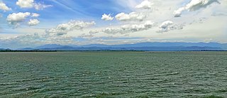
Udawalawe National Park is a national park on the boundary of Sabaragamuwa and Uva Provinces in Sri Lanka. The park was created to provide a sanctuary for wild animals displaced by the construction of the Udawalawe Reservoir on the Walawe River, as well as to protect the catchment of the reservoir. The reserve covers 30,821 hectares (119.00 sq mi) of land area and was established on 30 June 1972.

The Sri Lanka montane rain forests is an ecoregion found above 1,000 m in the central highlands of Sri Lanka. Owing to their rich biodiversity, this region is considered to be a super-hotspot within endemic hotspots of global importance. These forests are cooler than lowland forests and therefore they have ideal conditions for growth of cloud forests. These forests classifications tropical sub montane forest, tropical sub-montane and tropical upper montane. Half of Sri Lanka's endemic flowering plants and 51 percent of the endemic vertebrates are restricted to these forests. More than 34 percent of Sri Lanka's endemic trees, shrubs, and herbs can only be found in this ecoregion. Twisted, stunted trees are a common sight in these forests, together with many varieties of orchids, mosses and ferns. The trees of montane rain forests grow to a height 10–15 meters, shorter than the lowland rain forest trees. These high altitude forests are the catchment area for most of Sri Lanka's major rivers.

Wasgamuwa National Park is a natural park in Sri Lanka situated in the Matale and Polonnaruwa Districts. It was declared to protect and to make a refuge for the displaced wild animals during the Mahaweli Development Project in 1984 and is one of the four National Parks designated under the Project. Originally it was designated as a nature reserve in 1938, and then in the early 1970s the area was regraded as a strict nature reserve. Wasgamuwa is one of the protected areas where Sri Lankan Elephants can be seen in large herds. It is also one of the Important Bird Areas in Sri Lanka. The name of the Wasgamuwa has derived from the words "Walas Gamuwa". "Walasa" is Sinhala for sloth bear and "Gamuwa" means a wood. The park is situated 225 km away from Colombo.

The state of Karnataka in South India has a rich diversity of flora and fauna. It has a recorded forest area of 38,720 km2 which constitutes 55 of the geographical area of the state. These forests support 25% of the elephant population and 20% of the tiger population of India. Many regions of Karnataka are still unexplored and new species of flora and fauna are still found. The mountains of the Western Ghats in the western region of Karnataka are a biodiversity hotspot. Two sub-clusters of the Western Ghats, Talacauvery and Kudremukh, are on a tentative list of sites that could be designated as World Heritage Sites by UNESCO. The Bandipur and Nagarahole national parks which fall outside these subclusters were included in the Nilgiri biosphere reserve in 1986, a UNESCO designation. In the Biligiriranga Hills the Eastern Ghats meet the Western Ghats. The state bird and state animal of Karnataka are Indian roller and the Indian elephant. The state tree and state flower are sandalwood and lotus. Karnataka is home to 524 tigers.
Tangalle is a large town in Hambantota District, Southern Province, Sri Lanka, governed by an Urban Council. It is one of the largest towns in southern province. It is located 195 km (121 mi) south of Colombo and 35 km (22 mi) east of Matara. It has a mild climate, in comparison to the rest of the district, and sandy beaches.

Vedanthangal Bird Sanctuary is a 30-hectare (74-acre) protected area located in the Madurantakam taluk of the Chengalpattu District in the state of Tamil Nadu, India. The sanctuary is about 75 kilometres (47 mi) from Chennai on National Highway 45 ([NH45]). It is easily reachable from Madurantakam and Chengalpattu. More than 40,000 birds, from various parts of the world visit the sanctuary during the migratory season every year. Vedanthangal is home to migratory birds such as pintail, garganey, grey wagtail, blue-winged teal, common sandpiper and the like. It has been designated as a protected Ramsar site since 2022.

The Central Asian Flyway (CAF), Central Asian-Indian Flyway, or Central Asian-South Asian Flyway is a flyway covering a large continental area of Eurasia between the Arctic Ocean and the Indian Ocean and the associated island chains. The CAF comprises several important migration routes of waterbirds, most of which extend from the northernmost breeding grounds in Siberia to the southernmost non-breeding wintering grounds in West Asia, India, the Maldives and the British Indian Ocean Territory.
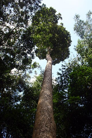
Dipterocarpus zeylanicus, commonly known as හොර - Hora in Sinhalese and සරල - Sarala or කිරිපලු - Kiripalu, is a species of Dipterocarpus that is endemic to Sri Lanka. A closely related Indian species is Dipterocarpus turbinatus. The Sri Lankan tree is a large tree that grows up to 40 – 45 m tall and 4 – 6 m in circumference. The bark is light pinkish brown or light yellowish brown. Leaves are big and oval, 5 to 8 inches long. The sharp-edged leaves are covered with silver hairy. Flowers bloom in April and seeds have two wings to spread from wind. The bark contains considerable amounts of gray caller oleo resin. D. zeylanicus can be found in moist low country like Ratnapura, Kaluthara, Galle and Mathara districts and also in the Sinharaja rain forest. The tallest trees of Hora in Sri Lanka are found in Udakiruwa village in Lunugala and under great threat of legal/illegal felling. There are many place names which begin with the name of the Hora tree. Even Tamil place names like Norochcholai is said to refer to a clump of Hora trees - i.e., "Horagolla" in Sinhalese.
Protected areas of Sri Lanka are administrated by Department of Forest Conservation and Department of Wildlife Conservation of Sri Lanka.There are 501 protected areas in Sri Lanka. The protected areas that fall under supervision of the Department of Forest Conservation include forests defined in National Heritage Wilderness Area Act in 1988, forest reservations, and forests managed for sustainability. Sinharaja Forest Reserve is an example for a National Heritage forest. There are 32 forests categorized as conservation forests including Knuckles Mountain Range. Strict nature reserves, national parks, nature reserves, forest corridors, and sanctuaries recognized under the Flora and Fauna Protection Ordinance are managed by Department of Wildlife Conservation. Total of all protected areas is 1,767,000 ha. Protected areas in Sri Lanka account for 26.5 percent of the total area. This is a higher percentage of protected areas than in all of Asia and much of the World.

The Sri Lanka lowland rain forests represents Sri Lanka's Tropical rainforests below 1,000 m (3,281 ft) in elevation in the southwestern part of the island. The year-around warm, wet climate together with thousands years of isolation from mainland India have resulted in the evolution of numerous plants and animal species that can only be found in rain forests in Sri Lanka. The thick forest canopy is made up of over 150 species of trees, some of the emergent layer reaching as high as 45 m (148 ft). The lowland rain forests accounts for 2.14 percent of Sri Lanka's land area. This ecoregion is the home of the jungle shrew, a small endemic mammal of Sri Lanka. Sri Lanka has the highest density of amphibian species worldwide. Many of these, including 250 species of tree frogs, live in these rain forests.

Bundala National Park is an internationally important wintering ground for migratory water birds in Sri Lanka. Bundala harbors 197 species of birds, the highlight being the greater flamingo, which migrate in large flocks. Bundala was designated a wildlife sanctuary in 1969 and redesignated to a national park on 4 January 1993. In 1991 Bundala became the first wetland to be declared as a Ramsar site in Sri Lanka. In 2005 the national park was designated as a biosphere reserve by UNESCO, the fourth biosphere reserve in Sri Lanka. The national park is situated 245 kilometres (152 mi) southeast of Colombo.
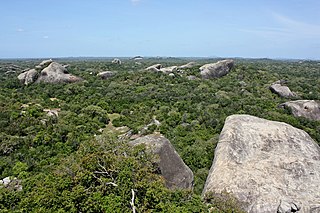
Kumana National Park in Sri Lanka is renowned for its avifauna, particularly its large flocks of migratory waterfowl and wading birds. The park is 391 kilometres (243 mi) southeast of Colombo on Sri Lanka's southeastern coast. Kumana is contiguous with Yala National Park. Kumana was formerly known as Yala East National Park, but changed to its present name on 5 September 2006.

Gal Oya National Park in Sri Lanka was established in 1954 and serves as the main catchment area for Senanayake Samudraya, the largest reservoir in Sri Lanka. Senanayake Samudraya was built under the Gal Oya development project by damming the Gal Oya at Inginiyagala in 1950. An important feature of the Gal Oya National Park is its elephant herd that can be seen throughout the year. Three important herbs of the Ayurveda medicine, triphala: Terminalia chebula, Terminalia bellirica and Emblica officinalis are amongst the notable flora of the forest. From 1954 to 1965 the park was administrated by the Gal Oya Development Board until the Department of Wildlife Conservation took over administration. The national park is situated 314 km (195 mi) from Colombo.

Kaudulla National Park is a national park on the island of Sri Lanka located 197 kilometres (122 mi) away from the largest city, Colombo. It was designated a national park on April 1, 2002, becoming the 15th such area on the island. In the 2004–2005 season more than 10,000 people visited the National Park, generating an income of Rs.100,000 from entrance fees. Along with Minneriya and Girithale BirdLife International have identified Kaudulla as an Important Bird Area.

Minneriya National Park is a national park in North Central Province of Sri Lanka. The area was designated as a national park on 12 August 1997, having been originally declared as a wildlife sanctuary in 1938. The reason for declaring the area as protected is to protect the catchment of Minneriya tank and the wildlife of the surrounding area. The tank is of historical importance, having been built by King Mahasen in third century AD. The park is a dry season feeding ground for the elephant population dwelling in forests of Matale, Polonnaruwa, and Trincomalee districts. The park earned revenue of Rs. 10.7 million in the six months ending in August 2009. Along with Kaudulla and Girithale, Minneriya forms one of the 70 Important Bird Areas (IBAs) of Sri Lanka. The park is situated 182 kilometres (113 mi) from Colombo.
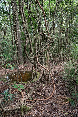
Galway's Land National Park is a small 27 ha (0.10 sq mi) national park, consisting of dense montane forest. It is located within the city limits of Nuwara Eliya in Sri Lanka, approximately 2 km (1 mi) east of the city centre. It was formally declared as a wildlife sanctuary on 27 May 1938. The Galway's Land was elevated to national park status on 18 May 2006. The park was declared to conserve the montane ecosystems. Field Ornithology Group of Sri Lanka considers that Victoria Park in Nuwara Eliya and Galway's Land are two of the most significant birding sites in Sri Lanka. Galway's Land harbours about 20 rare migrant bird species and 30 native species. Apart from the avifauna, the park has valuable floral species of both native and foreign origin. Galway Forest Lodge is located close to the park.

Dehing Patkai National Park is a national park in the Dibrugarh and Tinsukia districts of Assam covering an area of 231.65 km2 (89.44 sq mi) of rainforest. It was declared a wildlife sanctuary on 13 June 2004. On 13 December 2020, the Government of Assam upgraded it into a national park. On 9 June 2021, the Forest Department of Assam officially notified it as a national park. It is located in the Dehing Patkai Landscape which is a dipterocarp-dominated lowland rainforest. The rainforest stretches for more than 575 km2 (222 sq mi) in the districts of Dibrugarh, Tinsukia and Charaideo. The forest further spreads over in the Tirap and Changlang districts of Arunachal Pradesh. Dehing Patkai National Park harbours the largest stretch of lowland rainforests in India. Dehing Patkai Wildlife Sanctuary was declared as Dehing Patkai Elephant Reserve under Project Elephant. Dehing-Patkai as a potential wildlife sanctuary was identified in late 1980s during a primate survey as "Upper Dehing Wildlife Sanctuary". Subsequently during a study on white-winged wood duck in early 1990s, it was discovered as a globally important site for this duck and recommended to be upgraded to "Upper Dehing National Park".
Madhu Road National Park is a national park in northern Sri Lanka, approximately 25 km (16 mi) east of Mannar.
