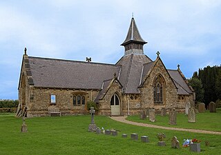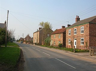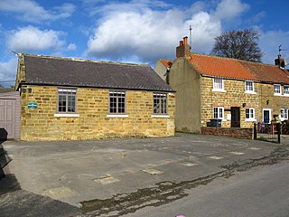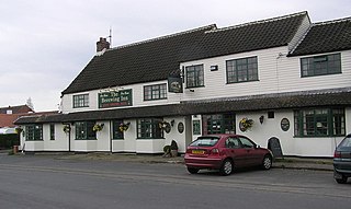
Picton is a hamlet and civil parish located in the north of North Yorkshire, England. It is situated approximately 4 miles (6 km) south from Yarm, 8 miles (13 km) south from Middlesbrough, and just over 1 mile (1.6 km) west from the A19 road. The name of the village derives from Old English and means "Pica's farm or settlement." Up until the 1850s, the village was spelt as Pickton with the old spelling being cut into the Picton Liberty stone which marked the boundary between the parishes of Picton and Kirklevington.

Aiskew is a village in the civil parish of Aiskew and Leeming Bar, in North Yorkshire, England. The village is situated to the immediate north-east of Bedale and separated from it by Bedale Beck.

Bagby is a village and civil parish in the former Hambleton District of North Yorkshire, England, 3 miles (5 km) south-east of Thirsk. The parish had a population of 470 according to the 2001 census and a population of 593 at the 2011 Census. The parish shares a grouped parish council with the adjacent parish of Balk.

Carlton Husthwaite is a village and civil parish in the former Hambleton District of North Yorkshire, England, about seven miles south-east of Thirsk. According to the 2001 census it had a population of 167, increasing to 180 at the 2011 Census.

Thormanby is a village and civil parish in the former Hambleton District of North Yorkshire, England. It lies on the A19 approximately halfway between Easingwold and Thirsk and about 14 miles (23 km) south east of the county town of Northallerton.

Easby is a village and civil parish in Hambleton District of North Yorkshire, England. It lies approximately 2 miles (3.2 km) south-east of Great Ayton. The larger village of Low Easby lies 0.3 miles (480 m) down the road, but neither have any amenities, only a postbox.

Flawith is a village and civil parish in the former Hambleton District of North Yorkshire, England. It is situated approximately 4 miles (6.4 km) south-west of Easingwold. The population taken at the 2011 Census was less than 100. Details are included in the civil parish of Aldwark.

Felixkirk is a village and civil parish in the former Hambleton District of North Yorkshire, England. The village is situated about three miles north-east of Thirsk. The population of the civil parish was estimated at 100 in 2014.

Sutton-under-Whitestonecliffe is a village and civil parish in North Yorkshire, England. Historically part of the North Riding of Yorkshire, it is situated on the A170 at the foot of Sutton Bank, about three miles east of Thirsk.

Melmerby is a village and civil parish in North Yorkshire, England, that lies 3.7 miles (6 km) north of Ripon and 0.6 miles (1 km) west of the A1(M) motorway. The population was 386 in the 2011 census.

Whitwell is a village and civil parish in North Yorkshire, England. It is 6.5 miles (10.5 km) north west of the county town of Northallerton At the 2011 Census the population was less than 100. Details are included in the civil parish of Great Langton.

Great Smeaton is a village and civil parish in North Yorkshire, England. It lies on elevated ground near the River Wiske, which is a tributary of the River Swale. The parish population at the 2011 census was 187.

East Cowton is a village and civil parish in the former Hambleton District of North Yorkshire, England. It is 7 miles (11 km) north west of the county town of Northallerton.

Danby Wiske is a village and the main settlement in the civil parish of Danby Wiske with Lazenby, in North Yorkshire, England. The village lies 3.7 miles (6 km) north north-west of the county town of Northallerton.

Hornby is a small village and civil parish located about 4 miles (6.4 km) north-west of Bedale. It is part of the non-metropolitan district of Richmondshire in the shire county of North Yorkshire, England.
Hackforth is a small village and civil parish in the former Hambleton District of North Yorkshire, England, about 4 miles (6 km) north of Bedale. Nearby settlements include Langthorne and Crakehall.

Crakehall is a village and civil parish in the former Hambleton District of North Yorkshire, England, approximately 2 miles (3 km) west of Bedale. The village lies along the route of the A684 and is split into two parts by Bedale Beck, a tributary of the River Swale. The population was estimated at 630 in 2015. The north-west part is known as Little Crakehall, and the south-east part as Great Crakehall. It is 8.3 miles (13.4 km) west-south-west of the county town of Northallerton.

Kirkby is a village and civil parish in the former Hambleton District of North Yorkshire, England, near Great Busby and 2 miles (3.2 km) south of Stokesley. The village is mentioned in the Domesday Book as belonging to Uhtred. The name of the village derives from the Old Norse kirkju-býr, which means church with a village. At the 2001 Census, the population of the village was recorded at 313, dropping slightly to 309 at the 2011 Census. In 2015, North Yorkshire County Council estimated the population to be 310.

Thornborough is a village in Hambleton District of North Yorkshire, England. It is about 7 miles (11 km) south of Bedale and 3 miles (5 km) west of the A1(M) motorway. Thornborough is in the West Tanfield parish. The Thornborough Henges ancient monuments are situated south and west of the village. The village lies just to the south of the B6267 road, which connects the A6055 in the east, with the A6108 road at Masham. The village is served by two buses a day in each direction between Ripon and Masham. When the Masham Branch of the North Eastern Railway was open, Tanfield station would have been the nearest railway station to Thornborough. Now the nearest railway station is at Thirsk.

Swainby is a village in the Hambleton District of North Yorkshire, England. It is situated on the A172 road, 8 miles (13 km) north-east from Northallerton and 5 miles (8 km) south-east from the small market town of Stokesley.


