A parish is a territorial entity in many Christian denominations, constituting a division within a diocese. A parish is under the pastoral care and clerical jurisdiction of a priest, often termed a parish priest, who might be assisted by one or more curates, and who operates from a parish church. Historically, a parish often covered the same geographical area as a manor. Its association with the parish church remains paramount.

Freguesia, usually translated as "parish" or "civil parish", is the third-level administrative subdivision of Portugal, as defined by the 1976 Constitution. It is also the designation for local government jurisdictions in the former Portuguese overseas territories of Cape Verde and Macau. In the past, it was also an administrative division of the other Portuguese overseas territories. The parroquia in the Spanish autonomous communities of Galicia and Asturias is similar to a freguesia. The average land area of a Portuguese parish is about 29.83 km2 (11.52 sq mi) and an average population of about 3,386 people. The largest parish by area is Alcácer do Sal e Santa Susana, with a land area of 888.35 km2 (342.99 sq mi), and the smallest parish by area is São Bartolomeu (Borba), with a land area of 0.208 km2 (0.080 sq mi). The most populous parish is Algueirão - Mem Martins, with a population of 68,649 people and the least populous is Mosteiro, with a population of just nineteen people.

The Borough of Scarborough was a non-metropolitan district with borough status in North Yorkshire, England. In addition to the town of Scarborough, it covered a large stretch of the coast of Yorkshire, including Whitby and Filey. It bordered Redcar and Cleveland to the north, the Ryedale and Hambleton districts to the west and the East Riding of Yorkshire to the south.

In England, a civil parish is a type of administrative parish used for local government. It is a territorial designation which is the lowest tier of local government. Civil parishes can trace their origin to the ancient system of parishes, which for centuries were the principal unit of secular and religious administration in most of England and Wales. Civil and religious parishes were formally split into two types in the 19th century and are now entirely separate. Civil parishes in their modern form came into being through the Local Government Act 1894, which established elected parish councils to take on the secular functions of the parish vestry.

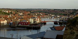
The River Esk is a river in North Yorkshire, England that empties into the North Sea at Whitby after a course of around 28 miles (45 km) through its valley of Eskdale. The river's name is derived from the Brythonic word "isca" meaning "water". The Esk is the only major river in Yorkshire that flows directly into the North Sea; all other watercourses defined as being major rivers by the Environment Agency, either flow to the North Sea via the River Tees or the Humber Estuary.

The Esk Valley Line is a railway line located in the north of England, covering a total distance of approximately 35 miles (56 km), running from Middlesbrough to Whitby. The line follows the course of the River Esk for much of its eastern half.

Langbaurgh was a liberty or wapentake of the North Riding of Yorkshire. It covered an area of the shire's north-eastern tip. The wapentake took its name from Langbaurgh hamlet, in present-day Great Ayton parish.

Glaisdale is a railway station on the Esk Valley Line, which runs between Middlesbrough and Whitby via Nunthorpe. The station, situated 9 miles 33 chains (15.1 km) west of Whitby, serves the village of Glaisdale in North Yorkshire, England. It is owned by Network Rail and managed by Northern Trains.

Jocelyn Edward Salis Simon, Baron Simon of Glaisdale, was a Law Lord in the United Kingdom, having been, by turns, a barrister, a commissioned officer in the British Army, a barrister again, a Conservative Party politician, a government minister, and a judge.

Egton Bridge is a village in the Scarborough district of North Yorkshire, England. It lies within the North York Moors National Park, on the River Esk, between the villages of Glaisdale and Grosmont, about six miles south-west of Whitby, and on the route of the Esk Valley Walk.

Glaisdale is a village and civil parish in the former Scarborough district of North Yorkshire, England, within the North York Moors National Park.

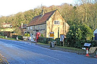
Lealholm is a small village in the Glaisdale civil parish of the former Borough of Scarborough, in North Yorkshire, England. It is sited at a crossing point of the River Esk, in Eskdale which is within the North York Moors National Park. It is 9.5 miles (15.3 km) by road from the nearest town of Whitby, and approximately 27 miles (43 km) from both Middlesbrough and Scarborough. The village is typical of those found all across the North York Moors which straddle the main through-routes along the valley bottoms. It is mostly built of local stone with pantiled or slate roofs.

Brandsby is a village in North Yorkshire, England. The village is the main constituent of the Brandsby-cum-Stearsby Civil Parish in the District of Hambleton. The village is mentioned in the Domesday book. It lies between Easingwold and Hovingham, some 12.3 miles (19.8 km) north of York.
Sir Peregrine Charles Hugo Simon, is a retired Lord Justice of Appeal.

Civil parishes are units of territory in the island of Ireland that have their origins in old Gaelic territorial divisions. They were adopted by the Anglo-Norman Lordship of Ireland and then by the Elizabethan Kingdom of Ireland, and were formalised as land divisions at the time of the Plantations of Ireland. They no longer correspond to the boundaries of Roman Catholic or Church of Ireland parishes, which are generally larger. Their use as administrative units was gradually replaced by Poor Law Divisions in the 19th century, although they were not formally abolished. Today they are still sometimes used for legal purposes, such as to locate property in deeds of property registered between 1833 and 1946.

A witch post is a local superstition where the cross of St Andrew is used as a hex sign on the fireplaces in Northern England, in Yorkshire and Lancashire, in order to prevent witches from flying down the chimney and entering the house to do mischief. By placing the St Andrew's cross on one of the fireplace posts or lintels, witches are thought to be prevented from entering through this opening. In this case, it is similar to the use of a witch ball, although the cross is supposed to actively prevent witches from entering, and the witch ball is supposed to passively delay or entice the witch, and perhaps entrap it.
Bluecoat Beechdale Academy is an 11–16 mixed secondary school with academy status in Bilborough, Nottingham, Nottinghamshire, England. It is part of the Archway Learning Trust.
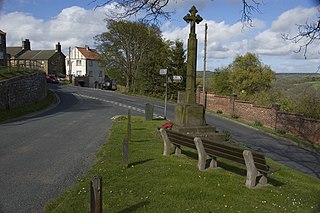
Glaisdale is a civil parish in the Scarborough district of North Yorkshire, England. It contains 47 listed buildings that are recorded in the National Heritage List for England. Of these, six are listed at Grade II*, the middle of the three grades, and the others are at Grade II, the lowest grade. The parish contains the villages of Glaisdale and Lealholm, the smaller settlement of Houlsyke, and the surrounding countryside and moorland. Most of the listed buildings consist of houses, cottages and associated structures, farmhouses and farm buildings. The others include churches and chapels, a wayside cross, bridges, a boundary stone, a drinking fountain, and two war memorials.

St Thomas' Church is the parish church of Glaisdale, a village in North Yorkshire, in England.


