San Francisco de los Romo is a municipality and city in the Mexican state of Aguascalientes. The city of San Francisco de los Romo serves as the municipal seat for the surrounding municipality of San Francisco de los Romo.

Mexicali Municipality is a municipality in the Mexican state of Baja California. Its municipal seat is located in the city of Mexicali. As of 2020, the municipality had a total population of 1,049,792. The municipality has an area of 13,700 km2 (5,300 sq mi). This includes many smaller outlying communities as well as the city of Mexicali. Also, the islands of Baja California located in the Gulf of California are part of the municipality, among them the mudflat islands at the mouth of the Colorado River, Isla Ángel de la Guarda and the islands of the San Lorenzo Marine Archipelago National Park. Mexicali is the northernmost municipality of Latin America.

Playas de Rosarito Municipality is located in the northwestern part of the Mexican state of Baja California comprising part of the Tijuana metropolitan area. It lies just south of the city of Tijuana. Its municipal seat is the city of Rosarito. According to the 2020 census, the municipality had a population of 126,890 inhabitants. Its area is 513.32 km2.

The Municipality of Pachuca de Soto, or Municipality of Pachuca, is one of the Municipalities of the state of Hidalgo, located in east-central Mexico.

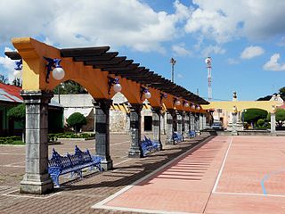
Calvillo is a municipality in the Mexican state of Aguascalientes. The city of Calvillo, the second largest in the state, serves as the municipal seat. It is located to the western part of the state, at about 52 kilometers of the city of Aguascalientes. It stands at 21°51′N102°43′W in the southwestern corner of the state. It is bounded by Jalisco and Zacatecas. The municipality, which has an area of 931.26 km², reported a population of 54,136 by 2010. The town of Ojocaliente is another significant community in the municipality. Calvillo is one of the richest, most prosperous municipalities in Aguascalientes.
Omitlán de Juárez is a town and one of the 84 municipalities of Hidalgo, in central-eastern Mexico. The municipality covers an area of 110.5 km².

Tenango de Doria is a town and one of the 84 municipalities of Hidalgo, in central-eastern Mexico. The municipality covers an area of 210.7 square kilometers (81.4 sq mi).

Hueypoxtla is a municipality situated in the Zumpango Region, which is located in the northeastern part of the state of Mexico in Mexico. The municipality is positioned at a northern pass that serves as an exit from the Valley of Mexico and Mezquital Valley. The name "Hueypoxtla" originates from Nahuatl and translates to "place of great merchants".
Huehuetla is a rural municipality in Puebla, Mexico.

Tlaxco is a town and its surrounding municipality in the Mexican state of Tlaxcala.

The Pachuca metropolitan area is a metropolitan area located in the state of Hidalgo in Mexico. It consists of the municipalities of Pachuca, Mineral del Monte, Mineral de la Reforma, San Agustín Tlaxiaca, Epazoyucan, Zapotlán de Juárez and Zempoala.

Senguio is a municipality in the Mexican state of Michoacán. It is located approximately 90 kilometres (56 mi) east of the state capital of Morelia.
Tepojaco is locality in the municipality of Tizayuca, in the state of Hidalgo in central-eastern Mexico. It is located in Tizayuca Valley and is part of Greater Mexico City.

San Gerónimo Tlamaco is a locality in Mexico belonging to the municipality of Atitalaquia in the state of Hidalgo.
Tunititlán is a town in the municipality of Chilcuautla, in the Mexican state of Hidalgo.
Huitexcalco is a locality in Mexico belonging to the municipality of Chilcuautla in the state of Hidalgo.
El Mandho is a town in Mexico located in the municipality of Ixmiquilpan in the state of Hidalgo.
San José Acoculco is a town in the municipality of Atotonilco de Tula in the Mexican state of Hidalgo.

The geography of the State of Hidalgo refers to the physical geography and human geography of Hidalgo, a state in central Mexico.
Pahuayo is a locality in Mexico located in the Municipality of Tlanchinol in the state of Hidalgo.