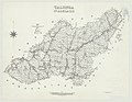
The Mid Murray Council is a local government area in South Australia in the Murray and Mallee region of South Australia. The council spans the area from the Riverland through the Murraylands to the eastern slopes of the Mount Lofty Ranges. It includes 220 km of the Murray River. The council seat is at Mannum; it also maintains secondary offices at Cambrai and Morgan.

Adelaide Hills Council is a local government area in the Adelaide Hills of South Australia. It is in the hills east of Adelaide, the capital of South Australia, and extends from the South Para Reservoir in the north to the Mount Bold Reservoir in the south.

Birdwood is a town near Adelaide, South Australia. It is located in the local government areas of the Adelaide Hills Council and the Mid Murray Council.

Inglewood is a small town near Adelaide, South Australia. It is located in the Adelaide Hills Council local government area, and is adjacent to Houghton, Paracombe and the rural districts of Upper Hermitage and Chain of Ponds. At the 2006 census, Inglewood had a population of 264.
Chain of Ponds is a locality and former town near Adelaide, South Australia. It is located in the Adelaide Hills Council local government area.

Gumeracha is a town in the Adelaide Hills, South Australia, located on the Adelaide-Mannum Road. It is located in the Adelaide Hills Council local government area on the south bank of the upper River Torrens. At the 2006 census, Gumeracha had a population of 731.

Mount Pleasant is a town situated in the Barossa Council, just north of the Adelaide Hills region of South Australia, 55 kilometres east-north-east of the state capital, Adelaide. It is located in the Barossa Council and Mid Murray Council local government areas, and is at an altitude of 440 metres above sea level. Rainfall in the area averages 687 mm per annum.

Mount Torrens is a town in the eastern Adelaide Hills region of South Australia, 46 kilometres east-north-east of the state capital, Adelaide and 8 km east of Lobethal. It is located in the Adelaide Hills Council and the Mid Murray Council local government areas. At the 2006 census, Mount Torrens had a population of 337.
The Hills Football League (HFL) is an Australian rules football league, situated in the Adelaide Hills region of South Australia, to the south east of the state capital Adelaide.

The County of Adelaide is one of the 49 cadastral counties of South Australia and contains the city of Adelaide. It was proclaimed on 2 June 1842 by Governor Grey. It is bounded by the Gawler River and North Para River in the north, the Mount Lofty Ranges in the east, and Gulf St Vincent in the west. The south border runs from Aldinga Bay to Willunga South and Mount Magnificent.
The District Council of East Torrens was a local government council of South Australia from 1853 to 1997.
The District Council of Mount Pleasant was a local government area in South Australia from 1935 to 1997. The council seat was located at Mount Pleasant.

The Hundred of Kanmantoo is a cadastral unit of hundred in the eastern Adelaide Hills. One of the 10 hundreds of the County of Sturt, it was proclaimed on 13 November 1847 by Governor Frederick Robe and named after the Kanmantoo gold mine, itself presumed to be named after an indigenous term by William Giles.
The District Council of Onkaparinga was a local government council of South Australia from 1853 to 1997.

The Hundred of Tungkillo is a cadastral unit of hundred in the southeastern foothills of the Mount Lofty Ranges. One of the 10 hundreds of the County of Sturt, it was proclaimed on 7 August 1851 by Governor Henry Young. According to local historian Geoff Manning, the place name is derived from tainkila an indigenous term used by the Peramangk people meaning "ghost moth grubs" which was first applied to Tungkillo mine, about 2.5 kilometres (1.6 mi) south of the township of Palmer in the east of the hundred.

The Hundred of Barossa is a cadastral unit of hundred in South Australia in the northern Adelaide Hills. It lies west of the Barossa Range at the south end of the Barossa Valley and is bounded on the north and south by the North Para and South Para rivers, respectively. It is the most northern of the eleven hundreds of the County of Adelaide and was named in 1846 by Governor Frederick Robe after the Barossa Range.
The Hundred of Para Wirra is a cadastral hundred of the County of Adelaide, South Australia, spanning a portion of the Adelaide Hills north of the Torrens Valley including Mount Crawford.
The Hundred of Onkaparinga is a cadastral hundred of the County of Adelaide, South Australia, in the Adelaide Hills. It was proclaimed by Governor Frederick Robe in 1846 and named for the Onkaparinga River valley, which flows from north east to south west through the hundred.
The District Council of Gumeracha was a local government area of South Australia from 1935 to 1997, seated at Gumeracha.
Cudlee Creek Conservation Park is a protected area located in the Australian state of South Australia in the locality of Cudlee Creek in the Adelaide Hills state government region about 12 kilometres (7.5 mi) south-east of the state capital of Adelaide and about 4 kilometres (2.5 mi) south-west of the town centre in Gumeracha.