Hurricane Bridget

Last updated

Map key
  Tropical depression (≤38 mph, ≤62 km/h)
  Tropical storm (39–73 mph, 63–118 km/h)
  Category 1 (74–95 mph, 119–153 km/h)
  Category 2 (96–110 mph, 154–177 km/h)
  Category 3 (111–129 mph, 178–208 km/h)
  Category 4 (130–156 mph, 209–251 km/h)
  Category 5 (≥157 mph, ≥252 km/h)
  Unknown
Storm type
Disc Plain black.svg Tropical cyclone
Solid black.svg Subtropical cyclone
ArrowUp.svg Extratropical cyclone, remnant low, tropical disturbance, or monsoon depression

The origins of the hurricane were from a tropical wave that exited the coast of Africa on June 3. Around four days later the system entered the Caribbean Sea, passing over the San Andres islands on June 12. [1] The area of convection, or thunderstorms, spread across Central America. A surface circulation developed offshore El Salvador, [2] and the system formed into a tropical depression on June 14. [3] For much of the summer of 1971, a large pool of anomalously warm water temperatures extended from Central America to the Gulf of California off the Mexican coast, reaching 89.6 °F (32 °C). This allowed for steady intensification as it tracked through the Gulf of Tehuantepec. [2]

Early on June 15, a ship reported winds of 40 mph (65 km/h) and 13 ft (4.0 m) seas, which prompted the Eastern Pacific Hurricane Center (EPHC) to upgrade the depression to Tropical Storm Bridget. The storm maintained a general northwest track toward the southwest Mexican coastline. It gradually intensified, and satellite images late on June 16 indicated that Bridget attained hurricane status about 55 mi (95 km) southwest of Puerto Ángel, Oaxaca. [2] It quickly intensified as it neared the coast, reaching winds of 100 mph (155 km/h) just southwest of Acapulco coastline before weakening. [3] Bridget paralleled the Mexican coastline just offshore before making landfall at 1200  UTC on June 17, about 100 mi (160 km) southeast of Manzanillo, Colima. The hurricane rapidly weakened over the mountainous terrain, emerging into the Pacific Ocean as a tropical depression after being over land for only a few hours. [2] Bridget turned westward as a weak tropical cyclone, eventually dissipating on June 20 to the south of the Baja California peninsula. [3]

Preparations and impact

While passing to the southwest of Acapulco, Bridget produced heavy rainfall and strong wind gusts reaching 104 mph (167 km/h). The winds damaged or destroyed many roofs across Acapulco, signs, and windows. [2] Strong winds also downed trees and power lines, which left most of Acapulco without electricity. [4] Along the coast, the hurricane produced high tides and waves which flooded low-lying coastal areas with around 1.5 ft (0.46 m) of water. [2] [5] The high tides damaged coastal properties and destroyed 21 boats, including the flagship of the Admiral of the Mexican Navy. [2] Debris-clogged drains caused drainage facilities to exceed their capacities following the heavy rainfall. [2] Overall, the storm killed 17 people in the region, [6] and caused five additional injuries. [4]

Damage in the area around Acapulco was estimated at 500 million pesos ($40 million USD). This made it the worst hurricane to hit the city in at least 25 years. Where Bridget made its final landfall, no damage reports were available due to the sparse population of the area. [2]

See also

Other hurricanes which severely affected Acapulco:

Related Research Articles

<span class="mw-page-title-main">1971 Atlantic hurricane season</span> Hurricane season in the Atlantic Ocean

The 1971 Atlantic hurricane season was fairly active with several notable storms. Hurricane Edith, the strongest of the season, was a Category 5 on the Saffir-Simpson scale, the highest category on the scale, even though it was the least intense for that category on record, at 943 mbar. It struck Nicaragua at peak intensity, killing dozens, and later hit southern Louisiana. Until 2003, Hurricane Ginger held the record for the longest known duration of a North Atlantic tropical cyclone, lasting 27.25 days from early September to early October; it is currently the second longest-lasting Atlantic hurricane. Ginger moved ashore in North Carolina, producing heavy rains and damaging winds. An unnamed storm in August attained hurricane status further north than any other Atlantic hurricane. On 11 September, seven tropical cyclones were active at the same time, the record for the Atlantic basin.

<span class="mw-page-title-main">1974 Atlantic hurricane season</span> Hurricane season in the Atlantic Ocean

The 1974 Atlantic hurricane season was a very deadly hurricane season. In terms of overall activity, it was near average, with eleven named storms forming, of which four became hurricanes. Two of those four became major hurricanes, which are Category 3 or higher systems on the Saffir–Simpson scale. The season officially began on June 1 and lasted until November 30. These dates conventionally delimit the period of each year when most tropical cyclones form in the Atlantic Ocean.

<span class="mw-page-title-main">1936 Atlantic hurricane season</span> Hurricane season in the Atlantic Ocean

The 1936 Atlantic hurricane season was a fairly active season, with 20 tropical cyclones recorded, 17 of which became tropical storms. Seven storms became hurricanes, of which one became a major hurricane. In addition, the season was unusual in the fact that no storms moved across large portions of the Caribbean Sea. Seven storms, including three hurricanes, struck the United States.

<span class="mw-page-title-main">1986 Pacific hurricane season</span> Hurricane season in the Pacific Ocean

The 1986 Pacific hurricane season featured several tropical cyclones that contributed to significant flooding to the Central United States. The hurricane season officially started May 15, 1986, in the eastern Pacific, and June 1, 1986 in the central Pacific, and lasted until November 30, 1986 in both regions. These dates conventionally delimit the period of each year when most tropical cyclones form in the northeastern Pacific Ocean. A total of 17 named storms and 9 hurricanes developed during the season; this is slightly above the averages of 15 named storms and 8 hurricanes, respectively. In addition, 26 tropical depressions formed in the eastern Pacific during 1986, which, at the time, was the second most ever recorded; only the 1982 Pacific hurricane season saw a higher total.

<span class="mw-page-title-main">1981 Pacific hurricane season</span> Hurricane season in the Pacific Ocean

The 1981 Pacific hurricane season was a slightly below average Pacific hurricane season. The season officially started on May 15 in the eastern Pacific basin and June 1 in the central Pacific basin. Both basins' seasons ended on November 30; these dates conventionally delimit the period during which most tropical cyclones form in the northeastern Pacific Ocean. The first tropical cyclone of the season was designated on May 30, and the final storm of the season, Hurricane Otis, dissipated on October 30. The season produced fifteen named storms and a total of eight hurricanes, which was near normal. However, the total of one major hurricane was below the average of three.

<span class="mw-page-title-main">1979 Pacific hurricane season</span> Hurricane season in the Pacific Ocean

The 1979 Pacific hurricane season was an inactive season, featuring 10 named storms, 6 hurricanes, and 4 major hurricanes. It featured zero tropical cyclones in the Central Pacific, the most recent occurrence on record as of 2023. An average year sees four to five tropical cyclones in that basin.

<span class="mw-page-title-main">1974 Pacific hurricane season</span> Hurricane season in the Pacific Ocean

The 1974 Pacific hurricane season featured one of the most active periods of tropical cyclones on record with five storms existing simultaneously. The season officially started May 15 in the eastern Pacific, and June 1 in the central Pacific, and lasted until November 30. These dates conventionally delimit the period of each year when most tropical cyclones form in the northeast Pacific Ocean.

<span class="mw-page-title-main">1976 Pacific hurricane season</span> Hurricane season in the Pacific Ocean

The 1976 Pacific hurricane season was a very deadly and costly season. Hurricanes Kathleen, Liza, and Madeline were the most notable storms this year. Hurricane Kathleen caused death and destruction in California and Arizona due to flooding. Hurricane Liza was the deadliest storm of the season when it killed over 600 people in Mexico. Hurricane Madeline is notable for being one of the most intense Pacific hurricanes at landfall.

<span class="mw-page-title-main">1975 Pacific hurricane season</span> Hurricane season in the Pacific Ocean

The 1975 Pacific hurricane season officially started May 15, 1975, in the eastern Pacific, and June 1, 1975, in the central Pacific, and lasted until November 30, 1975. These dates conventionally delimit the period of each year when most tropical cyclones form in the northeast Pacific Ocean.

<span class="mw-page-title-main">1978 Pacific hurricane season</span> Hurricane season in the Pacific Ocean

The 1978 Pacific hurricane season was the first Pacific hurricane season to use both masculine and feminine names for tropical cyclones. It also began the modern practice of utilizing naming lists every six years. Despite lacking an El Niño, a common driver of enhanced activity in the East and Central Pacific basins, the 1978 season was active. It featured 19 named storms, 14 hurricanes, and 7 major hurricanes, the latter of which are Category 3 or stronger cyclones on the Saffir–Simpson scale. Within the confines of the Central Pacific basin, located between the International Date Line and 140°W, 13 tropical cyclones or their remnants were observed by forecasters at the Central Pacific Hurricane Center, a record number of occurrences at the time. Seasonal activity began on May 30 and ended on October 21, within the limits of a traditional hurricane season which begins on May 15 in the East Pacific and June 1 in the Central Pacific. The season ends on November 30 in both basins. These dates conventionally delimit the period during each year when most tropical cyclones form.

<span class="mw-page-title-main">Hurricane Fico</span> Category 4 Pacific hurricane in 1978

Hurricane Fico was the longest-lived hurricane of the 1978 Pacific hurricane season and became the longest-lasting Pacific hurricane on record, a record broken by Hurricane Tina fourteen years later. The sixth tropical storm, fourth hurricane, and third major hurricane, Fico developed from a tropical disturbance off the Pacific coast of Mexico on July 9. It moved northwestward and then westward, quickly reaching peak winds of 140 mph (230 km/h) on July 12. Moving nearly due westward, the intensity of Fico fluctuated from Category 1 to Category 4 status on the Saffir–Simpson hurricane scale for the following days, and it passed about 170 miles (270 km) south of Hawaii on July 20 with winds of 115 mph (185 km/h). Fico slowly weakened as it turned to the northwest over cooler waters, and became an extratropical cyclone on July 28 to the northeast of Midway Island.

<span class="mw-page-title-main">1971 Pacific hurricane season</span> Hurricane season in the Pacific Ocean

The 1971 Pacific hurricane season began on May 15, 1971 in the eastern Pacific, and on June 1, 1971 in the Central Pacific ; both ended on November 30, 1971. These dates, adopted by convention, historically describe the period in each year when most tropical cyclogenesis occurs in these regions of the Pacific. It was the first year that continuous Weather satellite coverage existed over the entire Central Pacific. As such, this season is often viewed as the start year for modern reliable tropical cyclone data in the Pacific Ocean.

<span class="mw-page-title-main">Hurricane Greta–Olivia</span> Category 4 Atlantic and Pacific hurricane in 1978

Hurricane Greta, later Hurricane Olivia, was one of fourteen named Atlantic hurricanes to cross over Central America into the eastern Pacific while remaining a tropical cyclone. The seventh named storm of the 1978 Atlantic hurricane season, Greta formed from a tropical wave just northwest of Trinidad on September 13, and despite being in a climatologically unfavorable area, gradually intensified while moving west-northwestward. On September 16, it became a hurricane south of Jamaica. Two days later, the well-defined eye approached northeastern Honduras but veered to the northwest. After reaching peak winds of 130 mph (210 km/h) that day, Greta weakened while paralleling the northern Honduras coast just offshore. On September 19, it made landfall on Belize near Dangriga and quickly weakened into a tropical depression while crossing Guatemala and southeastern Mexico. After entering the eastern Pacific, the system re-intensified into a hurricane and was renamed Olivia, the eighteenth named storm of the 1978 Pacific hurricane season which weakened before landfall and dissipated over Chiapas on September 23.

<span class="mw-page-title-main">Hurricane Boris (1996)</span> Category 1 Pacific hurricane in 1996

Hurricane Boris was the second of three storms to impact the Pacific coast of Mexico in June and July 1996. The fourth tropical cyclone and second hurricane of the 1996 Pacific hurricane season, Boris formed out of a tropical wave roughly 250 mi (400 km) south of the Gulf of Tehuantepec on June 27. The storm gradually intensified, becoming a tropical storm the following day and then hurricane on June 29. As the storm neared landfall, an eye developed and Boris reached its peak intensity with winds of 90 mph (140 km/h). Shortly after, the hurricane made landfall along the south coast of Mexico, between Lazaro Cardenas and Acapulco, at this intensity. Boris quickly weakened following its landfall, becoming a tropical depression roughly 18 hours later. The remnants of the system persisted until July 1, at which time it dissipated just offshore the Mexican coastline. Boris caused heavy flooding in southern Mexico that resulted in ten fatalities; however, a damage estimate is unknown.

<span class="mw-page-title-main">Hurricane Irene–Olivia</span> Category 3 Atlantic and Pacific hurricane in 1971

Hurricane Irene–Olivia was the first actively tracked tropical cyclone to move into the eastern Pacific Ocean from the Atlantic basin. It originated as a tropical depression on September 11, 1971, in the tropical Atlantic. The cyclone tracked nearly due westward at a low latitude, passing through the southern Windward Islands and later over northern South America. In the southwest Caribbean Sea, it intensified to a tropical storm and later a hurricane. Irene made landfall on southeastern Nicaragua on September 19, and maintained its circulation as it crossed the low-lying terrain of the country. Restrengthening after reaching the Pacific, Irene was renamed Hurricane Olivia, which ultimately attained peak winds of 115 mph (185 km/h). Olivia weakened significantly before moving ashore on the Baja California Peninsula on September 30; the next day it dissipated.

<span class="mw-page-title-main">1957 Pacific hurricane season</span> Hurricane season in the Pacific Ocean

The 1957 Pacific hurricane season was a moderately active year in which 13 tropical cyclones formed. The hurricane season ran through the summer and fall months which conventionally delimit the period during which most tropical cyclones form in the northeastern Pacific Ocean. The first tropical cyclone developed on July 15. The final storm dissipated on December 6, becoming one of the few Pacific storms to exist outside of the seasonal dates. Of the season's 13 storms, five of these formed or crossed into the central Pacific.

<span class="mw-page-title-main">Hurricane Paine (1986)</span> Category 2 Pacific hurricane in 1986

Hurricane Paine was the sixteenth tropical storm and eighth hurricane of the fairly active 1986 Pacific hurricane season; moisture from the system contributed to one of the most significant flooding events in Oklahoma history. Paine formed on September 28 off the southeast coast of Mexico. It moved around a ridge, later turning to the north and brushing the Baja California Peninsula. By that time, Paine had attained peak winds of 100 mph (160 km/h), but it weakened slightly before hitting the Mexican state of Sonora. The remnant moisture combined with a cold front to produce heavy rainfall in the South Central United States.

<span class="mw-page-title-main">Hurricane Madeline (1976)</span> Category 4 Pacific hurricane in 1976

Hurricane Madeline was the second landfalling major hurricane along the Pacific coast of Mexico in a week. Madeline formed on September 29, not far from Central America. The next day, the circulation dissipated, and as a result weakened to a remnant low. Four days later, on October 3, the low regenerated into a tropical depression. The system remained weak for three days as it drifted west-northwest. When it began to recurve towards Mexico on October 6, the cyclone rapidly intensified and eventually made landfall at peak intensity as a Category 4. Shortly after landfall, the cyclone rapidly dissipated.

<span class="mw-page-title-main">Hurricane Eugene (1987)</span> Category 2 Pacific hurricane in 1987

Hurricane Eugene was the only tropical cyclone to make landfall in Mexico during the 1987 Pacific hurricane season. The eighth tropical cyclone, fifth named storm, and first hurricane of the season, Eugene developed on July 22 from a tropical disturbance centered well offshore of Mexico. Later that day, the system intensified into a tropical storm while moving northwestward. Eugene reached hurricane status on July 24; it briefly peaked as a Category 2 hurricane the next day. Hurricane Eugene weakened back to a Category 1 hurricane; subsequently, the hurricane made landfall near Manzanillo. Shortly after landfall, Eugene rapidly weakened inland, and was only a tropical storm when it re-emerged into open water, where it quickly dissipated. Throughout southwestern Mexico, the storm produced high winds, especially in the southwestern portion of the country. The hurricane deluged the southwest Mexican coastline, resulting in the highest rainfall totals from a tropical cyclone in five Mexican states. Over 5,000 people were left homeless, including 60 in Manzanillo. The city's airport control tower was also damaged, requiring closure. Elsewhere, 200 to 300 houses were destroyed in Colima. In all, Eugene injured 18 people, and caused three fatalities and $142.12 million (1987 USD) in damage.

<span class="mw-page-title-main">Hurricane Dolores (1974)</span> Category 1 Pacific hurricane in 1974

Hurricane Dolores was regarded as the worst hurricane to strike Acapulco since 1938. Developing on June 13, 1974, the system rapidly organized into a tropical storm the next day off the southern coast of Mexico. Over the following day, Dolores developed an eye-like feature and attained hurricane status. With peak winds of 80 mph (130 km/h), the storm made landfall near Acapulco. Once onshore, Dolores rapidly dissipated and was last noted on June 17.

References

  1. Neil L. Frank (April 1972). "Atlantic Tropical Systems of 1971" (PDF). Monthly Weather Review . 100 (4): 268. Bibcode:1972MWRv..100..268F. doi: 10.1175/1520-0493(1972)100<0268:ATSO>2.3.CO;2 . Retrieved 2011-07-19.
  2. 1 2 3 4 5 6 7 8 9 William J. Denney (April 1972). "Eastern Pacific Hurricane Season of 1971" (PDF). Monthly Weather Review. 100 (4): 276–282. Bibcode:1972MWRv..100..276D. CiteSeerX   10.1.1.395.3350 . doi:10.1175/1520-0493(1972)100<0276:EPHSO>2.3.CO;2 . Retrieved 2011-07-19.
  3. 1 2 3 National Hurricane Center; Hurricane Research Division; Central Pacific Hurricane Center (April 4, 2023). "The Northeast and North Central Pacific hurricane database 1949–2022". United States National Oceanic and Atmospheric Administration's National Weather Service. A guide on how to read the database is available here. PD-icon.svg This article incorporates text from this source, which is in the public domain .
  4. 1 2 Staff Writer (1971-06-17). "Storm Causes Damage". Reading Eagle. United Press International. Retrieved 2011-07-21.
  5. Staff Writer. "Mexican Storm Leaves 17 Lost". The Milwaukee Journal. Associated Press. Retrieved 2011-07-21.
  6. Office of U.S. Foreign Disaster Assistance (August 1993). "Significant Data on Major Disasters Worldwide 1990-present" (PDF). Retrieved 2009-03-25.


Hurricane Bridget
BridgetJune161971NOAA1.png
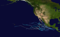
This NOAA 1 weather satellite picture of Hurricane Bridget was taken on June 16, 1971