Iași County

Last updated • 6 min readFrom Wikipedia, The Free Encyclopedia
Iași County
Județul Iași
Biserica Sf. Gheorghe din Harlau (cropped).jpg
St. George Church, Hârlău
Barajul Aroneanu (cropped).jpg
Starcea Lake, Butea
Actual Iasi county CoA.svg
Iasi in Romania.svg
Coordinates: 47°15′N27°19′E / 47.25°N 27.31°E / 47.25; 27.31
CountryRomania
Development region Nord-Est
Historical region Western Moldavia
Capital Iași
Government
  TypeCounty Board
  President of the County Board Alexe Costel  [ ro ]
  Prefect Constantin Guzgă  [ ro ]
Area
  Total
5,476 km2 (2,114 sq mi)
  Rank 23rd
Population
 (2021-12-01) [1]
  Total
760,774
  Rank 2nd
  Density140/km2 (360/sq mi)
Telephone code (+40) 232 or (+40) 332 [2]
ISO 3166 code RO-IS
GDP (nominal)US$ 5.431 billion (2015)
GDP/per capita US$ 27,032 (2022)
Website County Council
Prefecture

Iași County (Romanian pronunciation: [ˈjaʃʲ] ) is a county (județ) of Romania, in Western Moldavia, with the administrative seat at Iași. It is the most populous county in Romania, after the Municipality of Bucharest (which has the same administrative level as that of a county).

Contents

Geography

Three Lakes Area Hanul Trei Iazuri2.jpg
Three Lakes Area

This county has a total area of 5,476 km2 (2,114 sq mi). It lies on a plain between the Siret River and the Prut River. Two other rivers run through the county: the Bahlui River (on the banks of which lies the city of Iași) and the Jijia River.

Neighbours

Demographics

At the 2021 census Iași County had a population of 760,774. At the 2011 census, the county had a population of 772,348. [3] According to the 2012 data provided by the County Population Register Service, the total registered population of the county was 873,662 people. [4]

The population of Iași County nowadays is nearly double of what it was seventy years ago.

YearCounty population [6]
1948431,586 Steady2.svg
1956516,635 Increase2.svg
1966619,027 Increase2.svg
1977729,243 Increase2.svg
1992806,778 Increase2.svg
2002816,910 Increase2.svg
2011772,348 Decrease2.svg
2021 760,774 Decrease2.svg

County government

Iasi County Council and Prefecture Headquarters Iasi , Prefecture Headquarters.jpg
Iași County Council and Prefecture Headquarters

The Iași County Council, renewed at the 2020 local elections, consists of 36 counsellors, with the following party composition: [7]

   PartySeatsCurrent County Council
  National Liberal Party (PNL)17                 
  Social Democratic Party (PSD)10                 
  Save Romania Union (USR)6                 
  People's Movement Party (PMP)3                 

Economy

This county is predominantly agricultural, due to its topography. Industry is concentrated in the cities. The principal industries are:

Tourism

Hadambu Monastery Manastirea Hadambu24.jpg
Hadâmbu Monastery
Sturdza Palace in Miclauseni Castelul Sturdza din Miclauseni.jpg
Sturdza Palace in Miclăușeni

The city of Iași is the most important city in Moldavia and one of the most important social, cultural and business centres in Romania. It has the oldest University in the country, and, until the formation of the United Principalities, it was the capital of Moldavia.

Some of the tourist destinations in the county:

Communities

Iasi Barboi Church.jpg
Iași
Pascani RO IS Pascani centru de pe scari.jpeg
Pașcani
Targu Frumos The'ESPLANADE'Tg.Frumos.ROMANIA.JPG
Târgu Frumos

Iași County has 2 municipalities, 3 towns, and 93 communes

Historical county

Județul Iași
County (Județ)
Casa Carp din Iasi.jpg
The building of the prefecture of Iași County from the interwar period, now the George Enescu National University of Arts
Interbelic Iasi County CoA.png
Romania 1930 county Iasi.png
Country Flag of Romania.svg Romania
Historic region Moldavia
Capital city (Reședință de județ) Iași
Area
  Total
3,227 km2 (1,246 sq mi)
Population
 (1930)
  Total
275,796
  Density85/km2 (220/sq mi)
Time zone UTC+2 (EET)
  Summer (DST) UTC+3 (EEST)

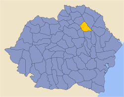
The county was located in the northeastern part of Greater Romania, in the northeast of the region of Moldavia. Today, most of the territory of the former county is part of the current Iași County. In the eastern part of the county, the county included a part of the left bank of the Prut River, now in the territory of the Republic of Moldova. It was bordered to the north by the counties of Botoșani and Bălți, to the east by Lăpușna County, to the south by the counties of Fălciu and Vaslui, and to the west by the counties of Roman and Baia.

Administration

Map of Iasi County as constituted in 1938. 1938 map of interwar county Iasi.jpg
Map of Iași County as constituted in 1938.

In 1938, the county was divided into six districts ( plăși ): [9]

  1. Plasa Bahlui, headquartered at Podu Iloaiei
  2. Plasa Cârligătura  [ ro ], headquartered at Târgu Frumos
  3. Plasa Codru  [ ro ], headquartered at Buciumii (at that time a commune, now Bucium District  [ ro ] in the city of Iași) [10]
  4. Plasa Copou, headquartered at Iași
  5. Plasa Turia, headquartered at Șipotele
  6. Plasa Ungheni, headquartered at Ungheni-Târg, now the city of Ungheni in the Republic of Moldova

Iași County included two urban localities: Iași (county seat) and urban commune Târgu Frumos, located at the western border of the county.

Population

According to the 1930 census data, the county population was 275,796 inhabitants, 81.6% Romanians, 14.6% Jews, 0.6% Russians, 0.5% Hungarians, 0.4% Germans, as well as other minorities. [11] From the religious point of view, the population was 82.0% Eastern Orthodox, 14.9% Jewish, 2.3% Roman Catholic, as well as other minorities.

Urban population

In 1930, the county's urban population was 107,804 inhabitants, 102,872 in Iaşi and 4,932 in Târgu Frumos, comprising 60.8% Romanians, 33.6% Jews, 0.9% Germans, 0.9% Russians, as well as other minorities. In the urban area, languages were Romanian (72.5%), followed by Yiddish (22.2%), Russian (1.8%), German (0.9%), as well as other minorities. [11] From the religious point of view, the urban population was composed of Eastern Orthodox (61.4%), Jewish (34.4%), Roman Catholic (3.0%), as well as other minorities.

Related Research Articles

<span class="mw-page-title-main">Neamț County</span> County of Romania

Neamț County is a county (județ) of Romania, in the historic region of Moldavia, with the county seat at Piatra Neamț. The county takes its name from the Neamț River.
<span class="mw-page-title-main">Iași</span> City and county seat of Iași County, Romania

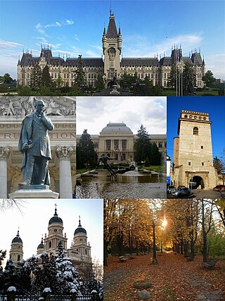
Iași, also referred to mostly historically as Jassy, is the third largest city in Romania and the seat of Iași County. Located in the historical region of Moldavia, it has traditionally been one of the leading centres of Romanian social, cultural, academic and artistic life. The city was the capital of the Principality of Moldavia from 1564 to 1859, then of the United Principalities from 1859 to 1862, and the capital of Romania from 1916 to 1918.

<span class="mw-page-title-main">Botoșani County</span> County of Romania

Botoșani County is a county (județ) of Romania, in Western Moldavia, with the county seat at Botoșani.

<span class="mw-page-title-main">Dolj County</span> County of Romania

Dolj County is a county (județ) of Romania on the border with Bulgaria, in Oltenia, with the capital city at Craiova.

<span class="mw-page-title-main">Vaslui County</span> County of Romania

Vaslui County is a county (județ) of Romania, in the historical region Western Moldavia, with the seat at Vaslui.

<span class="mw-page-title-main">Mureș County</span> County of Romania

Mureș County is a county (județ) of Romania, in the historical region of Transylvania, with the administrative centre in Târgu Mureș. The county was established in 1968, after the administrative reorganization that re-introduced the historical județ (county) system, still used today. This reform eliminated the previous Mureș-Magyar Autonomous Region, which had been created in 1952 within the People's Republic of Romania. Mureș County has a vibrant multicultural fabric that includes Hungarian-speaking Székelys and Transylvanian Saxons, with a rich heritage of fortified churches and towns.

<span class="mw-page-title-main">Bacău County</span> County of Romania

Bacău County is a county (județ) of Romania, in Western Moldavia, with its capital city at Bacău. It has one commune, Ghimeș-Făget, in Transylvania.

<span class="mw-page-title-main">Hârlău</span> Town in Iași, Romania

Hârlău is a town in Iași County, Western Moldavia, Romania. It was one of the princely court cities of Moldavia, in the 15th century. One village, Pârcovaci, is administered by the town.

<span class="mw-page-title-main">Cucuteni</span> Commune in Iași, Romania

Cucuteni is a commune in Iași County, Western Moldavia, Romania, with a population of 1,446 as of 2002. The commune is composed of four villages: Băiceni, Bărbătești, Cucuteni, and Săcărești.

<span class="mw-page-title-main">Cotnari</span> Commune in Iași, Romania

Cotnari is a village and the center of the eponymous commune in Iași County, Romania, in the historical region of Western Moldavia. It is located north-west of Iași and south of Hârlău, in a major wine-producing region of Romania, and is famous for the wine variety known as Grasă de Cotnari. Cârjoaia, the forest of Dumbrava Roșie, and other sites in Cotnari are regional tourist spots.

<span class="mw-page-title-main">Belcești</span> Commune in Iași, Romania

Belcești is a commune in Iași County, Western Moldavia, Romania. One of the county's largest communes, with a population of 10,231 as of 2021, it is composed of six villages: Belcești, Liteni, Munteni, Satu Nou, Tansa, and Ulmi.

The Bahlueț is a right tributary of the river Bahlui in Romania. It discharges into the Bahlui in Podu Iloaiei. Its length is 41 km (25 mi) and its basin size is 551 km2 (213 sq mi).

<span class="mw-page-title-main">Podu Iloaiei</span> Town in Iași, Romania

Podu Iloaiei is a town in Iași County, Western Moldavia, Romania. It has 8,992 inhabitants as of 2021, and was declared a town in 2005. Four villages are administered by the town: Budăi, Cosițeni, Holm, and Scobâlțeni.

<span class="mw-page-title-main">East–West Motorway (Romania)</span> Planned motorway in Romania

The A8 motorway, also known as The Union Motorway or the East-West Motorway is a planned motorway in Romania, that will cross the Eastern Carpathians to connect the historical regions of Moldavia and Transylvania. It will directly link the cities of Iași and Târgu Mureș. The A8 motorway route is an integral part of the Trans-European Transport (TEN-T) Core Network.

<span class="mw-page-title-main">First Battle of Târgu Frumos</span> Military conflict in 1944

The First Battle of Târgu Frumos was fought during World War II between Axis powers commanded by Otto Wöhler and Soviet forces led by Ivan Konev. Historian David Glantz has described it as part of a failed Soviet invasion of Romania, while Russian and German sources have described it as part of the Târgu Frumos Operation.

<span class="mw-page-title-main">First Jassy–Kishinev offensive</span> Soviet 1944 offensive into Romania

The first Jassy–Kishinev offensive, named after the two major cities in the area, Jassy and Kishinev, was a series of military engagements between 8 April and 6 June 1944 by the Soviet Union and Axis powers. Richard C. Hall also refers to a first Jassy–Kishinev operation which began on 5 April, without providing an exact date for its end. According to Glantz, the purported offensive was a coordinated invasion of Romania conducted by Red Army's 2nd and 3rd Ukrainian Fronts, in accordance with Joseph Stalin's strategy of projecting Soviet military power and political influence into the Balkans. However, according to the German Military History Research Office, a threatened Soviet offensive in northern Moldavia "failed to materialize" in the first part of April, and the military engagements during the rest of the month were used by the Axis forces to straighten the frontline; furthermore, on 6 May, the main command of the Soviet military (Stavka) issued orders to take no further offensive actions in this sector of the front.

This article discusses the administrative divisions of the Kingdom of Romania between 1941 and 1944. As a result of the Soviet occupation of Bessarabia and Northern Bukovina, Second Vienna Award and the Treaty of Craiova, territories that had previously been part of Romania were lost to the Soviet Union, Hungary and Bulgaria respectively. By September 1940 the administrative system set up in 1938 based on 'ținuturi' (regions) was disbanded and the former counties (județe) were reintroduced.

<span class="mw-page-title-main">Baia County</span> County in Romania

Baia County is one of the historic counties of Moldavia, Romania. The county seat was Fălticeni.

<span class="mw-page-title-main">Tecuci County</span> County in Romania

Tecuci County was a county in the Kingdom of Romania, in the historical region Moldavia. The county seat was Tecuci.

References

  1. "Populaţia rezidentă după grupa de vârstă, pe județe și municipii, orașe, comune, la 1 decembrie 2021" (XLS). National Institute of Statistics.
  2. The number used depends on the numbering system employed by the phone companies on the market.
  3. "Population at 20 October 2011" (in Romanian). INSSE. Archived from the original on 10 June 2017. Retrieved 28 March 2016.
  4. "Unul din 25 de ieșeni nu deține acte de identitate" (in Romanian). ziarulevenimentul.ro. 2013-02-14. Retrieved 2013-02-15.
  5. National Institute of Statistics, "Populația după etnie" Archived 2009-08-16 at the Wayback Machine
  6. National Institute of Statistics, "Populația la recensămintele din anii 1948, 1956, 1966, 1977, 1992 și 2002" Archived 2006-09-22 at the Wayback Machine
  7. "Rezultatele finale ale alegerilor locale din 2020" (Json) (in Romanian). Autoritatea Electorală Permanentă. Retrieved 2020-11-02.
  8. "Population on 1 January by age groups and sex - functional urban areas". Eurostat . Retrieved 8 June 2016.
  9. Portretul României Interbelice - Județul Iași
  10. Școala Gimnazială „Veronica Micle” din Iași
  11. 1 2 Recensământul general al populației României din 29 decemvrie 1930, Vol. II, pag. 246-247